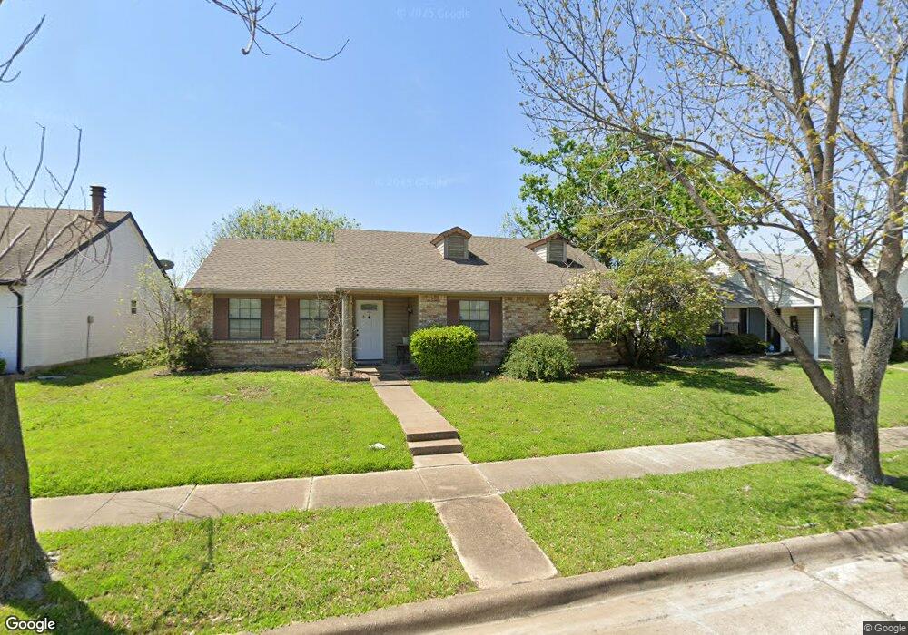
5645 N Colony Blvd the Colony, TX 75056
Estimated Value: $309,411 - $328,000
3
Beds
2
Baths
1,431
Sq Ft
$223/Sq Ft
Est. Value
About This Home
This home is located at 5645 N Colony Blvd, the Colony, TX 75056 and is currently estimated at $318,853, approximately $222 per square foot. 5645 N Colony Blvd is a home located in Denton County with nearby schools including B B Owen Elementary School, Griffin Middle School, and The Colony High School.
Ownership History
Date
Name
Owned For
Owner Type
Purchase Details
Closed on
Aug 30, 2010
Sold by
Davis Robert W and Davis Johnell
Bought by
Mcwilliams Fay M
Current Estimated Value
Home Financials for this Owner
Home Financials are based on the most recent Mortgage that was taken out on this home.
Original Mortgage
$79,000
Interest Rate
4.58%
Mortgage Type
New Conventional
Purchase Details
Closed on
Nov 16, 1994
Sold by
Montfort Mary H
Bought by
Davis Glen P
Home Financials for this Owner
Home Financials are based on the most recent Mortgage that was taken out on this home.
Original Mortgage
$52,839
Interest Rate
8.88%
Mortgage Type
Seller Take Back
Create a Home Valuation Report for This Property
The Home Valuation Report is an in-depth analysis detailing your home's value as well as a comparison with similar homes in the area
Home Values in the Area
Average Home Value in this Area
Purchase History
| Date | Buyer | Sale Price | Title Company |
|---|---|---|---|
| Mcwilliams Fay M | -- | Rtt | |
| Davis Glen P | -- | -- |
Source: Public Records
Mortgage History
| Date | Status | Borrower | Loan Amount |
|---|---|---|---|
| Closed | Mcwilliams Fay M | $79,000 | |
| Previous Owner | Davis Glen P | $52,839 |
Source: Public Records
Tax History Compared to Growth
Tax History
| Year | Tax Paid | Tax Assessment Tax Assessment Total Assessment is a certain percentage of the fair market value that is determined by local assessors to be the total taxable value of land and additions on the property. | Land | Improvement |
|---|---|---|---|---|
| 2025 | $5,826 | $295,879 | $69,300 | $226,579 |
| 2024 | $5,826 | $300,190 | $69,300 | $230,890 |
| 2023 | $6,015 | $306,944 | $59,400 | $247,544 |
| 2022 | $5,848 | $278,544 | $59,400 | $219,144 |
| 2021 | $4,554 | $204,472 | $46,200 | $158,272 |
| 2020 | $4,457 | $200,516 | $46,200 | $154,316 |
| 2019 | $4,705 | $204,959 | $46,200 | $158,759 |
| 2018 | $4,299 | $186,087 | $46,200 | $139,887 |
| 2017 | $3,831 | $163,995 | $34,320 | $129,675 |
| 2016 | $3,789 | $145,234 | $34,320 | $110,914 |
| 2015 | $2,779 | $127,570 | $18,810 | $108,760 |
| 2013 | -- | $98,971 | $18,810 | $80,161 |
Source: Public Records
Map
Nearby Homes
- 5613 Woodlands Dr
- 5617 Woodlands Dr
- 5621 Woodlands Dr
- 5612 Pearce St
- 5548 Rice Dr
- 5528 King Dr
- 5549 Ragan Dr
- 5633 Trego St
- 5500 Slay Dr
- 5529 Gates Dr
- 5841 Baker Dr
- 5912 Madison Dr
- 5400 N Colony Blvd
- 5632 Westwood Ln
- 5512 Gates Dr
- 5605 Overland Dr
- 5513 Rearn Dr
- 6605 Oxford Ln
- 5633 Westwood Ln
- 5305 Sagers Blvd
- 5649 N Colony Blvd
- 5641 N Colony Blvd
- 5637 N Colony Blvd
- 5641 Powers St
- 5645 Powers St
- 5637 Powers St
- 5633 N Colony Blvd
- 5649 Powers St
- 5657 N Colony Blvd
- 5633 Powers St
- 5653 Powers St
- 5629 Powers St
- 5629 N Colony Blvd
- 5661 N Colony Blvd
- 5657 Powers St
- 5644 Powers St
- 5640 Powers St
- 5625 Powers St
- 5636 Powers St
- 5648 Powers St