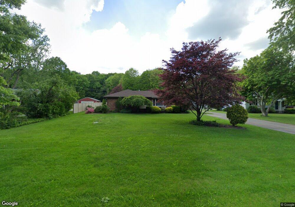
5646 Myers Rd New Franklin, OH 44319
Estimated Value: $259,000 - $303,000
3
Beds
2
Baths
1,774
Sq Ft
$163/Sq Ft
Est. Value
About This Home
This home is located at 5646 Myers Rd, New Franklin, OH 44319 and is currently estimated at $288,556, approximately $162 per square foot. 5646 Myers Rd is a home located in Summit County.
Ownership History
Date
Name
Owned For
Owner Type
Purchase Details
Closed on
Jun 11, 2014
Sold by
Shaffer William E and Shaffer Jane A
Bought by
Shaffer Barry L and Silver Diamond Trust
Current Estimated Value
Purchase Details
Closed on
Aug 13, 2010
Sold by
Boggs Michael B
Bought by
Shaffer William E and Shaffer Jane A
Home Financials for this Owner
Home Financials are based on the most recent Mortgage that was taken out on this home.
Original Mortgage
$112,800
Outstanding Balance
$74,910
Interest Rate
4.63%
Mortgage Type
New Conventional
Estimated Equity
$213,646
Purchase Details
Closed on
Jul 31, 2010
Sold by
Estate Of Patricia Louise Boggs
Bought by
Boggs Michael B
Home Financials for this Owner
Home Financials are based on the most recent Mortgage that was taken out on this home.
Original Mortgage
$112,800
Outstanding Balance
$74,910
Interest Rate
4.63%
Mortgage Type
New Conventional
Estimated Equity
$213,646
Create a Home Valuation Report for This Property
The Home Valuation Report is an in-depth analysis detailing your home's value as well as a comparison with similar homes in the area
Home Values in the Area
Average Home Value in this Area
Purchase History
| Date | Buyer | Sale Price | Title Company |
|---|---|---|---|
| Shaffer Barry L | -- | First American Title Ins Co | |
| Shaffer William E | $141,000 | Attorney | |
| Boggs Michael B | -- | None Available |
Source: Public Records
Mortgage History
| Date | Status | Borrower | Loan Amount |
|---|---|---|---|
| Open | Shaffer William E | $112,800 |
Source: Public Records
Tax History Compared to Growth
Tax History
| Year | Tax Paid | Tax Assessment Tax Assessment Total Assessment is a certain percentage of the fair market value that is determined by local assessors to be the total taxable value of land and additions on the property. | Land | Improvement |
|---|---|---|---|---|
| 2025 | $4,595 | $92,019 | $19,173 | $72,846 |
| 2024 | $4,595 | $92,019 | $19,173 | $72,846 |
| 2023 | $4,595 | $92,019 | $19,173 | $72,846 |
| 2022 | $4,234 | $66,060 | $13,598 | $52,462 |
| 2021 | $4,249 | $66,060 | $13,598 | $52,462 |
| 2020 | $4,176 | $66,060 | $13,600 | $52,460 |
| 2019 | $4,082 | $57,850 | $19,040 | $38,810 |
| 2018 | $3,522 | $57,850 | $19,040 | $38,810 |
| 2017 | $3,494 | $57,850 | $19,040 | $38,810 |
| 2016 | $3,453 | $51,990 | $19,040 | $32,950 |
| 2015 | $3,494 | $51,990 | $19,040 | $32,950 |
| 2014 | $3,371 | $49,340 | $19,040 | $30,300 |
| 2013 | $3,432 | $50,560 | $19,040 | $31,520 |
Source: Public Records
Map
Nearby Homes
- 451 Yager Rd
- 5776 Harter Home Dr
- 427 Center Rd
- 715 Highland Park Dr
- 781 Leeman Dr
- 6090 Manchester Rd Unit 6096
- 6407 Southview Dr
- 899 Loway Dr
- 5892 Woodward Dr
- 1062 Stump Rd
- S/L 14,15 Shakes Hotel Dr
- 4944 Coleman Dr
- 6 Shrakes Hotel Dr
- 4 Shrakes Hotel Dr
- 7 Shrakes Hotel Dr
- 5 Shrakes Hotel Dr
- 3 Shrakes Hotel Dr
- 6387 Hampsher Rd
- 4881 S Main St
- 4831 Christman Rd