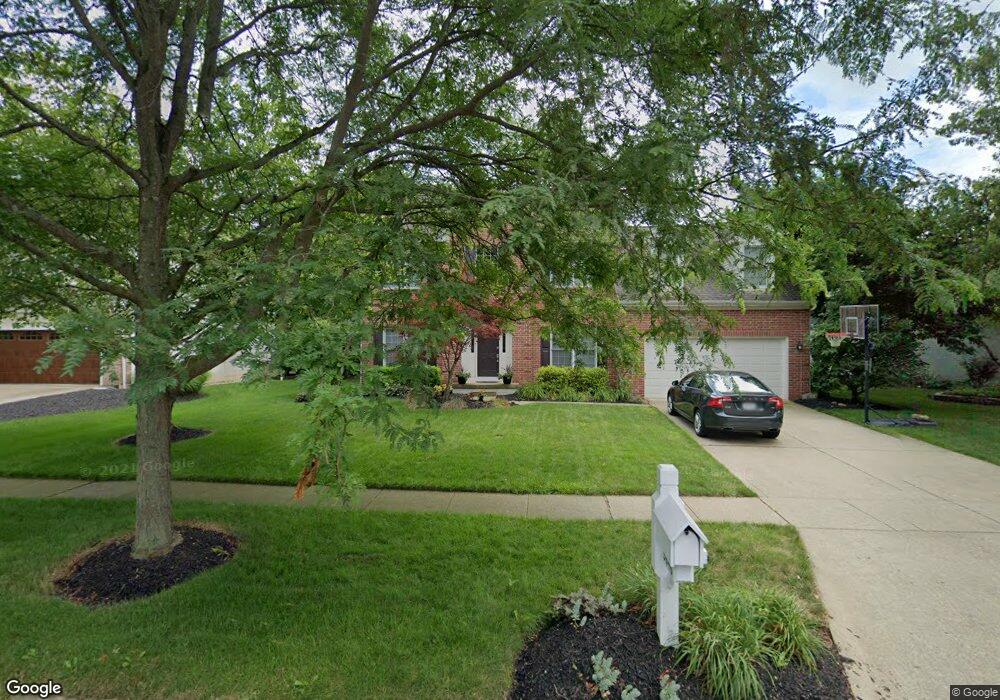
5646 Saint Andrews Dr Westerville, OH 43082
Genoa NeighborhoodEstimated Value: $543,554 - $605,000
4
Beds
3
Baths
2,660
Sq Ft
$218/Sq Ft
Est. Value
About This Home
This home is located at 5646 Saint Andrews Dr, Westerville, OH 43082 and is currently estimated at $579,139, approximately $217 per square foot. 5646 Saint Andrews Dr is a home located in Delaware County with nearby schools including Fouse Elementary School, Genoa Middle School, and Westerville Central High School.
Ownership History
Date
Name
Owned For
Owner Type
Purchase Details
Closed on
Jul 19, 2001
Sold by
Young Brian E
Bought by
Buehler Robert A and Buehler Angelik P
Current Estimated Value
Home Financials for this Owner
Home Financials are based on the most recent Mortgage that was taken out on this home.
Original Mortgage
$185,000
Outstanding Balance
$69,271
Interest Rate
6.75%
Mortgage Type
New Conventional
Estimated Equity
$509,868
Purchase Details
Closed on
Jun 5, 1998
Sold by
C V Perry & Co
Bought by
Young Brian E and Young Stephanie C
Home Financials for this Owner
Home Financials are based on the most recent Mortgage that was taken out on this home.
Original Mortgage
$195,900
Interest Rate
7.27%
Mortgage Type
New Conventional
Create a Home Valuation Report for This Property
The Home Valuation Report is an in-depth analysis detailing your home's value as well as a comparison with similar homes in the area
Home Values in the Area
Average Home Value in this Area
Purchase History
| Date | Buyer | Sale Price | Title Company |
|---|---|---|---|
| Buehler Robert A | $267,000 | -- | |
| Young Brian E | $244,900 | -- |
Source: Public Records
Mortgage History
| Date | Status | Borrower | Loan Amount |
|---|---|---|---|
| Open | Buehler Robert A | $185,000 | |
| Previous Owner | Young Brian E | $195,900 |
Source: Public Records
Tax History Compared to Growth
Tax History
| Year | Tax Paid | Tax Assessment Tax Assessment Total Assessment is a certain percentage of the fair market value that is determined by local assessors to be the total taxable value of land and additions on the property. | Land | Improvement |
|---|---|---|---|---|
| 2024 | $8,276 | $159,990 | $33,950 | $126,040 |
| 2023 | $8,113 | $159,990 | $33,950 | $126,040 |
| 2022 | $7,372 | $111,900 | $21,000 | $90,900 |
| 2021 | $7,446 | $111,900 | $21,000 | $90,900 |
| 2020 | $7,491 | $111,900 | $21,000 | $90,900 |
| 2019 | $7,227 | $103,640 | $21,000 | $82,640 |
| 2018 | $7,006 | $103,640 | $21,000 | $82,640 |
| 2017 | $6,862 | $97,090 | $18,480 | $78,610 |
| 2016 | $7,058 | $97,090 | $18,480 | $78,610 |
| 2015 | $7,002 | $97,090 | $18,480 | $78,610 |
| 2014 | $6,917 | $97,090 | $18,480 | $78,610 |
| 2013 | $6,662 | $94,080 | $18,480 | $75,600 |
Source: Public Records
Map
Nearby Homes
- 5515 Stillwater Ave
- 5552 Quail Hollow Way
- 7138 Cypress Dr
- 6573 Kenwood Place
- 7373 Frasier Rd
- 5633 Travis Pointe Ct
- 6394 Mission Hills Place
- 6311 Legends Ct
- 5259 Sorrento Ct
- 377 Westgreen Ln Unit 377
- 0 Paul Rd Unit 225001038
- 7513 Africa Rd
- 705 N State St Unit 211
- 6623 Henschen Cir
- 5532 Meadowood Ln
- 6014 Commonwealth Dr
- 5983 Congressional Dr
- 6410 Steinbeck Way
- 4960 Hawthorne Valley Dr
- 543 N State St
- 5636 Saint Andrews Dr
- 5660 Saint Andrews Dr
- 5622 Saint Andrews Dr
- 5672 Saint Andrews Dr
- 5631 Saint Andrews Dr
- 5645 Saint Andrews Dr
- 5623 St Andrews Dr
- 5623 Saint Andrews Dr
- 6842 Willoughby Ct
- 6854 Willoughby Ct
- 6866 Willoughby Ct
- 5657 Saint Andrews Dr
- 6874 Willoughby Ct
- 5657 Saint Andrews Dr
- 5611 Saint Andrews Dr
- 6886 Willoughby Ct
- 6834 Willoughby Ct
- 6900 Willoughby Ct
- 5669 Saint Andrews Dr
- 5595 Saint Andrews Dr