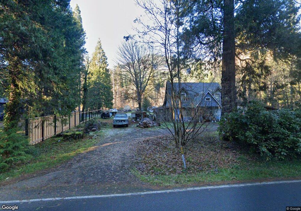
56467 N Bank Rd McKenzie Bridge, OR 97413
Estimated Value: $241,000 - $342,634
2
Beds
1
Bath
1,464
Sq Ft
$198/Sq Ft
Est. Value
About This Home
This home is located at 56467 N Bank Rd, McKenzie Bridge, OR 97413 and is currently estimated at $289,659, approximately $197 per square foot. 56467 N Bank Rd is a home located in Lane County with nearby schools including Mckenzie Elementary School.
Ownership History
Date
Name
Owned For
Owner Type
Purchase Details
Closed on
Aug 10, 2022
Sold by
Brown Jason and Brown Robin
Bought by
Burwell Tyee and Stelter-Burwell Julia
Current Estimated Value
Purchase Details
Closed on
May 16, 2015
Sold by
Brown Jason P and Brown Robin M
Bought by
Burwell Tyee B and Burwell Julia Stelter
Purchase Details
Closed on
Apr 25, 2006
Sold by
Richards Janet A
Bought by
Brown Jason P and Brown Robin M
Home Financials for this Owner
Home Financials are based on the most recent Mortgage that was taken out on this home.
Original Mortgage
$79,140
Interest Rate
6.29%
Mortgage Type
Credit Line Revolving
Purchase Details
Closed on
Dec 5, 2005
Sold by
Motter Edward C A
Bought by
Richards Janet A
Create a Home Valuation Report for This Property
The Home Valuation Report is an in-depth analysis detailing your home's value as well as a comparison with similar homes in the area
Home Values in the Area
Average Home Value in this Area
Purchase History
| Date | Buyer | Sale Price | Title Company |
|---|---|---|---|
| Burwell Tyee | -- | Evergreen Land Title | |
| Burwell Tyee B | $98,000 | Evergreen Land Title Company | |
| Brown Jason P | $95,000 | Fidelity National Title Insu | |
| Richards Janet A | $74,838 | Cascade Title Co |
Source: Public Records
Mortgage History
| Date | Status | Borrower | Loan Amount |
|---|---|---|---|
| Previous Owner | Brown Jason P | $79,140 | |
| Closed | Burwell Tyee B | $0 |
Source: Public Records
Tax History Compared to Growth
Tax History
| Year | Tax Paid | Tax Assessment Tax Assessment Total Assessment is a certain percentage of the fair market value that is determined by local assessors to be the total taxable value of land and additions on the property. | Land | Improvement |
|---|---|---|---|---|
| 2024 | $1,550 | $154,195 | -- | -- |
| 2023 | $1,550 | $149,704 | $0 | $0 |
| 2022 | $1,445 | $145,344 | $0 | $0 |
| 2021 | $1,406 | $141,111 | $0 | $0 |
| 2020 | $1,356 | $137,001 | $0 | $0 |
| 2019 | $1,303 | $133,011 | $0 | $0 |
| 2018 | $1,263 | $125,376 | $0 | $0 |
| 2017 | $1,211 | $125,376 | $0 | $0 |
| 2016 | $1,423 | $121,724 | $0 | $0 |
| 2015 | $1,398 | $118,179 | $0 | $0 |
| 2014 | $1,376 | $114,737 | $0 | $0 |
Source: Public Records
Map
Nearby Homes
- 56483 Mckenzie Hwy
- 56483 Mckenzie Hwy Unit 1
- 56642 Mckenzie Hwy
- 0 Alma Dr Unit 155780752
- 57255 N Bank Rd
- 0 McKenzie River Dr Unit 1800 613921739
- 54432 Mckenzie Hwy Unit 37
- 54432 Mckenzie Hwy Unit 38
- 54432 Mckenzie Hwy Unit 9
- 54432 Mckenzie Hwy Unit 18
- 54432 Mckenzie Hwy Unit 24
- 54432 Mckenzie Hwy Unit 23
- 54444 McKenzie River Dr
- 91747 Blue River Reservoir Rd
- 91737 Blue River Reservoir Rd
- 53198 Mckenzie Hwy
- 52984 Mckenzie Hwy
- 91591 Blue River Reservoir Rd
- 52958 Mckenzie Hwy
- 52262 Mckenzie Hwy
- 56459 N Bank Rd
- 91987 Taylor Rd
- 56474 N Bank Rd
- 56591 N Bank Rd
- 56449 N Bank Rd
- 56460 N Bank Rd
- 56496 N Bank Rd
- 91949 Taylor Rd
- 56429 N Bank Rd
- 91968 Taylor Rd
- 0 Taylor Rd Unit 2011520
- 0 Taylor Rd Unit 2023
- 0 Taylor Rd Unit 2301 23567264
- 0 Taylor Rd Unit 7008410
- 56413 N Bank Rd
- 56524 N Bank Rd
- 56483 Mckenzie Hwy Unit 14
- 56483 Mckenzie Hwy Unit 14
- 56483 Mckenzie Hwy Unit 16
- 56483 Mckenzie Hwy