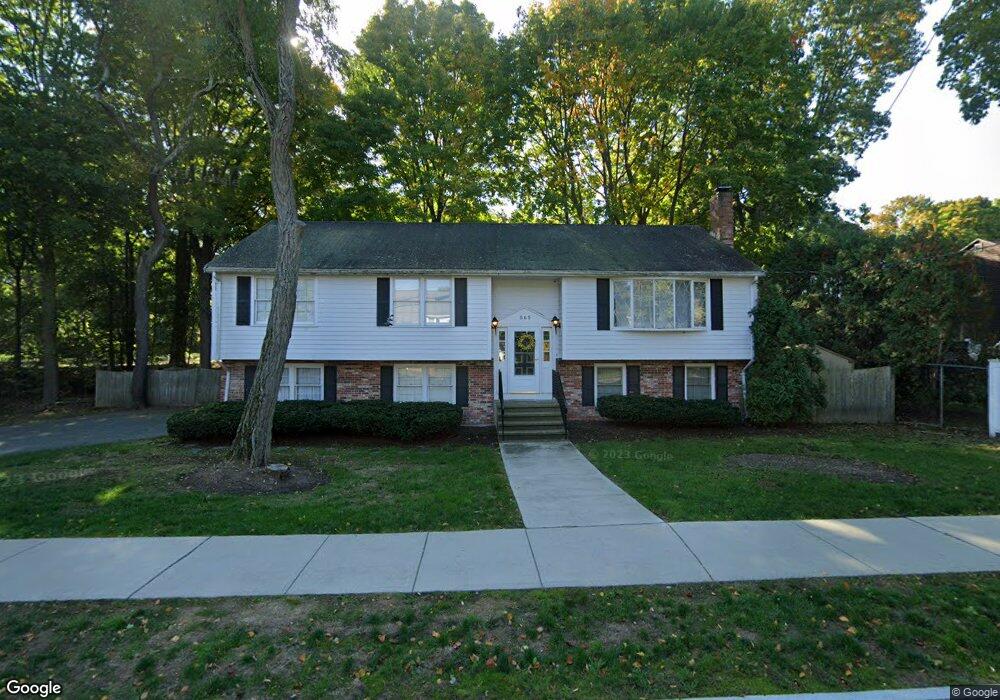
565 Brook Rd Milton, MA 02186
Milton Hill NeighborhoodEstimated Value: $1,012,012 - $1,149,000
3
Beds
3
Baths
2,118
Sq Ft
$509/Sq Ft
Est. Value
About This Home
This home is located at 565 Brook Rd, Milton, MA 02186 and is currently estimated at $1,078,253, approximately $509 per square foot. 565 Brook Rd is a home located in Norfolk County with nearby schools including Milton High School, St. Mary of the Hills School, and Milton Academy.
Ownership History
Date
Name
Owned For
Owner Type
Purchase Details
Closed on
Aug 1, 1984
Bought by
Mackinnon Nancy C
Current Estimated Value
Create a Home Valuation Report for This Property
The Home Valuation Report is an in-depth analysis detailing your home's value as well as a comparison with similar homes in the area
Home Values in the Area
Average Home Value in this Area
Purchase History
| Date | Buyer | Sale Price | Title Company |
|---|---|---|---|
| Mackinnon Nancy C | $139,900 | -- |
Source: Public Records
Mortgage History
| Date | Status | Borrower | Loan Amount |
|---|---|---|---|
| Open | Mackinnon Nancy C | $50,000 | |
| Open | Mackinnon Nancy C | $275,000 | |
| Closed | Mackinnon Nancy C | $150,000 |
Source: Public Records
Tax History Compared to Growth
Tax History
| Year | Tax Paid | Tax Assessment Tax Assessment Total Assessment is a certain percentage of the fair market value that is determined by local assessors to be the total taxable value of land and additions on the property. | Land | Improvement |
|---|---|---|---|---|
| 2025 | $8,656 | $780,500 | $444,400 | $336,100 |
| 2024 | $8,419 | $771,000 | $423,200 | $347,800 |
| 2023 | $7,983 | $700,300 | $403,300 | $297,000 |
| 2022 | $7,932 | $636,100 | $403,300 | $232,800 |
| 2021 | $7,632 | $581,300 | $356,000 | $225,300 |
| 2020 | $7,623 | $581,000 | $341,100 | $239,900 |
| 2019 | $7,435 | $564,100 | $331,200 | $232,900 |
| 2018 | $7,249 | $524,900 | $293,000 | $231,900 |
| 2017 | $6,780 | $500,000 | $279,000 | $221,000 |
| 2016 | $6,526 | $483,400 | $265,100 | $218,300 |
| 2015 | $6,255 | $448,700 | $224,600 | $224,100 |
Source: Public Records
Map
Nearby Homes
- 19 Lantern Ln
- 20 Herrick Dr
- 390 Central Ave
- 290 Central Ave
- 438 Central Ave Unit 2
- 795 Brook Rd
- 15 Cantwell Rd
- 32 Columbine Rd
- 4 School St
- 333 Eliot St
- 54 Elm St
- 137 Thacher St Unit 137
- 96 Houston Ave
- 131 Eliot St Unit 312
- 131 Eliot St Unit 408
- 131 Eliot St Unit 305
- 1 Chilton Park
- 651 Canton Ave
- 214 Brook Rd
- 15 Fairfax Rd