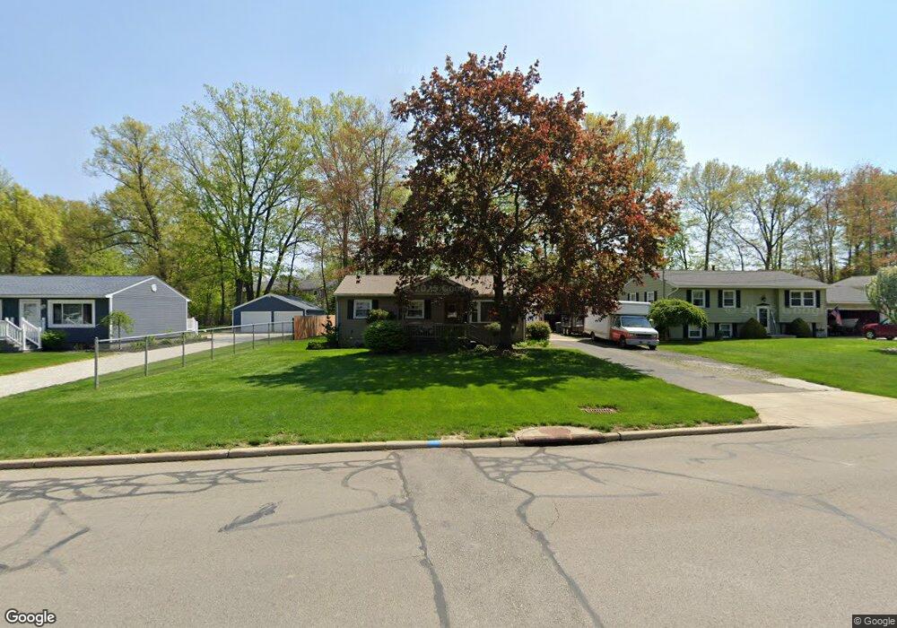
565 Cedar Dr Cortland, OH 44410
Estimated Value: $160,828 - $170,000
About This Home
This home is located at 565 Cedar Dr, Cortland, OH 44410 and is currently estimated at $165,207, approximately $167 per square foot. 565 Cedar Dr is a home located in Trumbull County with nearby schools including Lakeview Elementary School, Lakeview Middle School, and Lakeview High School.
Ownership History
We collect this data history from publicly available records. To have your information removed, we recommend requesting removal directly through your county’s website.
Purchase Details
Purchase Details
Purchase Details
Home Financials for this Owner
Home Financials are based on the most recent Mortgage that was taken out on this home.Purchase Details
Purchase Details
Home Values in the Area
Average Home Value in this Area
Purchase History
We collect this data history from publicly available records. To have your information removed, we recommend requesting removal directly through your county’s website.
| Date | Buyer | Sale Price | Title Company |
|---|---|---|---|
| -- | None Available | ||
| -- | None Available | ||
| $79,788 | -- | ||
| -- | -- | ||
| -- | -- |
Mortgage History
We collect this data history from publicly available records. To have your information removed, we recommend requesting removal directly through your county’s website.
| Date | Status | Borrower | Loan Amount |
|---|---|---|---|
| Previous Owner | $79,780 |
Tax History
We collect this data history from publicly available records. To have your information removed, we recommend requesting removal directly through your county’s website.
| Year | Tax Paid | Tax Assessment Tax Assessment Total Assessment is a certain percentage of the fair market value that is determined by local assessors to be the total taxable value of land and additions on the property. | Land | Improvement |
|---|---|---|---|---|
| 2025 | $2,372 | $43,790 | $6,790 | $37,000 |
| 2024 | $2,372 | $42,840 | $6,790 | $36,050 |
| 2023 | $2,252 | $42,840 | $6,790 | $36,050 |
| 2022 | $1,867 | $29,750 | $6,790 | $22,960 |
| 2021 | $1,874 | $29,750 | $6,790 | $22,960 |
| 2020 | $1,883 | $29,750 | $6,790 | $22,960 |
| 2019 | $1,660 | $25,030 | $6,790 | $18,240 |
| 2018 | $1,668 | $25,030 | $6,790 | $18,240 |
| 2017 | $1,666 | $25,030 | $6,790 | $18,240 |
| 2016 | $1,719 | $24,960 | $6,790 | $18,170 |
| 2015 | $1,714 | $24,960 | $6,790 | $18,170 |
| 2014 | $1,512 | $24,960 | $6,790 | $18,170 |
| 2013 | $1,539 | $24,960 | $6,790 | $18,170 |
Map
- 0 Fowler St
- 148 Woodland Trace Unit 148
- 105 Topaz Trail
- 352 Rosewae Ave
- 141 Wae Trail
- 160 Turquoise Dr Unit 160
- 23 Eagle Pointe Dr
- 3098 Fowler St
- 17 Harneds Landing
- 701 Lakeview Dr
- 306 S Colonial Dr
- 2031 Quail
- 133 Southdale Blvd
- 358 Tessa Place
- 141 Southdale Blvd
- 332 Stahl Ave
- 117 Dennis Dr
- 2821 Wilson Sharpsville Rd
- 120 Winter Ln
- 220 Fox Run
Ask me questions while you tour the home.