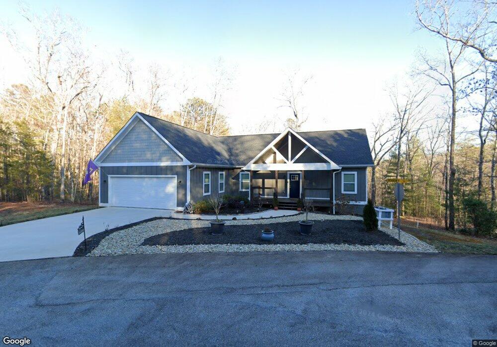
565 Celestial Cir Clayton, GA 30525
Estimated Value: $504,177 - $688,000
3
Beds
2
Baths
1,920
Sq Ft
$305/Sq Ft
Est. Value
About This Home
This home is located at 565 Celestial Cir, Clayton, GA 30525 and is currently estimated at $585,544, approximately $304 per square foot. 565 Celestial Cir is a home located in Rabun County with nearby schools including Rabun County Primary School, Rabun County High School, and Great Oaks Montessori .
Ownership History
Date
Name
Owned For
Owner Type
Purchase Details
Closed on
Oct 7, 2020
Sold by
Gilbert Thomas
Bought by
Granen Stepheni
Current Estimated Value
Home Financials for this Owner
Home Financials are based on the most recent Mortgage that was taken out on this home.
Original Mortgage
$367,780
Outstanding Balance
$326,524
Interest Rate
2.8%
Mortgage Type
VA
Estimated Equity
$259,020
Purchase Details
Closed on
Nov 18, 2019
Sold by
Queen Thomas Earl
Bought by
Gilbert Thomas
Purchase Details
Closed on
Jul 14, 2005
Sold by
Mountain Creek Estates Llc
Bought by
Queen Thomas Earl and Queen Wanda
Create a Home Valuation Report for This Property
The Home Valuation Report is an in-depth analysis detailing your home's value as well as a comparison with similar homes in the area
Home Values in the Area
Average Home Value in this Area
Purchase History
| Date | Buyer | Sale Price | Title Company |
|---|---|---|---|
| Granen Stepheni | $355,000 | -- | |
| Granen Stepheni | $355,000 | -- | |
| Gilbert Thomas | $32,000 | -- | |
| Gilbert Thomas | $32,000 | -- | |
| Queen Thomas Earl | $34,500 | -- | |
| Queen Thomas Earl | $34,500 | -- |
Source: Public Records
Mortgage History
| Date | Status | Borrower | Loan Amount |
|---|---|---|---|
| Open | Granen Stepheni | $367,780 | |
| Closed | Granen Stepheni | $367,780 |
Source: Public Records
Tax History Compared to Growth
Tax History
| Year | Tax Paid | Tax Assessment Tax Assessment Total Assessment is a certain percentage of the fair market value that is determined by local assessors to be the total taxable value of land and additions on the property. | Land | Improvement |
|---|---|---|---|---|
| 2024 | $2,698 | $168,121 | $14,000 | $154,121 |
| 2023 | $2,796 | $152,758 | $14,000 | $138,758 |
| 2022 | $2,712 | $148,186 | $14,000 | $134,186 |
| 2021 | $2,492 | $132,924 | $14,000 | $118,924 |
| 2020 | $244 | $12,600 | $12,600 | $0 |
| 2019 | $273 | $14,000 | $14,000 | $0 |
| 2018 | $274 | $14,000 | $14,000 | $0 |
| 2017 | $263 | $14,000 | $14,000 | $0 |
| 2016 | $264 | $14,000 | $14,000 | $0 |
| 2015 | $270 | $14,000 | $14,000 | $0 |
| 2014 | $271 | $14,000 | $14,000 | $0 |
Source: Public Records
Map
Nearby Homes
- 331 Duggan Hill Dr
- 0 Steepway Unit 10480160
- 0 Laurel Ln Unit 20110131
- LOTS 92 & 93 Chechero Heights St
- 41 Mike Foster Ln
- 51 Cottonwood St
- 121 N Church St Unit 101
- 582 Polly Gap Rd
- 25 Valley St
- 104 Hamby St
- 127 Hamby St
- 167 Travelers Ln
- 0 Travelers Ln Unit 10608680
- 0 Travelers Ln Unit 10590360
- 0 Toole St Unit 10538991
- 49 Toole St
- 124 Starlight Ln
- 180 Orme St
- 0 Juniper Trail Unit 10437006
- 0 Juniper Trail Unit 10437005
- 121 Highway 441 S
- 338 Duggan Hill Dr
- 68 Wade Ln
- 58 Free Bird Ln
- 287 Highway 441 S
- 278 Duggan Hill Dr
- 0 Autumn Ridge Unit 8414912
- 0 Autumn Ridge Unit 8 8305975
- 0 Autumn Ridge Unit 2940097
- 0 Autumn Ridge Unit 2940100
- 0 Autumn Ridge Unit 2940090
- 0 Autumn Ridge Unit 2940084
- 0 Autumn Ridge Unit 3173299
- 0 Autumn Ridge Unit 3173524
- 0 Autumn Ridge Unit 8149809
- 0 Autumn Ridge Unit 8919599
- 0 Autumn Ridge Unit 6833657
- 0 Autumn Ridge Unit 8075708
- 0 Autumn Ridge Unit 8149962
- 0 Autumn Ridge Unit 6635500