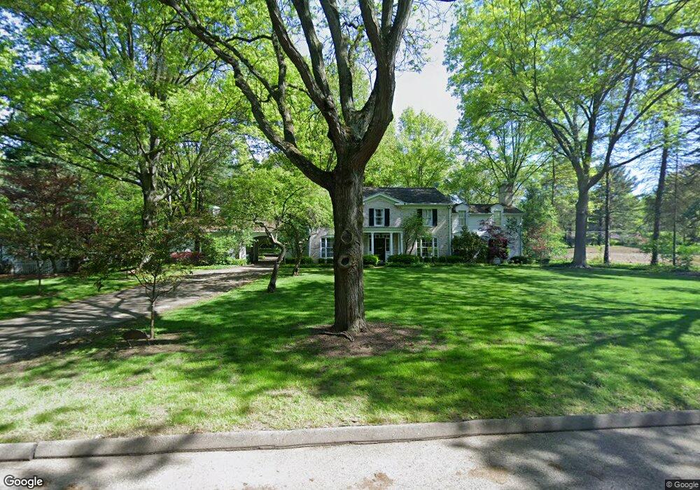
565 Deerfield Dr SW North Canton, OH 44720
Mount Vernon NeighborhoodEstimated Value: $431,000 - $525,000
4
Beds
5
Baths
4,230
Sq Ft
$114/Sq Ft
Est. Value
About This Home
This home is located at 565 Deerfield Dr SW, North Canton, OH 44720 and is currently estimated at $483,063, approximately $114 per square foot. 565 Deerfield Dr SW is a home located in Stark County with nearby schools including Orchard Hill Intermediate School, North Canton Middle School, and Hoover High School.
Ownership History
Date
Name
Owned For
Owner Type
Purchase Details
Closed on
Jan 23, 2020
Sold by
Botschner Andrew T
Bought by
Cerreta Samuel M and Cerreta Andrea L
Current Estimated Value
Home Financials for this Owner
Home Financials are based on the most recent Mortgage that was taken out on this home.
Original Mortgage
$347,000
Outstanding Balance
$307,413
Interest Rate
3.74%
Mortgage Type
Future Advance Clause Open End Mortgage
Estimated Equity
$175,651
Purchase Details
Closed on
Sep 18, 2019
Bought by
Botschner Andrew T Successor Truste
Create a Home Valuation Report for This Property
The Home Valuation Report is an in-depth analysis detailing your home's value as well as a comparison with similar homes in the area
Home Values in the Area
Average Home Value in this Area
Purchase History
| Date | Buyer | Sale Price | Title Company |
|---|---|---|---|
| Cerreta Samuel M | $434,000 | Landsel Title Agency | |
| Botschner Andrew T Successor Truste | -- | -- |
Source: Public Records
Mortgage History
| Date | Status | Borrower | Loan Amount |
|---|---|---|---|
| Open | Cerreta Samuel M | $347,000 |
Source: Public Records
Tax History Compared to Growth
Tax History
| Year | Tax Paid | Tax Assessment Tax Assessment Total Assessment is a certain percentage of the fair market value that is determined by local assessors to be the total taxable value of land and additions on the property. | Land | Improvement |
|---|---|---|---|---|
| 2025 | -- | $140,000 | $38,430 | $101,570 |
| 2024 | -- | $140,000 | $38,430 | $101,570 |
| 2023 | $6,580 | $123,060 | $28,840 | $94,220 |
| 2022 | $6,319 | $123,060 | $28,840 | $94,220 |
| 2021 | $6,095 | $123,060 | $28,840 | $94,220 |
| 2020 | $6,189 | $109,730 | $25,100 | $84,630 |
| 2019 | $5,789 | $109,730 | $25,100 | $84,630 |
| 2018 | $6,003 | $109,730 | $25,100 | $84,630 |
| 2017 | $5,632 | $107,770 | $24,470 | $83,300 |
| 2016 | $5,653 | $107,770 | $24,470 | $83,300 |
| 2015 | $5,673 | $107,770 | $24,470 | $83,300 |
| 2014 | $1,443 | $96,500 | $21,910 | $74,590 |
| 2013 | $2,726 | $96,500 | $21,910 | $74,590 |
Source: Public Records
Map
Nearby Homes
- 1138 Lindy Lane Ave SW
- 404 Cordelia St SW
- 727 Lorena St SW
- 253 Glenwood St SW
- 1276 Linwood Ave SW
- 218 Bonnett St SW
- 500 Heatherwood St SW
- 161 Hallum St SW
- 0 W Maple St Unit 5135089
- 139 Maplecrest St SW
- 322 Schneider St SE
- 624 Portage St NW
- 1236 W Maple St
- 1246 W Maple St Unit 4A
- 1222 W Maple St Unit 6A
- 0 Elberta Ave SW
- 742 Portage St NW
- 714 Pershing Ave SE
- 1171 Terrace Rd NW
- 505 Rose Lane St SE
- 545 Deerfield Dr SW
- 625 Deerfield Dr SW
- 600 Deerfield Dr SW
- 615 Oakridge St SW
- 714 Deerfield Dr SW
- 544 Deerfield Dr SW
- 1109 Sunset Blvd SW
- 605 Oakridge St SW
- 567 Rose Lane St SW
- 624 Deerfield Dr SW
- 630 Glenwood St SW
- 630 Deerfield Dr SW
- 616 Glenwood St SW
- 640 Glenwood St SW
- 566 Rose Lane St SW
- 705 Deerfield Dr SW
- 1018 Sunset Blvd SW
- 640 Deerfield Dr SW
- 606 Glenwood St SW
- 1110 Sunset Blvd SW