Estimated Value: $531,000 - $575,000
3
Beds
3
Baths
2,554
Sq Ft
$218/Sq Ft
Est. Value
About This Home
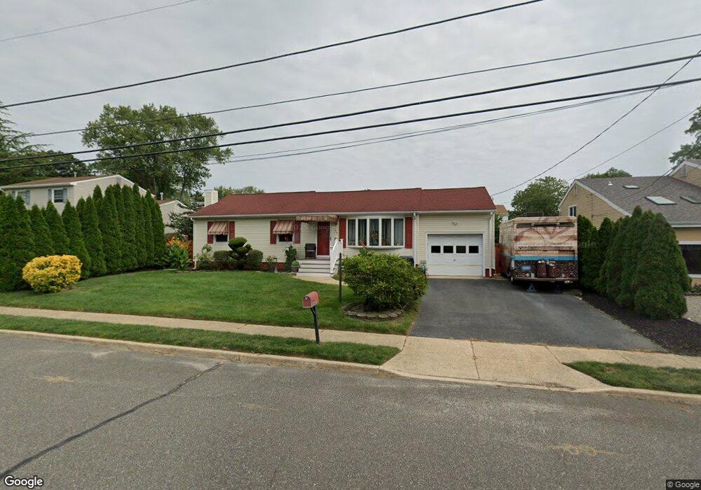
This home is located at 565 Michigan Ave, Brick, NJ 08724 and is currently estimated at $556,222, approximately $217 per square foot. 565 Michigan Ave is a home located in Ocean County with nearby schools including Lanes Mill Elementary School, Veterans Memorial Middle School, and Brick Township Memorial High School.
Ownership History
Date
Name
Owned For
Owner Type
Purchase Details
Closed on
Aug 23, 2024
Sold by
Polskin Robert E and Polskin Josephine
Bought by
Polskin Josephine
Current Estimated Value
Purchase Details
Closed on
Jun 29, 1998
Sold by
Casey Bruce W and Casey Arlene A
Bought by
Polskin Robert E and Polskin Josephine
Home Financials for this Owner
Home Financials are based on the most recent Mortgage that was taken out on this home.
Original Mortgage
$139,571
Interest Rate
7.04%
Mortgage Type
FHA
Create a Home Valuation Report for This Property
The Home Valuation Report is an in-depth analysis detailing your home's value as well as a comparison with similar homes in the area
Home Values in the Area
Average Home Value in this Area
Purchase History
| Date | Buyer | Sale Price | Title Company |
|---|---|---|---|
| Polskin Josephine | -- | None Listed On Document | |
| Polskin Josephine | -- | None Listed On Document | |
| Polskin Robert E | $143,000 | First American Title Ins Co |
Source: Public Records
Mortgage History
| Date | Status | Borrower | Loan Amount |
|---|---|---|---|
| Previous Owner | Polskin Robert E | $139,571 |
Source: Public Records
Tax History Compared to Growth
Tax History
| Year | Tax Paid | Tax Assessment Tax Assessment Total Assessment is a certain percentage of the fair market value that is determined by local assessors to be the total taxable value of land and additions on the property. | Land | Improvement |
|---|---|---|---|---|
| 2025 | $7,644 | $292,300 | $130,500 | $161,800 |
| 2024 | $7,267 | $292,300 | $130,500 | $161,800 |
| 2023 | $7,170 | $292,300 | $130,500 | $161,800 |
| 2022 | $7,170 | $292,300 | $130,500 | $161,800 |
| 2021 | $6,551 | $292,300 | $130,500 | $161,800 |
| 2020 | $6,928 | $292,300 | $130,500 | $161,800 |
| 2019 | $6,793 | $292,300 | $130,500 | $161,800 |
| 2018 | $6,638 | $292,300 | $130,500 | $161,800 |
| 2017 | $6,460 | $292,300 | $130,500 | $161,800 |
| 2016 | $6,413 | $292,300 | $130,500 | $161,800 |
| 2015 | $6,244 | $292,300 | $130,500 | $161,800 |
| 2014 | $6,182 | $292,300 | $130,500 | $161,800 |
Source: Public Records
Map
Nearby Homes
- 2110 Lanes Mill Rd
- 542 California Ave
- 549 Pennsylvania Ave
- 580 New Jersey Ave
- 595 Carolina Ave
- 526 New Jersey Ave
- 509 California Ave
- 491 Alexander Ave
- 556 Kirk Ln
- 832 Constitution Dr
- 922 Quincy Dr
- 131 Briar Mills Dr
- 720 Maidenstone Dr
- 682 Millbrook Rd
- 2023 Lanes Mill Rd
- 84 Briar Mills Dr Unit 84
- 79 Greenwood Loop Rd Unit 623
- 718 Millbrook Rd
- 7 Arlene Ct Unit 3804
- 7 Arlene Ct
- 561 Michigan Ave
- 567 Michigan Ave
- 00 Iowa Ave
- 000 Iowa Ave
- 0 Iowa Ave
- 566 Rhode Island Ave
- 568 Rhode Island Ave
- 559 Michigan Ave
- 564 Rhode Island Ave
- 569 Michigan Ave
- 570 Rhode Island Ave
- 568 Michigan Ave
- 560 Michigan Ave
- 562 Rhode Island Ave
- 576 Iowa Ave
- 555 Michigan Ave
- 572 Rhode Island Ave
- 563 Rhode Island Ave
- 561 Rhode Island Ave
- 572 Iowa Ave