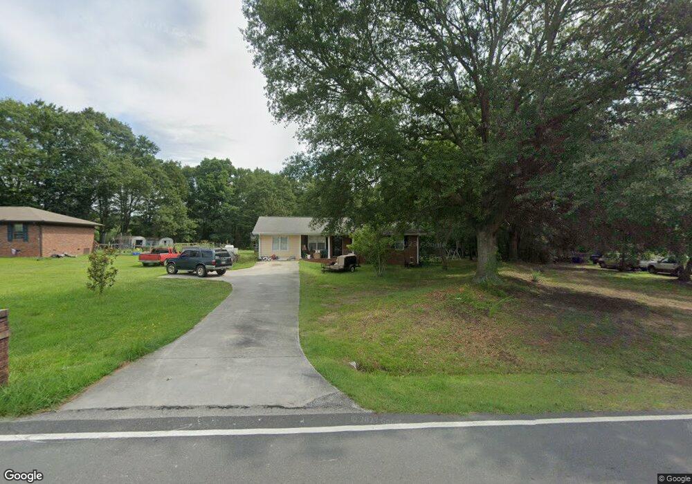
565 Miles Patrick Rd Winder, GA 30680
Estimated Value: $248,747 - $302,000
2
Beds
2
Baths
988
Sq Ft
$280/Sq Ft
Est. Value
About This Home
This home is located at 565 Miles Patrick Rd, Winder, GA 30680 and is currently estimated at $276,187, approximately $279 per square foot. 565 Miles Patrick Rd is a home located in Barrow County with nearby schools including County Line Elementary School, Russell Middle School, and Winder-Barrow High School.
Ownership History
Date
Name
Owned For
Owner Type
Purchase Details
Closed on
Feb 14, 1997
Sold by
Poole Christie
Bought by
Anderson Jonathan
Current Estimated Value
Purchase Details
Closed on
Mar 1, 1991
Bought by
Ivey Christie I
Create a Home Valuation Report for This Property
The Home Valuation Report is an in-depth analysis detailing your home's value as well as a comparison with similar homes in the area
Home Values in the Area
Average Home Value in this Area
Purchase History
| Date | Buyer | Sale Price | Title Company |
|---|---|---|---|
| Anderson Jonathan | $71,000 | -- | |
| Ivey Christie I | $54,000 | -- |
Source: Public Records
Mortgage History
| Date | Status | Borrower | Loan Amount |
|---|---|---|---|
| Closed | Anderson Jonathan | $0 |
Source: Public Records
Tax History
| Year | Tax Paid | Tax Assessment Tax Assessment Total Assessment is a certain percentage of the fair market value that is determined by local assessors to be the total taxable value of land and additions on the property. | Land | Improvement |
|---|---|---|---|---|
| 2025 | $1,647 | $62,194 | $13,440 | $48,754 |
| 2024 | $1,651 | $60,766 | $13,440 | $47,326 |
| 2023 | $1,170 | $60,766 | $13,440 | $47,326 |
| 2022 | $1,387 | $42,116 | $13,440 | $28,676 |
| 2021 | $1,402 | $42,116 | $13,440 | $28,676 |
| 2020 | $1,391 | $42,116 | $13,440 | $28,676 |
| 2019 | $1,315 | $39,287 | $13,440 | $25,847 |
| 2018 | $1,309 | $39,287 | $13,440 | $25,847 |
| 2017 | $1,006 | $33,734 | $13,440 | $20,294 |
| 2016 | $964 | $32,280 | $13,440 | $18,840 |
| 2015 | $973 | $32,507 | $13,440 | $19,067 |
| 2014 | $735 | $26,107 | $6,586 | $19,522 |
| 2013 | -- | $25,289 | $6,585 | $18,703 |
Source: Public Records
Map
Nearby Homes
- 128 Northridge Dr
- 932 Century Oak Dr
- 538 Valleyview Dr
- 311 Rockwell Church Rd NW
- 2050 Whispering Way
- 615 Wellington Dr
- 845 Idlewood Rd
- 716 Michael Dr
- 27 Creekside Dr
- 0 E Northcrest Dr Unit 10648147
- 421 N 5th Ave
- 469 Plantation Dr
- 403 Ryan Cir
- 436 Northcrest Dr
- 318 Ryan Rd
- 719 Mallard Dr
- 617 Teal Dr
- 713 Mallard Dr
- 236 Hidden Ct
- 222 Ryan Rd
- 569 Miles Patrick Rd
- 559 Miles Patrick Rd
- 564 Miles Patrick Rd
- 555 Miles Patrick Rd
- 560 Miles Patrick Rd Unit 1
- 560 Miles Patrick Rd
- 103 Ashwood Dr
- 551 Miles Patrick Rd
- 406 Winfield Terrace Unit 2
- 547 Miles Patrick Rd
- 107 Ashwood Dr
- 102 Ashwood Dr Unit 1
- 543 Miles Patrick Rd
- 109 Ashwood Dr
- 109 Ashwood Dr
- 609 Miles Patrick Rd
- 104 Ashwood Dr
- 104 Ashwood Dr Unit 1
- 405 Winfield Terrace
- 106 Ashwood Dr
Your Personal Tour Guide
Ask me questions while you tour the home.