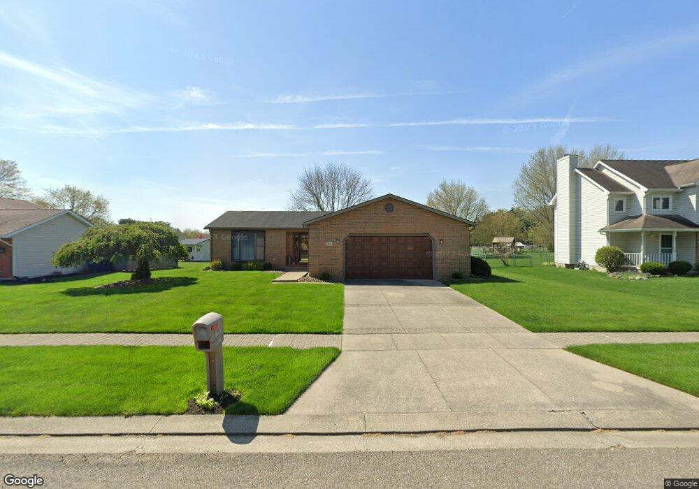
565 Myrtle Ave Newark, OH 43055
Estimated Value: $315,766 - $332,000
2
Beds
2
Baths
1,666
Sq Ft
$194/Sq Ft
Est. Value
About This Home
This home is located at 565 Myrtle Ave, Newark, OH 43055 and is currently estimated at $323,192, approximately $193 per square foot. 565 Myrtle Ave is a home located in Licking County with nearby schools including Legend Elementary School, Liberty Middle School, and Newark High School.
Ownership History
Date
Name
Owned For
Owner Type
Purchase Details
Closed on
Jul 11, 2011
Sold by
Wetzel Kelly S
Bought by
Wetzel M Joann
Current Estimated Value
Purchase Details
Closed on
Jun 24, 2011
Sold by
Price Stephen D
Bought by
Wetzel M Joann
Purchase Details
Closed on
Jun 21, 2011
Sold by
Price David L
Bought by
Wetzel Joann M
Purchase Details
Closed on
Jun 20, 2011
Sold by
Wetzel Wade L
Bought by
Wetzel M Joann
Purchase Details
Closed on
Jan 21, 2010
Sold by
Wetzel M Joann
Bought by
Wetzel M Joann and Price Stepehn D
Create a Home Valuation Report for This Property
The Home Valuation Report is an in-depth analysis detailing your home's value as well as a comparison with similar homes in the area
Home Values in the Area
Average Home Value in this Area
Purchase History
| Date | Buyer | Sale Price | Title Company |
|---|---|---|---|
| Wetzel M Joann | -- | Attorney | |
| Wetzel M Joann | -- | Attorney | |
| Wetzel Joann M | -- | Attorney | |
| Wetzel M Joann | -- | Attorney | |
| Wetzel M Joann | -- | Attorney | |
| Wetzel M Joann | -- | Attorney |
Source: Public Records
Tax History
| Year | Tax Paid | Tax Assessment Tax Assessment Total Assessment is a certain percentage of the fair market value that is determined by local assessors to be the total taxable value of land and additions on the property. | Land | Improvement |
|---|---|---|---|---|
| 2024 | $2,838 | $89,190 | $22,860 | $66,330 |
| 2023 | $2,855 | $89,190 | $22,860 | $66,330 |
| 2022 | $2,398 | $68,570 | $13,720 | $54,850 |
| 2021 | $2,515 | $68,570 | $13,720 | $54,850 |
| 2020 | $2,574 | $68,570 | $13,720 | $54,850 |
| 2019 | $2,162 | $57,160 | $11,450 | $45,710 |
| 2018 | $2,163 | $0 | $0 | $0 |
| 2017 | $1,941 | $0 | $0 | $0 |
| 2016 | $1,771 | $0 | $0 | $0 |
| 2015 | $1,810 | $0 | $0 | $0 |
| 2014 | $2,838 | $0 | $0 | $0 |
| 2013 | $1,826 | $0 | $0 | $0 |
Source: Public Records
Map
Nearby Homes
- 1860 Churchill Downs Rd
- 681 Woods Edge Ln
- 105 Margaret St
- 708 Olde Creek Dr
- 1517 S Hunters Dr
- 1636 E Turkey Run Dr
- 4491 Price Rd NE
- 301 N Vernon Ave
- 1001 Kingsbury Ct Unit 1001
- 1821 Mount Vernon Rd
- 0 Burch Dr NE
- 1251 Pineview Trail Unit A
- 11 Waterworks Rd
- 1954 Iselin St
- 946 Lateglow Ct
- 1989 Iselin St
- 1980 Jamesburg St
- 1956 Jamesburg St
- 1972 Jamesburg St
- 1964 Jamesburg St
- 557 Myrtle Ave
- 573 Myrtle Ave
- 1616 Jamestown Ct
- 1624 Jamestown Ct
- 549 Myrtle Ave
- 583 Myrtle Ave
- 1608 Jamestown Ct
- 564 Myrtle Ave
- 572 Myrtle Ave
- 556 Myrtle Ave
- 1600 Jamestown Ct
- 541 Myrtle Ave
- 1619 Jamestown Ct
- 548 Myrtle Ave
- 593 Myrtle Ave
- 540 Myrtle Ave
- 1592 Jamestown Ct
- 1613 Jamestown Ct
- 533 Myrtle Ave
- 592 Myrtle Ave
Your Personal Tour Guide
Ask me questions while you tour the home.