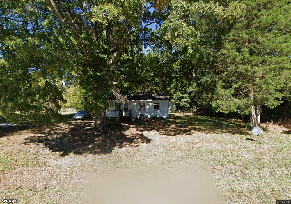
565 Pop Stirewalt Rd Salisbury, NC 28146
Estimated Value: $144,037 - $358,000
--
Bed
1
Bath
825
Sq Ft
$291/Sq Ft
Est. Value
About This Home
This home is located at 565 Pop Stirewalt Rd, Salisbury, NC 28146 and is currently estimated at $240,009, approximately $290 per square foot. 565 Pop Stirewalt Rd is a home located in Rowan County with nearby schools including Elizabeth Duncan Koontz Elementary School, Southeast Middle School, and Jesse C Carson High School.
Ownership History
Date
Name
Owned For
Owner Type
Purchase Details
Closed on
Apr 8, 2021
Sold by
Carriker Karen Greer and Carriker Samuel David
Bought by
Denton Kenneth David
Current Estimated Value
Purchase Details
Closed on
Jan 25, 2021
Sold by
Carriker Karen Greer and Carriker Samuel David
Bought by
Carriker Karen Greer
Purchase Details
Closed on
Jan 1, 1996
Bought by
Greer Myrtle C
Create a Home Valuation Report for This Property
The Home Valuation Report is an in-depth analysis detailing your home's value as well as a comparison with similar homes in the area
Home Values in the Area
Average Home Value in this Area
Purchase History
| Date | Buyer | Sale Price | Title Company |
|---|---|---|---|
| Denton Kenneth David | -- | None Available | |
| Carriker Karen Greer | -- | None Available | |
| Greer Myrtle C | -- | -- |
Source: Public Records
Tax History Compared to Growth
Tax History
| Year | Tax Paid | Tax Assessment Tax Assessment Total Assessment is a certain percentage of the fair market value that is determined by local assessors to be the total taxable value of land and additions on the property. | Land | Improvement |
|---|---|---|---|---|
| 2025 | $424 | $63,275 | $25,613 | $37,662 |
| 2024 | $424 | $63,275 | $25,613 | $37,662 |
| 2023 | $424 | $63,275 | $25,613 | $37,662 |
| 2022 | $367 | $49,096 | $23,405 | $25,691 |
| 2021 | $364 | $49,096 | $23,405 | $25,691 |
| 2020 | $364 | $49,096 | $23,405 | $25,691 |
| 2019 | $364 | $49,096 | $23,405 | $25,691 |
| 2018 | $326 | $44,369 | $23,404 | $20,965 |
| 2017 | $143 | $44,369 | $23,404 | $20,965 |
| 2016 | $152 | $44,369 | $23,404 | $20,965 |
| 2015 | $154 | $44,369 | $23,404 | $20,965 |
| 2014 | $154 | $45,327 | $23,404 | $21,923 |
Source: Public Records
Map
Nearby Homes
- 0 Maple St
- 4980 Mount Hope Church Rd
- 1008 Courtney Ln Unit 28
- 175 Sun Valley Dr
- 655 Lippard Rd
- 1143 Journey Ln
- 720 Bee Tree Rd
- 294 Wingate Ln
- 0 Bee Tree Rd
- 35 Happy Hollow Rd
- 295 Wingate Ln
- 130 Happy Hollow Rd
- 130 Happy Hollow Rd Unit 13/B
- 5037 Faith Rd
- 330 Oak Ridge Run
- 4505 Cook Rd
- 210 Rattlesnake St
- 345 Rainey Rd
- 1160 Long Creek Ln
- 4550 Cook Rd
- 535 Pop Stirewalt Rd
- 520 Pop Stirewalt Rd
- 7135 Pop Stirewalt Rd
- 483 Pop Stirewalt Rd
- 585 Pop Stirewalt Rd
- 110 Cliff Eagle Rd
- 145 Tarbox Ln
- 455 Pop Stirewalt Rd
- 470 Pop Stirewalt Rd
- 150 Tarbox Ln
- 445 Pop Stirewalt Rd
- 135 Tarbox Ln
- 610 Pop Stirewalt Rd
- 140 Tarbox Ln
- 625 Pop Stirewalt Rd
- 117 Cliff Eagle Rd
- 125 Tarbox Ln
- 119 Cliff Eagle Rd Unit 7
- 1010 Stoney Creek Dr
- 115 Cliff Eagle Rd