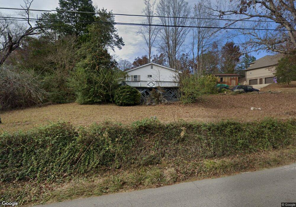
565 Roulain Rd Odenville, AL 35120
Estimated Value: $143,000 - $451,476
--
Bed
--
Bath
761
Sq Ft
$337/Sq Ft
Est. Value
About This Home
This home is located at 565 Roulain Rd, Odenville, AL 35120 and is currently estimated at $256,369, approximately $336 per square foot. 565 Roulain Rd is a home located in St. Clair County with nearby schools including Margaret Elementary School, Moody Middle School, and Moody High School.
Ownership History
Date
Name
Owned For
Owner Type
Purchase Details
Closed on
Feb 18, 2020
Sold by
Four Star Homes Llc
Bought by
Pendegraph Geirge Michael and Prndegraph Tiffany G
Current Estimated Value
Home Financials for this Owner
Home Financials are based on the most recent Mortgage that was taken out on this home.
Original Mortgage
$266,140
Outstanding Balance
$235,648
Interest Rate
3.6%
Mortgage Type
New Conventional
Estimated Equity
$20,721
Purchase Details
Closed on
May 7, 2019
Sold by
Pendegraph Janice Linda
Bought by
Four Star Homes Llc
Purchase Details
Closed on
Apr 5, 2014
Sold by
Esparza Juan Luis
Bought by
Pendegraph Freeman Ray and Pendegraph Janice Linda
Purchase Details
Closed on
May 3, 2012
Sold by
Pendegraph Freeman R and Harrison Charlotte D
Bought by
Pendegraph Freeman R and Pendegraph Janice B
Create a Home Valuation Report for This Property
The Home Valuation Report is an in-depth analysis detailing your home's value as well as a comparison with similar homes in the area
Home Values in the Area
Average Home Value in this Area
Purchase History
| Date | Buyer | Sale Price | Title Company |
|---|---|---|---|
| Pendegraph Geirge Michael | $296,140 | None Available | |
| Four Star Homes Llc | -- | None Available | |
| Pendegraph Freeman Ray | $5,000 | None Available | |
| Pendegraph Freeman R | -- | -- |
Source: Public Records
Mortgage History
| Date | Status | Borrower | Loan Amount |
|---|---|---|---|
| Open | Pendegraph Geirge Michael | $266,140 |
Source: Public Records
Tax History Compared to Growth
Tax History
| Year | Tax Paid | Tax Assessment Tax Assessment Total Assessment is a certain percentage of the fair market value that is determined by local assessors to be the total taxable value of land and additions on the property. | Land | Improvement |
|---|---|---|---|---|
| 2024 | $318 | $11,802 | $3,400 | $8,402 |
| 2023 | $602 | $11,802 | $3,400 | $8,402 |
| 2022 | $344 | $4,780 | $1,030 | $3,750 |
| 2021 | $291 | $4,774 | $1,024 | $3,750 |
| 2020 | $291 | $4,030 | $1,015 | $3,015 |
| 2019 | $318 | $8,830 | $2,800 | $6,030 |
| 2018 | $322 | $8,940 | $0 | $0 |
| 2017 | $294 | $8,940 | $0 | $0 |
| 2016 | $322 | $8,940 | $0 | $0 |
| 2015 | $294 | $8,240 | $0 | $0 |
| 2014 | $294 | $8,180 | $0 | $0 |
Source: Public Records
Map
Nearby Homes
- 0 Roulain Rd Unit 7.91 acres 21414127
- 74 Autumn Trace
- 260 Hawks Bend Ln
- 50 Mason Dr
- 1 Summit Ridge Way Unit 76
- 1 Summit Ridge Way Unit 60
- 80 Shadow Cove Ln
- 20 Shadow Cove Ln
- 922 Brookstone Place
- 117 Smith Ln
- 125 Deer Creek Dr
- 135 Deer Creek Dr
- 60 Deer Creek Dr
- 17 Greenleaf Ln
- 335 Jacobs Loop
- 345 Jacobs Loop
- 260 Bradford Way
- 250 Bradford Way
- 310 Jacobs Loop
- 390 Jacobs Loop