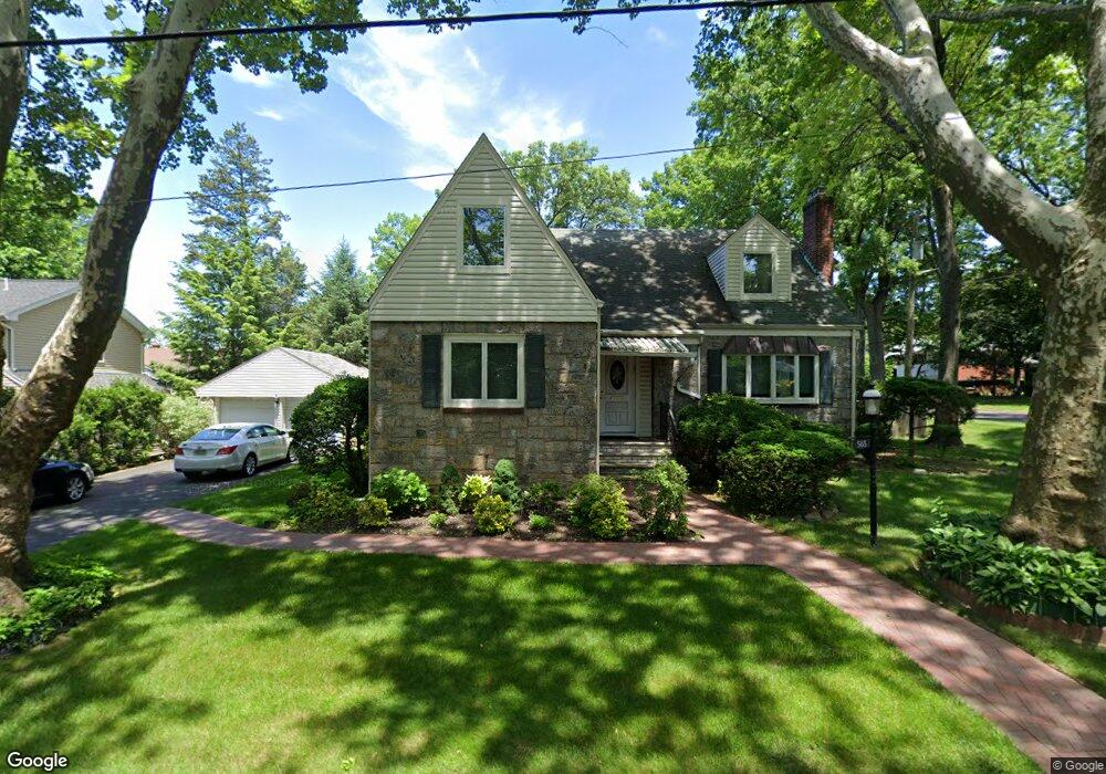
565 Rutland Ave Teaneck, NJ 07666
Estimated Value: $894,000 - $1,055,000
--
Bed
--
Bath
1,970
Sq Ft
$507/Sq Ft
Est. Value
About This Home
This home is located at 565 Rutland Ave, Teaneck, NJ 07666 and is currently estimated at $998,487, approximately $506 per square foot. 565 Rutland Ave is a home located in Bergen County with nearby schools including Teaneck Senior High School, Grace Lutheran School, and Yeshivat He'atid.
Ownership History
Date
Name
Owned For
Owner Type
Purchase Details
Closed on
Sep 5, 2007
Sold by
Aulstine Norris and Norris Sonia
Bought by
Loplon David L and Koplon Marilyn
Current Estimated Value
Home Financials for this Owner
Home Financials are based on the most recent Mortgage that was taken out on this home.
Original Mortgage
$552,000
Outstanding Balance
$350,919
Interest Rate
6.65%
Mortgage Type
New Conventional
Estimated Equity
$647,568
Create a Home Valuation Report for This Property
The Home Valuation Report is an in-depth analysis detailing your home's value as well as a comparison with similar homes in the area
Home Values in the Area
Average Home Value in this Area
Purchase History
| Date | Buyer | Sale Price | Title Company |
|---|---|---|---|
| Loplon David L | $690,000 | -- |
Source: Public Records
Mortgage History
| Date | Status | Borrower | Loan Amount |
|---|---|---|---|
| Open | Loplon David L | $552,000 |
Source: Public Records
Tax History Compared to Growth
Tax History
| Year | Tax Paid | Tax Assessment Tax Assessment Total Assessment is a certain percentage of the fair market value that is determined by local assessors to be the total taxable value of land and additions on the property. | Land | Improvement |
|---|---|---|---|---|
| 2025 | $20,414 | $934,700 | $540,200 | $394,500 |
| 2024 | $19,300 | $934,700 | $540,200 | $394,500 |
| 2023 | $18,920 | $584,500 | $340,100 | $244,400 |
| 2022 | $18,920 | $584,500 | $340,100 | $244,400 |
| 2021 | $19,031 | $584,500 | $340,100 | $244,400 |
| 2020 | $18,903 | $584,500 | $340,100 | $244,400 |
| 2019 | $18,686 | $584,500 | $340,100 | $244,400 |
| 2018 | $18,546 | $584,500 | $340,100 | $244,400 |
| 2017 | $18,371 | $584,500 | $340,100 | $244,400 |
| 2016 | $18,096 | $584,500 | $340,100 | $244,400 |
| 2015 | $17,810 | $584,500 | $340,100 | $244,400 |
| 2014 | $15,087 | $586,800 | $400,100 | $186,700 |
Source: Public Records
Map
Nearby Homes
- 526 Rutland Ave
- 591 Warwick Ave
- 532 Winthrop Rd
- 364 Rutland Ave
- 21 Briarcliffe Rd
- 1329 Dickerson Rd
- 711 Camperdown Rd
- 565 N Forest Dr
- 506 Sunderland Rd
- 1328 Taft Rd
- 273 W Englewood Ave
- 48 Sussex Rd
- 325 New Bridge Rd
- 665 Northumberland Rd
- 98 John Place
- 64 Glenwood Dr S
- 1106 Bromley Ave
- 55 Maiden Ln
- 1105 Belle Ave
- 1093 Sheridan St
- 1454 Hudson Rd
- 577 Rutland Ave
- 583 Rutland Ave
- 564 Rutland Ave
- 572 Rutland Ave
- 1460 Hudson Rd
- 548 Maitland Ave
- 1445 Hudson Rd
- 580 Rutland Ave
- 1453 Hudson Rd
- 591 Rutland Ave
- 1435 Hudson Rd
- 584 Rutland Ave
- 1461 Hudson Rd
- 1429 Hudson Rd
- 545 Rutland Ave
- 556 Maitland Ave
- 597 Rutland Ave
- 590 Rutland Ave
- 534 Maitland Ave