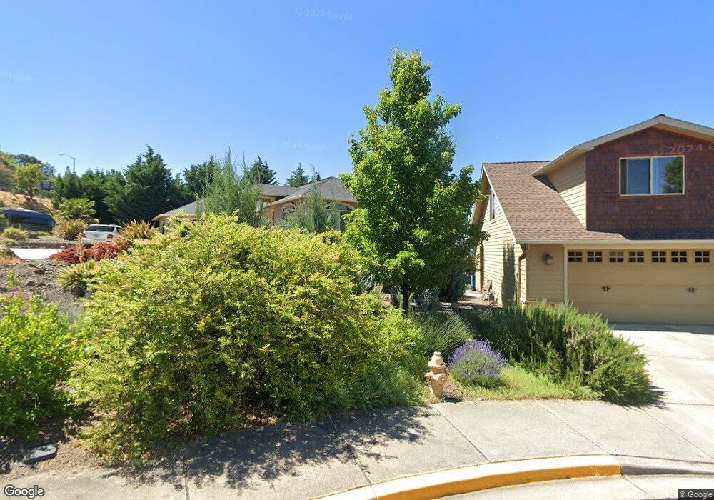
565 W Nevada Unit 16 Ashland, OR 97520
Quiet Village NeighborhoodEstimated Value: $700,000 - $758,000
2
Beds
2
Baths
1,988
Sq Ft
$370/Sq Ft
Est. Value
About This Home
This home is located at 565 W Nevada Unit 16, Ashland, OR 97520 and is currently estimated at $735,604, approximately $370 per square foot. 565 W Nevada Unit 16 is a home located in Jackson County with nearby schools including Helman Elementary School, Ashland Middle School, and Ashland High School.
Ownership History
Date
Name
Owned For
Owner Type
Purchase Details
Closed on
Mar 13, 2014
Sold by
Mckoin Elizabeth
Bought by
Smith James Greg and Smith Elizabeth Sharp
Current Estimated Value
Home Financials for this Owner
Home Financials are based on the most recent Mortgage that was taken out on this home.
Original Mortgage
$116,000
Outstanding Balance
$86,775
Interest Rate
4%
Mortgage Type
Adjustable Rate Mortgage/ARM
Estimated Equity
$648,829
Purchase Details
Closed on
Jun 19, 2008
Sold by
Bank Of The Cascades
Bought by
Mckoin Elizabeth
Create a Home Valuation Report for This Property
The Home Valuation Report is an in-depth analysis detailing your home's value as well as a comparison with similar homes in the area
Home Values in the Area
Average Home Value in this Area
Purchase History
| Date | Buyer | Sale Price | Title Company |
|---|---|---|---|
| Smith James Greg | $150,000 | First American Title Ins | |
| Mckoin Elizabeth | $135,000 | Amerititle |
Source: Public Records
Mortgage History
| Date | Status | Borrower | Loan Amount |
|---|---|---|---|
| Open | Smith James Greg | $116,000 |
Source: Public Records
Tax History Compared to Growth
Tax History
| Year | Tax Paid | Tax Assessment Tax Assessment Total Assessment is a certain percentage of the fair market value that is determined by local assessors to be the total taxable value of land and additions on the property. | Land | Improvement |
|---|---|---|---|---|
| 2025 | $6,662 | $429,710 | $168,260 | $261,450 |
| 2024 | $6,662 | $417,200 | $163,360 | $253,840 |
| 2023 | $6,445 | $405,050 | $158,600 | $246,450 |
| 2022 | $6,239 | $405,050 | $158,600 | $246,450 |
| 2021 | $6,026 | $393,260 | $153,980 | $239,280 |
| 2020 | $5,857 | $381,810 | $149,490 | $232,320 |
| 2019 | $5,765 | $359,900 | $140,900 | $219,000 |
| 2018 | $5,445 | $349,420 | $136,800 | $212,620 |
| 2017 | $5,406 | $349,420 | $136,800 | $212,620 |
| 2016 | $5,265 | $329,370 | $128,940 | $200,430 |
| 2015 | $3,784 | $349,740 | $131,480 | $218,260 |
| 2014 | $1,394 | $88,370 | $88,370 | $0 |
Source: Public Records
Map
Nearby Homes
- 720 Grover St
- 230 Grant St
- 472 Lindsay Ln
- 242 Grant St
- 662 Vansant St
- 0 Schofield St Unit TL7200-TL7100
- 581 Scenic Dr Unit 9
- 317 Maple St
- 566 Coffee Ln
- 364 Randy St
- 356 Randy St
- 332 Randy St
- 1179 N Main St
- 595 Elizabeth Ave
- 360 Coventry Place
- 495 Chestnut St Unit 6
- 495 Chestnut St Unit 19
- 311 Glenn St Unit 3
- 323 Glenn St Unit 6
- 311 Luna Vista St Unit 2
- 565 W Nevada
- 555 W Nevada St Unit 15
- 555 W Nevada St
- 554 W Nevada St Unit 18
- 554 W Nevada St
- 575 W Nevada St Unit 17
- 575 W Nevada St
- 550 W Nevada St
- 546 W Nevada St Unit 20
- 546 W Nevada St
- 535 W Nevada St Unit 14
- 535 W Nevada St
- 542 W Nevada St Unit 21
- 542 W Nevada St
- 525 W Nevada St Unit 13
- 525 W Nevada St
- 538 W Nevada St Unit 22
- 538 W Nevada St
- 847 N Main St
- 849 N Main St