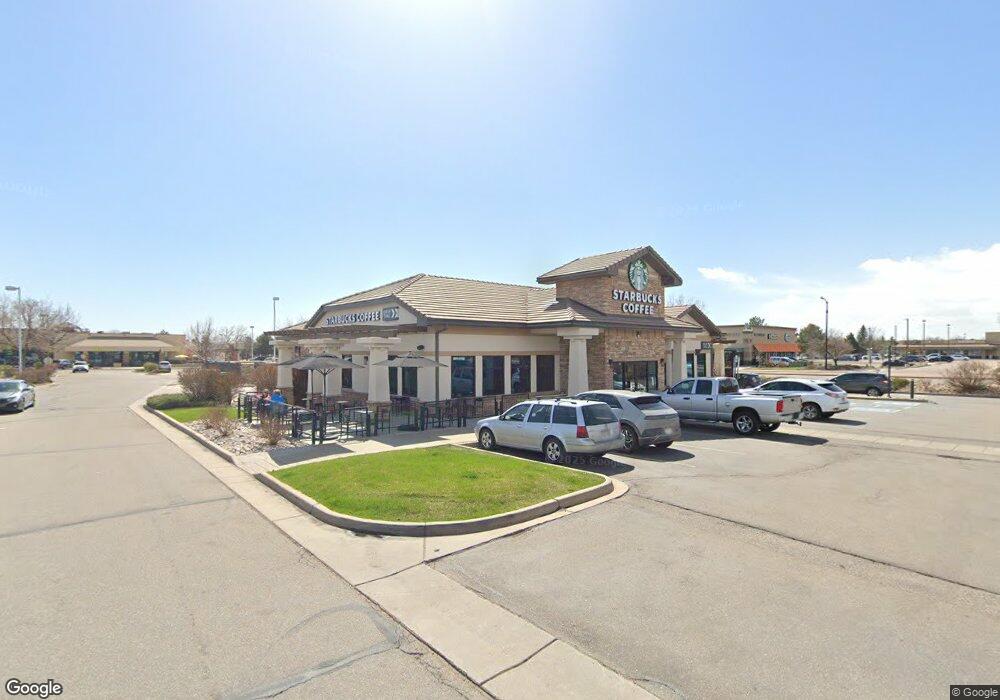
565 W South Boulder Rd Lafayette, CO 80026
--
Bed
--
Bath
4,520
Sq Ft
0.98
Acres
About This Home
This home is located at 565 W South Boulder Rd, Lafayette, CO 80026. 565 W South Boulder Rd is a home located in Boulder County with nearby schools including Ryan Elementary School, Angevine Middle School, and Centaurus High School.
Ownership History
Date
Name
Owned For
Owner Type
Purchase Details
Closed on
Oct 20, 2021
Sold by
Ladendorf Equilties 2 Llc
Bought by
Cdg Lafayette Llc
Home Financials for this Owner
Home Financials are based on the most recent Mortgage that was taken out on this home.
Original Mortgage
$2,248,640
Outstanding Balance
$1,441,972
Interest Rate
2.8%
Mortgage Type
Commercial
Purchase Details
Closed on
Jun 13, 2017
Sold by
Guaranty Bank And Trust Company
Bought by
Ladendorf Equities 2 Llc
Home Financials for this Owner
Home Financials are based on the most recent Mortgage that was taken out on this home.
Original Mortgage
$1,700,000
Interest Rate
4.02%
Mortgage Type
Commercial
Purchase Details
Closed on
Nov 16, 2012
Sold by
Guaranty Bank & Trust Company
Bought by
The Home State Bank
Purchase Details
Closed on
Dec 20, 2002
Sold by
Waneka Huckins Waneka Llc
Bought by
First National Bank Of Longmont
Create a Home Valuation Report for This Property
The Home Valuation Report is an in-depth analysis detailing your home's value as well as a comparison with similar homes in the area
Home Values in the Area
Average Home Value in this Area
Purchase History
| Date | Buyer | Sale Price | Title Company |
|---|---|---|---|
| Cdg Lafayette Llc | -- | None Available | |
| Ladendorf Equities 2 Llc | $125,000 | Thomas Title & Escrow | |
| The Home State Bank | $790,000 | Land Title Guarantee Company | |
| First National Bank Of Longmont | $774,000 | First American Heritage Titl |
Source: Public Records
Mortgage History
| Date | Status | Borrower | Loan Amount |
|---|---|---|---|
| Open | Cdg Lafayette Llc | $2,248,640 | |
| Previous Owner | Ladendorf Equities 2 Llc | $1,700,000 |
Source: Public Records
Tax History Compared to Growth
Tax History
| Year | Tax Paid | Tax Assessment Tax Assessment Total Assessment is a certain percentage of the fair market value that is determined by local assessors to be the total taxable value of land and additions on the property. | Land | Improvement |
|---|---|---|---|---|
| 2025 | $53,103 | $628,344 | $239,247 | $389,097 |
| 2024 | $53,103 | $628,344 | $239,247 | $389,097 |
| 2023 | $52,195 | $599,292 | $242,228 | $365,434 |
| 2022 | $41,384 | $440,574 | $199,932 | $240,642 |
| 2021 | $39,786 | $440,574 | $199,932 | $240,642 |
| 2020 | $37,875 | $414,410 | $199,932 | $214,478 |
| 2019 | $37,351 | $414,410 | $199,932 | $214,478 |
| 2018 | $36,019 | $394,551 | $153,303 | $241,248 |
| 2017 | $35,070 | $394,551 | $153,303 | $241,248 |
| 2016 | $25,875 | $281,822 | $153,294 | $128,528 |
| 2015 | $24,245 | $281,822 | $225,127 | $56,695 |
| 2014 | $24,369 | $281,822 | $225,127 | $56,695 |
Source: Public Records
Map
Nearby Homes
- 1198 Milo Cir Unit A
- 1068 Milo Cir Unit A
- 1091 Milo Cir Unit B
- 1045 Milo Cir Unit A
- 998 Milo Cir Unit A
- 1191 Milo Cir Unit A
- 924 Milo Cir Unit A
- 1418 Marigold Dr
- 911 Homer Cir
- 1053 Delta Dr Unit B
- 1065 Delta Dr Unit A
- 655 N Gooseberry Ct
- 880 Orion Dr
- 511 S Roosevelt Ave
- 490 E Sutton Cir
- 805 Argos Cir
- 285 Skylark Cir
- 925 Sparta Dr
- 304 Skylark Cir
- 372 S Carr Ave
- 1100 Milo Cir Unit B
- 1100 Milo Cir Unit A
- 1100 Milo Cir
- 1220 Milo Cir Unit B
- 1220 Milo Cir Unit A
- 1220 Milo Cir
- 1240 Milo Cir Unit B
- 1240 Milo Cir Unit A
- 1240 Milo Cir Unit 14B
- 1230 Milo Cir Unit B
- 1230 Milo Cir Unit A
- 1200 Milo Cir Unit B
- 1200 Milo Cir Unit A
- 1210 Milo Cir Unit B
- 1210 Milo Cir Unit A
- 1210 Milo Cir
- 1198 Milo Cir Unit B
- 1098 Milo Cir Unit B
- 1098 Milo Cir Unit A
- 1110 Milo Cir Unit B