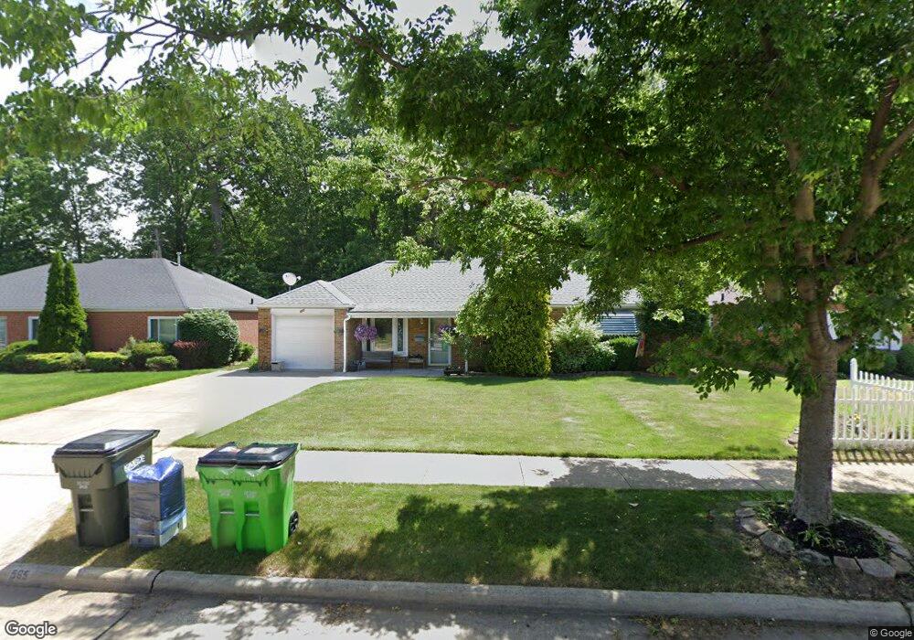
565 Walnut Dr Euclid, OH 44132
Estimated Value: $162,765 - $185,000
3
Beds
2
Baths
1,401
Sq Ft
$125/Sq Ft
Est. Value
About This Home
This home is located at 565 Walnut Dr, Euclid, OH 44132 and is currently estimated at $175,691, approximately $125 per square foot. 565 Walnut Dr is a home located in Cuyahoga County with nearby schools including Shoreview Elementary School, Euclid High School, and Mater Dei Academy.
Ownership History
Date
Name
Owned For
Owner Type
Purchase Details
Closed on
Mar 25, 1992
Sold by
Sawicki Kenneth G
Bought by
Mcconville Denise
Current Estimated Value
Purchase Details
Closed on
Apr 14, 1989
Sold by
Poropat Stanley D
Bought by
Sawicki Kenneth G
Purchase Details
Closed on
Jun 2, 1980
Sold by
August Victor
Bought by
Poropat Stanley D
Purchase Details
Closed on
Oct 6, 1977
Sold by
Korosec Louis J and M J
Bought by
August Victor
Purchase Details
Closed on
Jan 1, 1975
Bought by
Korosec Louis J and M J
Create a Home Valuation Report for This Property
The Home Valuation Report is an in-depth analysis detailing your home's value as well as a comparison with similar homes in the area
Home Values in the Area
Average Home Value in this Area
Purchase History
We collect this data history from publicly available records. To have your information removed, we recommend requesting removal directly through your county’s website.
| Date | Buyer | Sale Price | Title Company |
|---|---|---|---|
| Mcconville Denise | $76,500 | -- | |
| Sawicki Kenneth G | $68,000 | -- | |
| Poropat Stanley D | $57,000 | -- | |
| August Victor | $41,000 | -- | |
| Korosec Louis J | -- | -- |
Source: Public Records
Tax History
| Year | Tax Paid | Tax Assessment Tax Assessment Total Assessment is a certain percentage of the fair market value that is determined by local assessors to be the total taxable value of land and additions on the property. | Land | Improvement |
|---|---|---|---|---|
| 2025 | $3,495 | $52,675 | $9,660 | $43,015 |
| 2024 | $3,612 | $52,675 | $9,660 | $43,015 |
| 2023 | $3,385 | $39,410 | $8,540 | $30,870 |
| 2022 | $3,308 | $39,410 | $8,540 | $30,870 |
| 2021 | $3,681 | $39,410 | $8,540 | $30,870 |
| 2020 | $3,088 | $29,860 | $6,480 | $23,380 |
| 2019 | $2,777 | $85,300 | $18,500 | $66,800 |
| 2018 | $2,804 | $29,860 | $6,480 | $23,380 |
| 2017 | $2,940 | $26,150 | $5,180 | $20,970 |
| 2016 | $2,946 | $26,150 | $5,180 | $20,970 |
| 2015 | $2,681 | $26,150 | $5,180 | $20,970 |
| 2014 | $2,681 | $26,150 | $5,180 | $20,970 |
Source: Public Records
Map
Nearby Homes
- 29107 Fuller Ave
- 29023 Weber Ave
- 670 Walnut Dr
- 29234 Grand Blvd
- 27182 Oriole Ave
- 29468 Woodway Dr
- 754 Hemlock Dr
- 27030 Farringdon Ave
- 420 E 271st St
- 26831 Shoreview Ave
- 746 N Elmwood Ave
- 26890 Drakefield Ave
- 610 E 266th St
- 29616 Grand Blvd
- 26530 Shoreview Ave
- 26361 Elinore Ave
- 295 E 276th St
- 311 E 262nd St
- 355 E 257th St
- 325 E 257th St
Your Personal Tour Guide
Ask me questions while you tour the home.