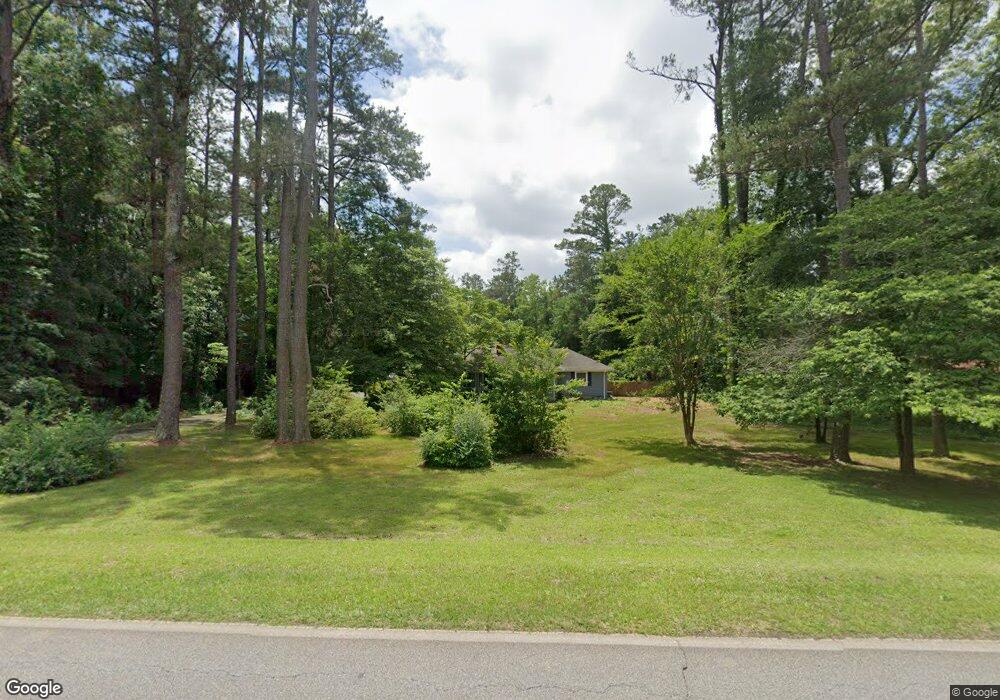
5650 Arkwright Rd Macon, GA 31210
Estimated Value: $207,734 - $271,000
3
Beds
2
Baths
1,728
Sq Ft
$139/Sq Ft
Est. Value
About This Home
This home is located at 5650 Arkwright Rd, Macon, GA 31210 and is currently estimated at $240,184, approximately $138 per square foot. 5650 Arkwright Rd is a home located in Bibb County with nearby schools including Lane Elementary School, Howard Middle School, and Howard High School.
Ownership History
Date
Name
Owned For
Owner Type
Purchase Details
Closed on
Aug 1, 2022
Sold by
Joan Stewart Wanda
Bought by
Stewart Wanda Joan and Minnick John H
Current Estimated Value
Purchase Details
Closed on
Oct 14, 2005
Sold by
Burdette Michael G
Bought by
Stewart Wanda Joan and Burdette Wanda J
Home Financials for this Owner
Home Financials are based on the most recent Mortgage that was taken out on this home.
Original Mortgage
$134,400
Interest Rate
6.19%
Mortgage Type
New Conventional
Create a Home Valuation Report for This Property
The Home Valuation Report is an in-depth analysis detailing your home's value as well as a comparison with similar homes in the area
Purchase History
| Date | Buyer | Sale Price | Title Company |
|---|---|---|---|
| Stewart Wanda Joan | -- | Moore Jennifer N | |
| Stewart Wanda Joan | -- | Moore Jennifer N | |
| Stewart Wanda Joan | -- | None Available |
Source: Public Records
Mortgage History
| Date | Status | Borrower | Loan Amount |
|---|---|---|---|
| Previous Owner | Stewart Wanda Joan | $134,400 |
Source: Public Records
Tax History
| Year | Tax Paid | Tax Assessment Tax Assessment Total Assessment is a certain percentage of the fair market value that is determined by local assessors to be the total taxable value of land and additions on the property. | Land | Improvement |
|---|---|---|---|---|
| 2025 | $1,149 | $53,760 | $6,838 | $46,922 |
| 2024 | $1,139 | $51,846 | $4,924 | $46,922 |
| 2023 | $1,328 | $51,846 | $4,924 | $46,922 |
| 2022 | $1,725 | $56,814 | $16,934 | $39,880 |
| 2021 | $1,893 | $56,814 | $16,934 | $39,880 |
| 2020 | $1,934 | $56,814 | $16,934 | $39,880 |
| 2019 | $1,909 | $55,766 | $16,934 | $38,832 |
| 2018 | $3,104 | $55,766 | $16,934 | $38,832 |
| 2017 | $1,898 | $57,648 | $18,816 | $38,832 |
| 2016 | $1,752 | $57,648 | $18,816 | $38,832 |
| 2015 | $2,481 | $57,648 | $18,816 | $38,832 |
| 2014 | $2,485 | $57,648 | $18,816 | $38,832 |
Source: Public Records
Map
Nearby Homes
- 87 Georgia 87
- 310 Chadwick Ct
- 0 Highway 87 Unit 183111
- 0 Highway 87 Unit 10689530
- 135 Chadwick Dr
- 251 Chadwick Cir
- 285 Sheraton Blvd
- 2586 Wesleyan Dr N
- 5158 Bowman Rd
- 4598 Arkwright Rd
- 116 Brookefield Dr
- 1643 Wesleyan Hills Dr
- 309 Millwood Ct
- 405 Amberly Ct
- 1064 Brookford Rd
- 504 Edgefield Way
- 643 Millrun Ct
- 169 Brookefield Dr
- 138 Dumbarton Dr
- 100 Palmer Dr
- 5660 Arkwright Rd
- 5243 Riverside Dr
- 5570 Arkwright Rd
- 5778 Arkwright Rd
- 5550 Arkwright Rd
- 5293 Riverside Dr
- 2167 Wesleyan Dr
- 326 Corporate Pkwy
- 135 Martin Ln
- 2169 Wesleyan Dr
- 5101 Riverside Dr
- 2175 Wesleyan Dr
- 5389 Riverside Dr
- 2183 Wesleyan Dr
- 5097 Riverside Dr
- 5444 Arkwright Rd
- 5632 Charles Dr
- 5431 Riverside Dr
- 5430 Arkwright Rd
- 2186 Wesleyan Dr
Your Personal Tour Guide
Ask me questions while you tour the home.