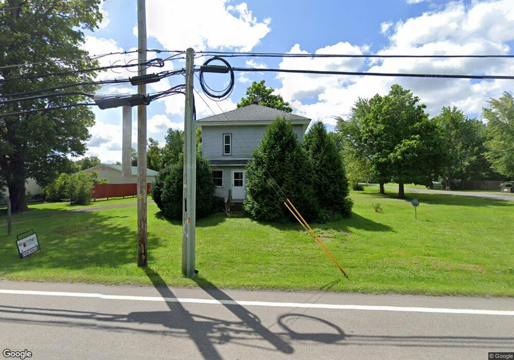
5650 Us Route 6 Andover, OH 44003
Estimated Value: $129,000 - $188,601
4
Beds
2
Baths
1,772
Sq Ft
$93/Sq Ft
Est. Value
About This Home
This home is located at 5650 Us Route 6, Andover, OH 44003 and is currently estimated at $164,900, approximately $93 per square foot. 5650 Us Route 6 is a home located in Ashtabula County with nearby schools including Pymatuning Valley Primary School, Pymatuning Valley Middle School, and Pymatuning Valley High School.
Ownership History
Date
Name
Owned For
Owner Type
Purchase Details
Closed on
Aug 12, 2025
Sold by
Wludyga Rickey R and Wludyga Suzanne E
Bought by
Sheets Jacob M
Current Estimated Value
Home Financials for this Owner
Home Financials are based on the most recent Mortgage that was taken out on this home.
Original Mortgage
$134,141
Outstanding Balance
$134,024
Interest Rate
6.67%
Mortgage Type
New Conventional
Estimated Equity
$30,876
Create a Home Valuation Report for This Property
The Home Valuation Report is an in-depth analysis detailing your home's value as well as a comparison with similar homes in the area
Home Values in the Area
Average Home Value in this Area
Purchase History
| Date | Buyer | Sale Price | Title Company |
|---|---|---|---|
| Sheets Jacob M | $130,000 | Andover Title | |
| Sheets Jacob M | $130,000 | Andover Title |
Source: Public Records
Mortgage History
| Date | Status | Borrower | Loan Amount |
|---|---|---|---|
| Open | Sheets Jacob M | $134,141 | |
| Closed | Sheets Jacob M | $134,141 |
Source: Public Records
Tax History Compared to Growth
Tax History
| Year | Tax Paid | Tax Assessment Tax Assessment Total Assessment is a certain percentage of the fair market value that is determined by local assessors to be the total taxable value of land and additions on the property. | Land | Improvement |
|---|---|---|---|---|
| 2024 | $2,632 | $44,350 | $7,670 | $36,680 |
| 2023 | $1,890 | $44,350 | $7,670 | $36,680 |
| 2022 | $1,428 | $32,140 | $5,920 | $26,220 |
| 2021 | $1,491 | $32,140 | $5,920 | $26,220 |
| 2020 | $1,492 | $32,140 | $5,920 | $26,220 |
| 2019 | $1,298 | $26,820 | $3,960 | $22,860 |
| 2018 | $1,257 | $26,820 | $3,960 | $22,860 |
| 2017 | $1,255 | $26,820 | $3,960 | $22,860 |
| 2016 | $1,262 | $26,820 | $3,960 | $22,860 |
| 2015 | $1,267 | $26,820 | $3,960 | $22,860 |
| 2014 | $1,200 | $26,820 | $3,960 | $22,860 |
| 2013 | $1,285 | $27,550 | $3,640 | $23,910 |
Source: Public Records
Map
Nearby Homes
- 0 Chestnut St Unit 5136238
- 151 Gates St
- 143 Hickory St
- 185 Maple Ave
- 0 Maple Ave
- 4974 N Main St
- 5378 Owen Hill Rd
- 6490 Willow Way
- 5123 4th Ave
- 5000 Pymatuning Lake Rd
- 0000 Pymatuning Blvd
- 4594 Center Rd
- 6738 State Route 7
- 6968 Morningview Dr
- 5427 Slater Rd
- 5422 Slater Rd
- 10820 N Lake Rd
- 1238 Hickory St
- 5372 Slater Rd
- 1059 Clover Ln
- 323 W Main St
- 5333 Chestnut St
- 329 W Main St
- 5647 Chestnut St
- 5337 Chestnut St
- 317 W Main St
- 350 Chestnut St
- 400 W Main St
- 326 W Main St
- 340 Chestnut St
- 315 W Main St
- 5649 U S 6
- 311 W Main St
- 303 W Main St
- 0 Case Ave Unit 3084368
- 0 Case Ave Unit 3188258
- 5349 Chestnut St
- 339 Chestnut St
- 314 W Main St
- 337 Chestnut St