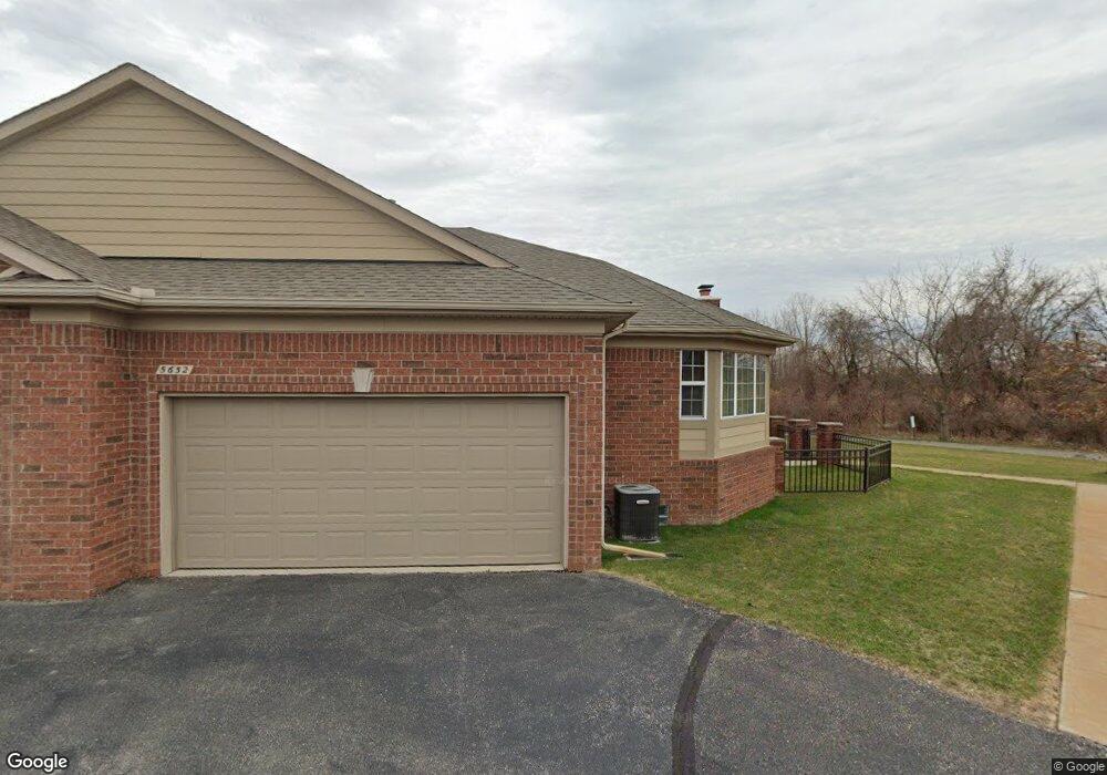
5652 Murphy Ct Warren, MI 48092
Northwest Warren NeighborhoodEstimated Value: $290,774 - $322,000
2
Beds
3
Baths
1,855
Sq Ft
$165/Sq Ft
Est. Value
About This Home
This home is located at 5652 Murphy Ct, Warren, MI 48092 and is currently estimated at $306,444, approximately $165 per square foot. 5652 Murphy Ct is a home located in Macomb County with nearby schools including Green Acres Elementary School, Beer Middle School, and Warren Mott High School.
Ownership History
Date
Name
Owned For
Owner Type
Purchase Details
Closed on
Aug 7, 2025
Sold by
Ahrens William H and Ahrens Onnalee June
Bought by
Ahrens William H and Ahrens William K
Current Estimated Value
Purchase Details
Closed on
Feb 27, 2007
Sold by
Lombardo Warren Llc
Bought by
Ahrens William H and Ahrens Onnalee J
Create a Home Valuation Report for This Property
The Home Valuation Report is an in-depth analysis detailing your home's value as well as a comparison with similar homes in the area
Home Values in the Area
Average Home Value in this Area
Purchase History
| Date | Buyer | Sale Price | Title Company |
|---|---|---|---|
| Ahrens William H | -- | None Listed On Document | |
| Ahrens William H | -- | Metropolitan Title Company |
Source: Public Records
Tax History
| Year | Tax Paid | Tax Assessment Tax Assessment Total Assessment is a certain percentage of the fair market value that is determined by local assessors to be the total taxable value of land and additions on the property. | Land | Improvement |
|---|---|---|---|---|
| 2025 | $3,903 | $137,520 | $0 | $0 |
| 2024 | $38 | $126,570 | $0 | $0 |
| 2023 | $3,620 | $114,930 | $0 | $0 |
| 2022 | $3,498 | $106,100 | $0 | $0 |
| 2021 | $3,559 | $101,410 | $0 | $0 |
| 2020 | $3,432 | $91,760 | $0 | $0 |
| 2019 | $3,308 | $87,610 | $0 | $0 |
| 2018 | $0 | $82,000 | $0 | $0 |
| 2017 | $3,318 | $78,340 | $8,250 | $70,090 |
| 2016 | $3,314 | $78,340 | $0 | $0 |
| 2015 | -- | $74,200 | $0 | $0 |
| 2013 | $3,109 | $56,990 | $0 | $0 |
Source: Public Records
Map
Nearby Homes
- 30520 Berghway Trail
- 30475 Berghway Trail
- 5239 E 13 Mile Rd
- 4832 Muriel Dr
- 29412 Woodpark Cir
- 4749 Lutz Dr
- 29900 N Grand Oaks Dr
- 30987 Boewe Dr
- 4519 Reader Dr
- 4878 Wolgast Dr
- 32075 Saint Annes Dr
- 5873 Elmgrove Ave
- 4829 Wolgast Dr
- 29659 van Laan Dr
- 4775 Stanley Ave
- 4812 Berwyn Dr
- 4125 Derray Ct Unit 7
- 32176 Exeter Dr
- 32436 Saint Annes Dr
- 5612 Streefkerk Dr
- 5670 Murphy Ct
- 5664 Murphy Ct
- 5658 Murphy Ct
- 5694 Murphy Ct Unit 100
- 5688 Murphy Ct Unit 99
- 5682 Murphy Ct Unit 98
- 5676 Murphy Ct
- 5646 Murphy Ct
- 5640 Murphy Ct Unit 91
- 5634 Murphy Ct Unit 90
- 5628 Murphy Ct Unit 89
- 5604 Murphy Ct
- 5622 Murphy Ct Unit 88
- 5616 Murphy Ct Unit 87
- 5610 Murphy Ct
- 30573 Berghway Trail
- 30577 Berghway Trail
- 30573 Berghway Trail Unit 108
- 5677 Storrow Ct Unit 120
- 5677 Storrow Ct