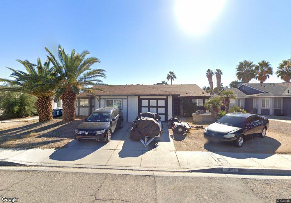
5655 Blue Sea St Unit 2 Las Vegas, NV 89110
Estimated Value: $250,000 - $298,000
3
Beds
2
Baths
1,118
Sq Ft
$245/Sq Ft
Est. Value
About This Home
This home is located at 5655 Blue Sea St Unit 2, Las Vegas, NV 89110 and is currently estimated at $274,125, approximately $245 per square foot. 5655 Blue Sea St Unit 2 is a home located in Clark County with nearby schools including Kirk Adams Elementary School, Duane D. Keller Middle School, and Eldorado High School.
Ownership History
Date
Name
Owned For
Owner Type
Purchase Details
Closed on
Apr 13, 2004
Sold by
Gifford Ron S and Gifford Carol
Bought by
Lucatero Adrian and Llamas Rocio
Current Estimated Value
Home Financials for this Owner
Home Financials are based on the most recent Mortgage that was taken out on this home.
Original Mortgage
$126,350
Outstanding Balance
$61,359
Interest Rate
6.12%
Mortgage Type
Unknown
Estimated Equity
$212,766
Create a Home Valuation Report for This Property
The Home Valuation Report is an in-depth analysis detailing your home's value as well as a comparison with similar homes in the area
Home Values in the Area
Average Home Value in this Area
Purchase History
| Date | Buyer | Sale Price | Title Company |
|---|---|---|---|
| Lucatero Adrian | $133,000 | First American Title Co Of |
Source: Public Records
Mortgage History
| Date | Status | Borrower | Loan Amount |
|---|---|---|---|
| Open | Lucatero Adrian | $126,350 |
Source: Public Records
Tax History Compared to Growth
Tax History
| Year | Tax Paid | Tax Assessment Tax Assessment Total Assessment is a certain percentage of the fair market value that is determined by local assessors to be the total taxable value of land and additions on the property. | Land | Improvement |
|---|---|---|---|---|
| 2025 | $592 | $44,254 | $22,400 | $21,854 |
| 2024 | $548 | $44,254 | $22,400 | $21,854 |
| 2023 | $365 | $38,790 | $18,200 | $20,590 |
| 2022 | $514 | $37,420 | $17,500 | $19,920 |
| 2021 | $471 | $32,124 | $15,750 | $16,374 |
| 2020 | $434 | $32,135 | $14,700 | $17,435 |
| 2019 | $407 | $27,682 | $10,150 | $17,532 |
| 2018 | $388 | $24,984 | $8,050 | $16,934 |
| 2017 | $708 | $24,137 | $7,000 | $17,137 |
| 2016 | $365 | $21,326 | $4,900 | $16,426 |
| 2015 | $363 | $15,030 | $3,850 | $11,180 |
| 2014 | $352 | $11,647 | $3,150 | $8,497 |
Source: Public Records
Map
Nearby Homes
- 5583 Orchard Ln Unit 152
- 5564 Orchard Ln Unit 133
- 5600 Orchard Ln
- 5794 Sea Breeze Ave
- 147 N Christy Ln
- 262 Solicito St
- 316 Linn Ln
- 1361 Elaine Dr
- 266 Lyra Ln
- 280 Sir Phillip St
- 360 Sir Richard Dr E
- 5330 E Charleston Blvd Unit 113
- 5907 Zawawi Ct
- 1487 Elaine Dr
- 5854 Heather Marie Dr
- 1200 Pleasant Brook St
- 5913 Autumn Harvest Ave
- 1224 Pleasant Brook St
- 0 E Charleston Blvd
- 140 Sir David Way
- 5661 Blue Sea St
- 5649 Blue Sea St
- 5667 Blue Sea St Unit 2
- 5643 Blue Sea St
- 5656 Sea Breeze Ave
- 5673 Blue Sea St
- 5637 Blue Sea St
- 5662 Sea Breeze Ave
- 5650 Sea Breeze Ave
- 5644 Sea Breeze Ave
- 5679 Blue Sea St
- 5631 Blue Sea St
- 5674 Sea Breeze Ave
- 5638 Sea Breeze Ave
- 5654 Blue Sea St
- 5660 Blue Sea St
- 5648 Blue Sea St
- 5642 Blue Sea St
- 5666 Blue Sea St