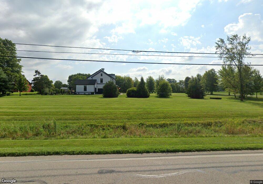
5655 Liberty Rd N Powell, OH 43065
Liberty Township NeighborhoodEstimated Value: $837,000 - $991,000
3
Beds
3
Baths
2,900
Sq Ft
$314/Sq Ft
Est. Value
About This Home
This home is located at 5655 Liberty Rd N, Powell, OH 43065 and is currently estimated at $909,206, approximately $313 per square foot. 5655 Liberty Rd N is a home located in Delaware County with nearby schools including Liberty Tree Elementary School, Hyatts Middle School, and Olentangy Berlin High School.
Ownership History
Date
Name
Owned For
Owner Type
Purchase Details
Closed on
Jul 31, 2015
Sold by
Windsor Homes Llc
Bought by
Merriss Daniel and Merriss Mary E
Current Estimated Value
Purchase Details
Closed on
Jan 20, 2015
Sold by
Dorsey Alexius J and Dorsey Karmon
Bought by
Windsor Homes Llc
Purchase Details
Closed on
Mar 19, 2014
Sold by
Dorsey Alex and Dorsey Karmon
Bought by
Windsor Homes Llc
Home Financials for this Owner
Home Financials are based on the most recent Mortgage that was taken out on this home.
Original Mortgage
$1,275,000
Interest Rate
4.24%
Mortgage Type
Future Advance Clause Open End Mortgage
Create a Home Valuation Report for This Property
The Home Valuation Report is an in-depth analysis detailing your home's value as well as a comparison with similar homes in the area
Home Values in the Area
Average Home Value in this Area
Purchase History
| Date | Buyer | Sale Price | Title Company |
|---|---|---|---|
| Merriss Daniel | $85,000 | Columbus Title Box | |
| Windsor Homes Llc | -- | None Available | |
| Dorsey Alexius J | -- | None Available | |
| Windsor Homes Llc | -- | Columbus Title |
Source: Public Records
Mortgage History
| Date | Status | Borrower | Loan Amount |
|---|---|---|---|
| Previous Owner | Windsor Homes Llc | $1,275,000 |
Source: Public Records
Tax History Compared to Growth
Tax History
| Year | Tax Paid | Tax Assessment Tax Assessment Total Assessment is a certain percentage of the fair market value that is determined by local assessors to be the total taxable value of land and additions on the property. | Land | Improvement |
|---|---|---|---|---|
| 2024 | $13,023 | $242,130 | $46,130 | $196,000 |
| 2023 | $13,074 | $242,130 | $46,130 | $196,000 |
| 2022 | $15,606 | $229,500 | $33,040 | $196,460 |
| 2021 | $15,704 | $229,500 | $33,040 | $196,460 |
| 2020 | $15,774 | $229,500 | $33,040 | $196,460 |
| 2019 | $12,427 | $187,990 | $27,550 | $160,440 |
| 2018 | $12,480 | $187,990 | $27,550 | $160,440 |
| 2017 | $5,094 | $17,920 | $17,920 | $0 |
| 2016 | $1,278 | $17,920 | $17,920 | $0 |
| 2015 | $1,155 | $17,920 | $17,920 | $0 |
| 2014 | $703 | $10,780 | $10,780 | $0 |
Source: Public Records
Map
Nearby Homes
- 2661 Main St
- 2073 Liberty Trail
- 2481 Clark Shaw Rd
- 2513 Clark Shaw Rd
- 5482 Dutch Ln
- 5488 Fawnsbury Ct
- 5492 Fawnsbury Ct
- 5480 Fawnsbury Ct
- 5484 Fawnsbury Ct
- 5502 Dutch Ln
- 5479 Fawnsbury Ct
- 5487 Fawnsbury Ct
- 2603 Hammersley Loop Unit Lot 7096
- 2770 Drycreek Ct
- 2762 Drycreek Ct
- 2746 Drycreek Ct
- 5515 Fawnsbury Ct
- 2752 Drycreek Ct
- 5507 Fawnsbury Ct
- 5519 Fawnsbury Ct
- 5677 Liberty Rd N
- 5615 Liberty Rd N
- 5643 Liberty Rd N
- 5611 Liberty Rd N
- 5683 Liberty Rd N
- 5591 Liberty Rd N
- 5607 Liberty Rd N
- 7065 Thea Ln
- 5680 Liberty Rd N
- 5788 Liberty Rd N
- 2035 Hardin Ln
- 0 Thea Ln Unit Tract 11 223029671
- 0 Thea Ln Unit Tract 10 223029668
- 0 Thea Ln Unit Tract 8 223029664
- 0 Thea Ln Unit Tract 5 223029655
- 5847 Liberty Rd N
- 5510 Liberty Rd N
- 1955 Hardin Ln
- 5873 Liberty Rd N
- 2085 Hardin Ln
