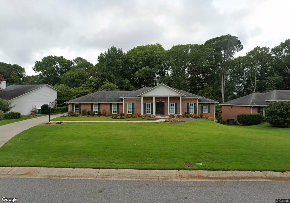
5655 Queensborough Dr Unit 4 Atlanta, GA 30338
Estimated Value: $662,000 - $815,000
3
Beds
3
Baths
2,296
Sq Ft
$315/Sq Ft
Est. Value
About This Home
This home is located at 5655 Queensborough Dr Unit 4, Atlanta, GA 30338 and is currently estimated at $722,654, approximately $314 per square foot. 5655 Queensborough Dr Unit 4 is a home located in DeKalb County with nearby schools including Austin Elementary School, Peachtree Middle School, and Dunwoody High School.
Ownership History
Date
Name
Owned For
Owner Type
Purchase Details
Closed on
Oct 7, 2020
Sold by
Byrd Clayton R
Bought by
Owings Edward Clay and Owings Barbara Jeaan
Current Estimated Value
Home Financials for this Owner
Home Financials are based on the most recent Mortgage that was taken out on this home.
Original Mortgage
$408,500
Outstanding Balance
$361,844
Interest Rate
2.8%
Mortgage Type
New Conventional
Estimated Equity
$360,810
Purchase Details
Closed on
Jun 14, 1995
Sold by
Singleton Larry G Gloria M
Bought by
Byrd Clayton R Gloria F
Create a Home Valuation Report for This Property
The Home Valuation Report is an in-depth analysis detailing your home's value as well as a comparison with similar homes in the area
Home Values in the Area
Average Home Value in this Area
Purchase History
| Date | Buyer | Sale Price | Title Company |
|---|---|---|---|
| Owings Edward Clay | -- | -- | |
| Owings Edward Clay | $430,000 | -- | |
| Byrd Clayton R Gloria F | $213,000 | -- |
Source: Public Records
Mortgage History
| Date | Status | Borrower | Loan Amount |
|---|---|---|---|
| Open | Owings Edward Clay | $408,500 | |
| Closed | Owings Edward Clay | $408,500 | |
| Closed | Byrd Clayton R Gloria F | $0 |
Source: Public Records
Tax History Compared to Growth
Tax History
| Year | Tax Paid | Tax Assessment Tax Assessment Total Assessment is a certain percentage of the fair market value that is determined by local assessors to be the total taxable value of land and additions on the property. | Land | Improvement |
|---|---|---|---|---|
| 2025 | $7,166 | $271,720 | $80,000 | $191,720 |
| 2024 | $6,726 | $247,160 | $80,000 | $167,160 |
| 2023 | $6,726 | $254,360 | $80,000 | $174,360 |
| 2022 | $5,917 | $210,760 | $80,000 | $130,760 |
| 2021 | $7,086 | $172,000 | $73,360 | $98,640 |
| 2020 | $1,186 | $153,880 | $80,000 | $73,880 |
| 2019 | $1,109 | $153,320 | $80,000 | $73,320 |
| 2018 | $1,444 | $152,240 | $80,000 | $72,240 |
| 2017 | $1,626 | $158,480 | $89,640 | $68,840 |
| 2016 | $1,478 | $146,840 | $89,640 | $57,200 |
| 2014 | $1,436 | $141,480 | $89,640 | $51,840 |
Source: Public Records
Map
Nearby Homes
- 5662 Queensborough Dr
- 1136 Coronation Dr
- 1120 Whitehall Pointe
- 5697 Whitehall Walk
- 5625 Roberts Dr
- 812 Stratford Ct
- 1015 Wingate Way
- 4006 Wingate Way
- 2015 Wingate Way
- 7632 Auden Trail
- 3020 Wingate Way
- 7967 Magnolia Square
- 1495 Spalding Dr
- 1503 Wingate Way
- 1293 Witham Dr
- 980 Fenimore Cir
- 942 Telfair Close
- 1804 Wingate Way Unit 1804
- 5663 Queensborough Dr
- 5647 Queensborough Dr Unit Basement Unit
- 5647 Queensborough Dr
- 5602 Coronation Ct Unit 2
- 5681 Queensborough Dr
- 5654 Queensborough Dr Unit 4
- 5646 Queensborough Dr Unit 4
- 5607 Coronation Ct
- 5638 Queensborough Dr
- 5619 Queensborough Dr Unit 4
- 5676 Queensborough Dr
- 5598 Coronation Ct Unit 2
- 1084 Manning Farms Ct
- 1078 Manning Farms Ct
- 5684 Queensborough Dr
- 5599 Coronation Ct
- 5630 Queensborough Dr
- 1090 Manning Farms Ct
- 5611 Queensborough Dr
- 5594 Coronation Ct