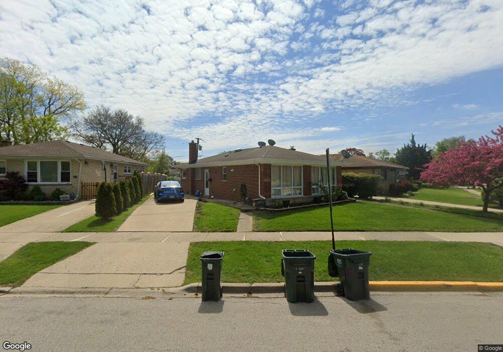
5655 Theobald Rd Morton Grove, IL 60053
Estimated Value: $402,000 - $445,000
3
Beds
2
Baths
1,061
Sq Ft
$405/Sq Ft
Est. Value
About This Home
This home is located at 5655 Theobald Rd, Morton Grove, IL 60053 and is currently estimated at $430,224, approximately $405 per square foot. 5655 Theobald Rd is a home located in Cook County with nearby schools including Park View Elementary School, Niles West High School, and Arie Crown Hebrew Day School.
Ownership History
Date
Name
Owned For
Owner Type
Purchase Details
Closed on
Jun 30, 2004
Sold by
Quadri Syed M and Kulsum Syeda
Bought by
Syeda Quadri Syed Abdul and Syeda Ashrafunnisa
Current Estimated Value
Purchase Details
Closed on
Dec 28, 1998
Sold by
Kozer Seymour L and Kozer Marlene B
Bought by
Quadri Syed M and Kulsum Syeda
Home Financials for this Owner
Home Financials are based on the most recent Mortgage that was taken out on this home.
Original Mortgage
$170,000
Outstanding Balance
$39,532
Interest Rate
6.79%
Estimated Equity
$390,692
Create a Home Valuation Report for This Property
The Home Valuation Report is an in-depth analysis detailing your home's value as well as a comparison with similar homes in the area
Home Values in the Area
Average Home Value in this Area
Purchase History
| Date | Buyer | Sale Price | Title Company |
|---|---|---|---|
| Syeda Quadri Syed Abdul | $288,000 | First American Title Ins Co | |
| Quadri Syed M | $180,000 | -- |
Source: Public Records
Mortgage History
| Date | Status | Borrower | Loan Amount |
|---|---|---|---|
| Open | Quadri Syed M | $170,000 |
Source: Public Records
Tax History Compared to Growth
Tax History
| Year | Tax Paid | Tax Assessment Tax Assessment Total Assessment is a certain percentage of the fair market value that is determined by local assessors to be the total taxable value of land and additions on the property. | Land | Improvement |
|---|---|---|---|---|
| 2024 | $7,996 | $31,000 | $7,140 | $23,860 |
| 2023 | $7,590 | $31,000 | $7,140 | $23,860 |
| 2022 | $7,590 | $31,000 | $7,140 | $23,860 |
| 2021 | $7,255 | $25,950 | $4,393 | $21,557 |
| 2020 | $7,133 | $25,950 | $4,393 | $21,557 |
| 2019 | $7,204 | $29,158 | $4,393 | $24,765 |
| 2018 | $5,993 | $22,427 | $3,981 | $18,446 |
| 2017 | $6,056 | $22,427 | $3,981 | $18,446 |
| 2016 | $5,972 | $22,427 | $3,981 | $18,446 |
| 2015 | $5,044 | $18,277 | $3,432 | $14,845 |
| 2014 | $5,057 | $18,277 | $3,432 | $14,845 |
| 2013 | $4,922 | $18,277 | $3,432 | $14,845 |
Source: Public Records
Map
Nearby Homes
- 8708 Central Ave
- 5510 Lincoln Ave Unit B301
- 5510 Lincoln Ave Unit B101
- 5506 Lincoln Ave Unit A117
- 5506 Lincoln Ave Unit A211
- 5506 Lincoln Ave Unit A216
- 8541 Lotus Ave Unit 914
- 8655 Harms Rd
- 5500 Lincoln Ave Unit 407W
- 5500 Lincoln Ave Unit 116E
- 5500 Lincoln Ave Unit 109W
- 5501 Lincoln Ave Unit 203
- 8841 Menard Ave
- 8836 Mansfield Ave
- 8918 Parkside Ave
- 5536 Greenwood St
- 8464 Gross Point Rd
- 5459 Suffield Ct
- 6020 Lincoln Ave Unit 407
- 8461 Gross Point Rd
- 8609 Major Ave
- 5651 Theobald Rd
- 8605 Major Ave
- 5647 Theobald Rd Unit 10
- 5636 S Park Ave Unit 10
- 5642 S Park Ave Unit 10
- 5643 Theobald Rd
- 5632 S Park Ave
- 8627 Major Ave
- 5705 Capulina Ave
- 5641 Theobald Rd
- 8604 Lillibet Terrace
- 8606 Lillibet Terrace
- 5700 S Park Ave
- 8600 Lillibet Terrace
- 5635 Theobald Rd
- 5707 Capulina Ave
- 5644 Theobald Rd
- 5644 Theobald Rd
- 8633 Major Ave