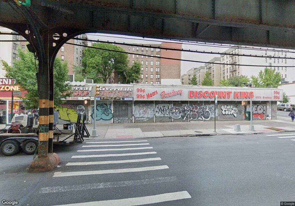
5657-5659 Broadway Bronx, NY 10463
Kingsbridge Neighborhood
--
Bed
--
Bath
11,000
Sq Ft
10,542
Sq Ft Lot
About This Home
This home is located at 5657-5659 Broadway, Bronx, NY 10463. 5657-5659 Broadway is a home located in Bronx County with nearby schools including Milton Fein School, John R Bonfield Elementary School, and Pilot Butte Middle School.
Ownership History
Date
Name
Owned For
Owner Type
Purchase Details
Closed on
May 7, 2025
Sold by
Charles C Goldman Llc
Bought by
Broadway Bronx Llc
Purchase Details
Closed on
Jun 21, 2001
Sold by
Martin Goldman Llc
Bought by
Charles C Goldman Llc
Purchase Details
Closed on
Oct 19, 2000
Sold by
3938 White Plains Road Associates
Bought by
Charles C Goldman Llc and Martin Goldman Llc
Create a Home Valuation Report for This Property
The Home Valuation Report is an in-depth analysis detailing your home's value as well as a comparison with similar homes in the area
Home Values in the Area
Average Home Value in this Area
Purchase History
| Date | Buyer | Sale Price | Title Company |
|---|---|---|---|
| Broadway Bronx Llc | -- | -- | |
| Charles C Goldman Llc | -- | -- | |
| Charles C Goldman Llc | -- | -- | |
| Charles C Goldman Llc | -- | First American | |
| Charles C Goldman Llc | -- | First American |
Source: Public Records
Tax History Compared to Growth
Tax History
| Year | Tax Paid | Tax Assessment Tax Assessment Total Assessment is a certain percentage of the fair market value that is determined by local assessors to be the total taxable value of land and additions on the property. | Land | Improvement |
|---|---|---|---|---|
| 2025 | $103,288 | $976,430 | $283,950 | $692,480 |
| 2024 | $103,288 | $1,017,980 | $283,950 | $734,030 |
| 2023 | $119,415 | $1,121,690 | $283,950 | $837,740 |
| 2022 | $116,928 | $1,087,200 | $283,950 | $803,250 |
| 2021 | $103,705 | $969,750 | $283,950 | $685,800 |
| 2020 | $124,373 | $1,252,350 | $283,950 | $968,400 |
| 2019 | $120,194 | $1,166,400 | $283,950 | $882,450 |
| 2018 | $123,188 | $1,226,250 | $283,950 | $942,300 |
| 2017 | $112,532 | $1,251,450 | $283,950 | $967,500 |
| 2016 | $108,861 | $1,251,450 | $283,950 | $967,500 |
| 2015 | $48,174 | $1,066,500 | $146,250 | $920,250 |
| 2014 | $48,174 | $1,064,250 | $146,250 | $918,000 |
Source: Public Records
Map
Nearby Homes
- 3123 Bailey Ave Unit 4A
- 3123 Bailey Ave Unit 3A
- 3119 Bailey Ave Unit 2E
- 290 W 232 St Unit 4D
- 290 W 232nd St Unit 2C
- 315 W 232nd St Unit 2M
- 315 W 232nd St Unit 3C
- 315 W 232nd St Unit 1F
- 3099 Heath Ave Unit 2A
- 3083 Heath Ave
- 3130 Irwin Ave Unit 2C
- 3384 Fort Independence St
- 511 W 232 St Unit E56
- 3629 Tibbett Ave
- 3496 Fort Independence St
- 3475 Greystone Ave Unit 7E
- 3607 Irwin Ave
- 3488 Cannon Place
- 3065 Sedgwick Ave Unit 3A
- 3235 Cambridge Ave Unit 5J
- 208-216 W 233rd St
- 5645 Broadway
- 5661-5669 Broadway
- 225 W 232nd St
- 222 W 233rd St
- 225 W 233rd St
- 233 W 232nd St Unit 4A
- 5640 Broadway
- 217-223 W 233rd St
- 5622 U S 9
- 3136-3140 Godwin Terrace
- 5619-5625 Broadway
- 170 W 233rd St
- 5618 Broadway
- 3214 Kingsbridge Ave
- 3204 Kingsbridge Ave
- 5660-5680 Broadway
- 229 W 232nd St Unit 2H
- 235 W 233rd St Unit 5D
- 233-235 W 233rd St