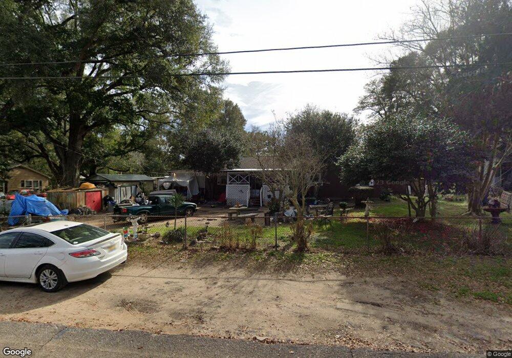
5659 Andrews Rd Mobile, AL 36619
Nevius NeighborhoodEstimated Value: $56,000 - $156,000
4
Beds
2
Baths
1,464
Sq Ft
$72/Sq Ft
Est. Value
About This Home
This home is located at 5659 Andrews Rd, Mobile, AL 36619 and is currently estimated at $105,095, approximately $71 per square foot. 5659 Andrews Rd is a home located in Mobile County with nearby schools including WC Griggs Elementary School, Burns Middle School, and Theodore High School.
Ownership History
Date
Name
Owned For
Owner Type
Purchase Details
Closed on
Jun 24, 2024
Sold by
Freddie Mac Seasoned Cr Risk T and Federal Home Loan Mtg Corp
Bought by
Petty Kevin R
Current Estimated Value
Purchase Details
Closed on
May 23, 2023
Sold by
Freddie Mac Seasoned Credit Risk Transfe
Bought by
Freddie Mac Seasoned Credit Risk Transfer Tru
Purchase Details
Closed on
Aug 29, 2019
Sold by
Rabon John Gregory and Rabon Rosalie Cain
Bought by
Rabon John Gregory
Create a Home Valuation Report for This Property
The Home Valuation Report is an in-depth analysis detailing your home's value as well as a comparison with similar homes in the area
Home Values in the Area
Average Home Value in this Area
Purchase History
| Date | Buyer | Sale Price | Title Company |
|---|---|---|---|
| Petty Kevin R | $52,000 | None Listed On Document | |
| Freddie Mac Seasoned Credit Risk Transfer Tru | $49,258 | None Listed On Document | |
| Rabon John Gregory | -- | None Available |
Source: Public Records
Tax History
| Year | Tax Paid | Tax Assessment Tax Assessment Total Assessment is a certain percentage of the fair market value that is determined by local assessors to be the total taxable value of land and additions on the property. | Land | Improvement |
|---|---|---|---|---|
| 2025 | $389 | $6,810 | $1,600 | $5,210 |
| 2024 | $389 | $12,660 | $3,000 | $9,660 |
| 2023 | $770 | $13,300 | $3,000 | $10,300 |
| 2022 | $0 | $8,120 | $1,500 | $6,620 |
| 2021 | $0 | $7,920 | $1,500 | $6,420 |
| 2020 | $0 | $7,920 | $1,500 | $6,420 |
| 2019 | $0 | $7,280 | $0 | $0 |
| 2018 | $0 | $7,280 | $0 | $0 |
| 2017 | $0 | $7,280 | $0 | $0 |
| 2016 | -- | $7,460 | $0 | $0 |
| 2013 | -- | $8,260 | $0 | $0 |
Source: Public Records
Map
Nearby Homes
- 4630 General Rd
- 5674 Nevius Rd
- 4800 Bush Ln
- 5480 Inn Rd
- 4314 Lumsden Battery Cir W
- 5023 Freeway Ln
- 6116 General Lee Ave
- 4244 Lumsden Battery Cir W
- 5015 Santos Dr W
- 0 Higgins Rd Unit 153 371518
- 0 Higgins Rd Unit 7497709
- 0 Higgins Rd Unit 5 384060
- 0 Higgins Rd Unit 7634227
- 5185 Santos Dr W
- 5084 Fairland Dr
- 5544 Candia Ct
- 5551 Springer Ct
- 5171 Fairland Dr
- 0 Stone Mill Ct Unit 7715820
- 0 Stone Mill Ct Unit 1
- 5659 Andrew Rd
- 5671 Andrews Rd
- 5641 Andrews Rd
- 5683 Andrews Rd
- 5629 Andrews Rd
- 5629 Andrew Rd
- 5666 Andrew Rd
- 5662 Andrew Rd
- 5650 Jackson Rd
- 5666 Andrews Rd
- 5644 Jackson Rd
- 5619 Andrews Rd
- 4735 Calhoun Rd
- 5672 Andrew Rd
- 5619 Andrew Rd
- 5672 Andrews Rd
- 5636 Jackson Rd
- 4763 Calhoun Rd
- 5638 Andrews Rd
- 5626 Andrews Rd
Your Personal Tour Guide
Ask me questions while you tour the home.