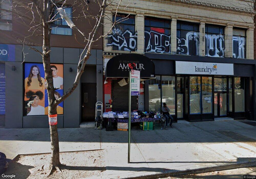
566-568 Nostrand Ave Brooklyn, NY 11216
Bed-Stuy Neighborhood
--
Bed
--
Bath
7,800
Sq Ft
4,008
Sq Ft Lot
About This Home
This home is located at 566-568 Nostrand Ave, Brooklyn, NY 11216. 566-568 Nostrand Ave is a home located in Kings County with nearby schools including P.S. 93 - William H. Prescott, Leadership Preparatory Bedford Stuyvesant Charter School, and The Co-op School.
Ownership History
Date
Name
Owned For
Owner Type
Purchase Details
Closed on
Dec 11, 1998
Sold by
R & B Nostrand Realty Corp
Bought by
Jay Aye Dee Realty Inc
Home Financials for this Owner
Home Financials are based on the most recent Mortgage that was taken out on this home.
Original Mortgage
$375,000
Interest Rate
6.74%
Mortgage Type
Commercial
Purchase Details
Closed on
Sep 3, 1996
Sold by
566 Nostrand Realty Corp
Bought by
R & B Nostrand Realty Corp
Home Financials for this Owner
Home Financials are based on the most recent Mortgage that was taken out on this home.
Original Mortgage
$450,000
Interest Rate
10%
Mortgage Type
Seller Take Back
Create a Home Valuation Report for This Property
The Home Valuation Report is an in-depth analysis detailing your home's value as well as a comparison with similar homes in the area
Home Values in the Area
Average Home Value in this Area
Purchase History
| Date | Buyer | Sale Price | Title Company |
|---|---|---|---|
| Jay Aye Dee Realty Inc | $550,000 | Security Title & Guaranty Co | |
| Jay Aye Dee Realty Inc | $550,000 | Security Title & Guaranty Co | |
| R & B Nostrand Realty Corp | $550,000 | First American Title Ins Co | |
| R & B Nostrand Realty Corp | $550,000 | First American Title Ins Co |
Source: Public Records
Mortgage History
| Date | Status | Borrower | Loan Amount |
|---|---|---|---|
| Previous Owner | Jay Aye Dee Realty Inc | $375,000 | |
| Previous Owner | R & B Nostrand Realty Corp | $450,000 |
Source: Public Records
Tax History Compared to Growth
Tax History
| Year | Tax Paid | Tax Assessment Tax Assessment Total Assessment is a certain percentage of the fair market value that is determined by local assessors to be the total taxable value of land and additions on the property. | Land | Improvement |
|---|---|---|---|---|
| 2025 | $49,857 | $518,400 | $54,000 | $464,400 |
| 2024 | $49,857 | $496,350 | $54,000 | $442,350 |
| 2023 | $48,562 | $514,800 | $54,000 | $460,800 |
| 2022 | $45,670 | $480,150 | $54,000 | $426,150 |
| 2021 | $43,050 | $423,000 | $54,000 | $369,000 |
| 2020 | $21,525 | $439,200 | $54,000 | $385,200 |
| 2019 | $39,149 | $451,350 | $54,000 | $397,350 |
| 2018 | $38,974 | $400,950 | $54,000 | $346,950 |
| 2017 | $34,113 | $386,550 | $54,000 | $332,550 |
| 2016 | $31,461 | $436,050 | $54,000 | $382,050 |
| 2015 | $12,129 | $385,650 | $54,000 | $331,650 |
| 2014 | $12,129 | $373,050 | $54,000 | $319,050 |
Source: Public Records
Map
Nearby Homes
- 1251 Pacific St Unit 1 A
- 1251 Pacific St Unit 2 A
- 1251 Pacific St Unit 4
- 1251 Pacific St Unit 1
- 1251 Pacific St Unit 2
- 35 Herkimer St
- 151 Herkimer St
- 1219 Dean St
- 1235 Dean St Unit 4
- 11A Arlington Place
- 18 Arlington Place
- 1304 Pacific St Unit B1
- 1150 Pacific St
- 1106 Bergen St
- 15 Verona Place
- 43 Halsey St Unit 4
- 43 Halsey St Unit 3
- 77 Macon St
- 113 Halsey St
- 140 Halsey St
- 570-572 Nostrand Ave
- 560-564 Nostrand Ave
- 556 Nostrand Ave
- 90-92 Herkimer St
- 531 Nostrand Ave
- 531 Nostrand Ave Unit 2nd
- 529 Nostrand Ave Unit 4
- 529 Nostrand Ave Unit 1
- 529 Nostrand Ave
- 529 Nostrand Ave Unit 2
- 529 Nostrand Ave Unit 3
- 527 Nostrand Ave Unit 4
- 527 Nostrand Ave
- 527 Nostrand Ave Unit 3
- 527 Nostrand Ave Unit 2
- 527 Nostrand Ave Unit 1
- 92 Herkimer St
- 525 Nostrand Ave Unit 2
- 525 Nostrand Ave
- 525 Nostrand Ave Unit 3