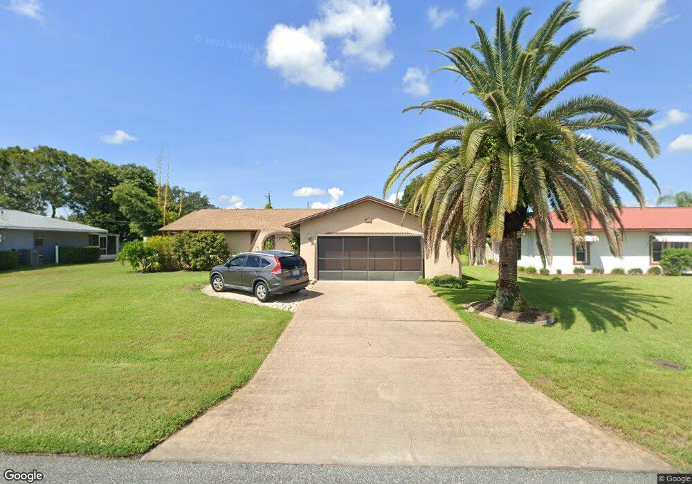
566 Addison Ave NE Palm Bay, FL 32907
Port Malabar NeighborhoodEstimated Value: $256,000 - $292,000
3
Beds
2
Baths
1,586
Sq Ft
$174/Sq Ft
Est. Value
About This Home
This home is located at 566 Addison Ave NE, Palm Bay, FL 32907 and is currently estimated at $276,381, approximately $174 per square foot. 566 Addison Ave NE is a home located in Brevard County with nearby schools including Port Malabar Elementary School, Stone Magnet Middle School, and Palm Bay Magnet Senior High School.
Ownership History
Date
Name
Owned For
Owner Type
Purchase Details
Closed on
Apr 14, 2008
Sold by
Wadsworth Edwin E and Wadsworth Herbert E
Bought by
White Christine
Current Estimated Value
Home Financials for this Owner
Home Financials are based on the most recent Mortgage that was taken out on this home.
Original Mortgage
$63,000
Outstanding Balance
$40,033
Interest Rate
6.03%
Estimated Equity
$236,348
Purchase Details
Closed on
Jun 11, 1996
Sold by
Lochner Herbert E and Lochner Geraldine L
Bought by
Lochner Herbert E
Create a Home Valuation Report for This Property
The Home Valuation Report is an in-depth analysis detailing your home's value as well as a comparison with similar homes in the area
Home Values in the Area
Average Home Value in this Area
Purchase History
| Date | Buyer | Sale Price | Title Company |
|---|---|---|---|
| White Christine | $110,000 | State Title Partners Llp | |
| Lochner Herbert E | -- | -- |
Source: Public Records
Mortgage History
| Date | Status | Borrower | Loan Amount |
|---|---|---|---|
| Open | White Christine | $63,000 |
Source: Public Records
Tax History Compared to Growth
Tax History
| Year | Tax Paid | Tax Assessment Tax Assessment Total Assessment is a certain percentage of the fair market value that is determined by local assessors to be the total taxable value of land and additions on the property. | Land | Improvement |
|---|---|---|---|---|
| 2025 | $489 | $53,250 | -- | -- |
| 2024 | $479 | $51,750 | -- | -- |
| 2023 | $479 | $50,250 | $0 | $0 |
| 2022 | $454 | $48,790 | $0 | $0 |
| 2021 | $447 | $47,370 | $0 | $0 |
| 2020 | $432 | $46,720 | $0 | $0 |
| 2019 | $576 | $45,670 | $0 | $0 |
| 2018 | $561 | $44,820 | $0 | $0 |
| 2017 | $574 | $43,900 | $0 | $0 |
| 2016 | $468 | $43,000 | $5,500 | $37,500 |
| 2015 | $471 | $42,710 | $5,500 | $37,210 |
| 2014 | $470 | $42,380 | $5,500 | $36,880 |
Source: Public Records
Map
Nearby Homes
- 1723 Fallon Blvd NE
- 1651 Alpha St NE
- 1650 Alpha St NE
- 1810 Brookside St NE
- 1563 Omega St NE
- 1706 Apache St NE
- 1712 Apache St NE
- 712 Brevity Ave NE
- 449 Brookdale Ave NE
- 1886 Garcia St NE
- 458 Beauregard Ave NE
- 401 Homestead Ave NE
- 1811 Barker St NE
- 609 Cedar Side Cir NE
- 1507 Meadowbrook Rd NE
- 790 Aragon Ave NE
- 000 Pioneer Ave NE
- 1581 Charles Blvd NE
- 1779 Fallon Blvd NE
- 1787 Fallon Blvd NE
- 576 Addison Ave NE
- 556 Addison Ave NE
- 5521 Babcock St NE
- 5541 Babcock St NE
- 5515 Babcock St NE
- 1705 Brookside St NE
- 546 Addison Ave NE
- 586 Addison Ave NE
- 5551 Babcock St NE
- 5511 Babcock St NE
- 1706 Brookside St NE
- 1712 Ardmore St NE
- 1711 Brookside St NE
- 596 Addison Ave NE
- 5501 Babcock St NE
- 5561 Babcock St NE
- 1712 Brookside St NE
- 1724 Ardmore St NE
- 1725 Brookside St NE
- 1731 Fallon Blvd NE