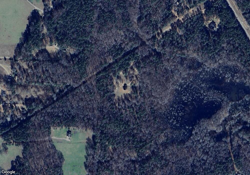
566 Crest Hwy Molena, GA 30258
Estimated Value: $342,000 - $606,911
3
Beds
2
Baths
1,792
Sq Ft
$265/Sq Ft
Est. Value
About This Home
This home is located at 566 Crest Hwy, Molena, GA 30258 and is currently estimated at $474,456, approximately $264 per square foot. 566 Crest Hwy is a home with nearby schools including Pike County Primary School, Pike County Elementary School, and Pike County Middle School.
Ownership History
Date
Name
Owned For
Owner Type
Purchase Details
Closed on
Feb 16, 2006
Sold by
Crawford Robert M
Bought by
Eubanks Justin T
Current Estimated Value
Purchase Details
Closed on
Apr 12, 2004
Bought by
Eubanks Veronica W and Eubanks Chester J
Purchase Details
Closed on
May 25, 2001
Sold by
Eubanks Veronica W
Bought by
Eubanks Veronica W and Eubanks Chester
Purchase Details
Closed on
Apr 25, 1991
Bought by
Eubanks Veronica W
Create a Home Valuation Report for This Property
The Home Valuation Report is an in-depth analysis detailing your home's value as well as a comparison with similar homes in the area
Home Values in the Area
Average Home Value in this Area
Purchase History
| Date | Buyer | Sale Price | Title Company |
|---|---|---|---|
| Eubanks Justin T | $52,500 | -- | |
| Eubanks Veronica W | -- | -- | |
| Eubanks Veronica W | -- | -- | |
| Eubanks Veronica W | -- | -- |
Source: Public Records
Tax History Compared to Growth
Tax History
| Year | Tax Paid | Tax Assessment Tax Assessment Total Assessment is a certain percentage of the fair market value that is determined by local assessors to be the total taxable value of land and additions on the property. | Land | Improvement |
|---|---|---|---|---|
| 2024 | $2,536 | $203,300 | $85,517 | $117,783 |
| 2023 | $2,947 | $203,300 | $85,517 | $117,783 |
| 2022 | $1,890 | $137,730 | $65,782 | $71,948 |
| 2021 | $1,885 | $119,756 | $47,808 | $71,948 |
| 2020 | $1,901 | $119,756 | $47,808 | $71,948 |
| 2019 | $1,546 | $101,983 | $47,808 | $54,175 |
| 2018 | $1,540 | $101,983 | $47,808 | $54,175 |
| 2017 | $1,518 | $101,983 | $47,808 | $54,175 |
| 2016 | $1,320 | $98,967 | $47,808 | $51,159 |
| 2015 | $1,260 | $98,967 | $47,808 | $51,159 |
| 2014 | $1,271 | $98,967 | $47,808 | $51,159 |
| 2013 | -- | $100,162 | $47,808 | $52,354 |
Source: Public Records
Map
Nearby Homes
- 0 Ga Hwy 18 Unit 223299
- 0 Ga Highway 18 Unit 10599105
- 694 Highway 18
- 9.09 ACRE Flint River Rd
- 135 Zachariah Rd
- 50 Judy Ct
- 6177 Crest Hwy
- 3940 Georgia 18
- 3940 Highway 18
- 3 Waddell Rd
- 0 Bagwell Rd Unit 10511111
- 178 Bray St
- LOT 2 Waddell Rd
- 30 Cedar St
- 285 Flat Shoals Rd
- 8272 Old Zebulon Rd
- 0 Highway 85 Unit 10349582
- 1044 Union School Rd
- 453 Folk Ave
- 10275 Millarden Rd
- 333 Dripping Rock Rd
- 495 Dripping Rock Rd
- 613 Dripping Rock Rd
- 551 Dripping Rock Rd
- 392 Crest Hwy
- 820 Lawrence Mill Rd
- 580 Lawrence Mill Rd
- 598 Lawrence Mill Rd
- 598 Lawrence Mill Rd Unit 3
- 791 Dripping Rock Rd
- 430 Dripping Rock Rd
- 67 Kelly Rd
- 0 Dripping Rock Rd
- 0 Dripping Rock Rd Unit 18 10559170
- 0 Dripping Rock Rd Unit 17 10559167
- 0 Dripping Rock Rd Unit 10559165
- 0 Dripping Rock Rd Unit 10559162
- 0 Dripping Rock Rd Unit 20 10470007
- 0 Dripping Rock Rd Unit 19 10470000
- 0 Dripping Rock Rd Unit 18 10469568
