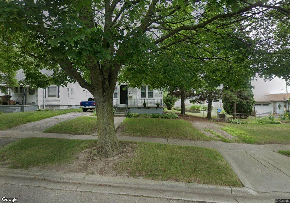
566 E Beverly Ave Pontiac, MI 48340
Estimated Value: $129,722 - $199,000
4
Beds
1
Bath
1,364
Sq Ft
$124/Sq Ft
Est. Value
About This Home
This home is located at 566 E Beverly Ave, Pontiac, MI 48340 and is currently estimated at $169,181, approximately $124 per square foot. 566 E Beverly Ave is a home located in Oakland County with nearby schools including Owen Elementary School, Pontiac Middle School, and Pontiac High School.
Ownership History
Date
Name
Owned For
Owner Type
Purchase Details
Closed on
Mar 27, 1997
Sold by
Willis Rosa
Bought by
Willis Gerald
Current Estimated Value
Home Financials for this Owner
Home Financials are based on the most recent Mortgage that was taken out on this home.
Original Mortgage
$60,000
Outstanding Balance
$6,508
Interest Rate
7.74%
Estimated Equity
$162,673
Purchase Details
Closed on
Aug 10, 1995
Sold by
Gomez Epifanio
Bought by
Willis Gerald and Willis Rosa
Home Financials for this Owner
Home Financials are based on the most recent Mortgage that was taken out on this home.
Original Mortgage
$46,800
Interest Rate
7.81%
Mortgage Type
New Conventional
Create a Home Valuation Report for This Property
The Home Valuation Report is an in-depth analysis detailing your home's value as well as a comparison with similar homes in the area
Home Values in the Area
Average Home Value in this Area
Purchase History
| Date | Buyer | Sale Price | Title Company |
|---|---|---|---|
| Willis Gerald | -- | -- | |
| Willis Gerald | $52,000 | -- |
Source: Public Records
Mortgage History
| Date | Status | Borrower | Loan Amount |
|---|---|---|---|
| Open | Willis Gerald | $60,000 | |
| Previous Owner | Willis Gerald | $46,800 |
Source: Public Records
Tax History
| Year | Tax Paid | Tax Assessment Tax Assessment Total Assessment is a certain percentage of the fair market value that is determined by local assessors to be the total taxable value of land and additions on the property. | Land | Improvement |
|---|---|---|---|---|
| 2025 | $723 | $52,760 | $0 | $0 |
| 2024 | $621 | $47,800 | $0 | $0 |
| 2023 | $592 | $42,630 | $0 | $0 |
| 2022 | $638 | $36,890 | $0 | $0 |
| 2021 | $612 | $30,900 | $0 | $0 |
| 2020 | $529 | $27,650 | $0 | $0 |
| 2019 | $587 | $23,840 | $0 | $0 |
| 2018 | $557 | $21,320 | $0 | $0 |
| 2017 | $530 | $20,220 | $0 | $0 |
| 2016 | $558 | $17,710 | $0 | $0 |
| 2015 | -- | $15,480 | $0 | $0 |
| 2014 | -- | $13,580 | $0 | $0 |
| 2011 | -- | $21,320 | $0 | $0 |
Source: Public Records
Map
Nearby Homes
- 594 E Mansfield Ave
- 635 E Tennyson Ave
- 643 E Mansfield Ave
- 647 E Mansfield Ave
- 590 E Madison Ave
- 630 E Madison Ave
- 671 E Mansfield Ave
- 683 E Mansfield Ave
- 165 Lot 220 S Opdyke Rd
- 603 Wesbrook St
- 635 Wesbrook St
- 575 4th Ave
- 691 3rd Ave
- 638 Raskob St
- 577 Peacock Ave
- 000 S Walton
- 771 Robinwood St
- 811 Melrose St
- 674 Parkwood Ave
- 672 Linda Vista Dr
- 570 E Beverly Ave
- 556 E Beverly Ave
- 574 E Beverly Ave
- 563 E Tennyson Ave
- 567 E Tennyson Ave
- 559 E Tennyson Ave
- 575 E Tennyson Ave
- 578 E Beverly Ave
- 1004 Joslyn Ave
- 582 E Beverly Ave
- 579 E Tennyson Ave
- 583 E Tennyson Ave
- 586 E Beverly Ave
- 587 E Tennyson Ave
- 590 E Beverly Ave
- 562 E Tennyson Ave
- 594 E Beverly Ave
- 570 E Tennyson Ave
- 566 E Tennyson Ave
- 598 E Beverly Ave
Your Personal Tour Guide
Ask me questions while you tour the home.