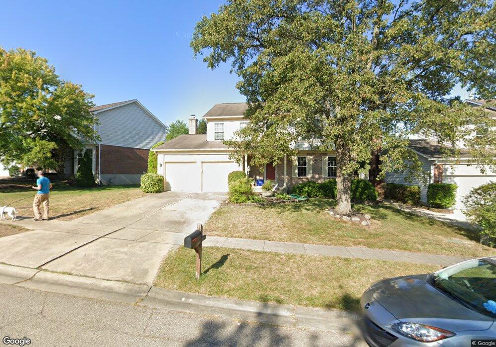
566 Forest Ridge Ct Cincinnati, OH 45244
Summerside NeighborhoodEstimated Value: $315,000 - $386,000
4
Beds
3
Baths
2,064
Sq Ft
$171/Sq Ft
Est. Value
About This Home
This home is located at 566 Forest Ridge Ct, Cincinnati, OH 45244 and is currently estimated at $353,974, approximately $171 per square foot. 566 Forest Ridge Ct is a home located in Clermont County with nearby schools including Summerside Elementary School, West Clermont Middle School, and West Clermont High School.
Ownership History
Date
Name
Owned For
Owner Type
Purchase Details
Closed on
Jun 11, 2002
Sold by
Corporate Transfer Servi
Bought by
Brown Christopher A Renee E Adcock
Current Estimated Value
Home Financials for this Owner
Home Financials are based on the most recent Mortgage that was taken out on this home.
Original Mortgage
$50,000
Interest Rate
6.41%
Mortgage Type
New Conventional
Purchase Details
Closed on
Dec 29, 1999
Sold by
Rasch David M
Bought by
Vandermyde Brent S and Vandermyde Joann L
Home Financials for this Owner
Home Financials are based on the most recent Mortgage that was taken out on this home.
Original Mortgage
$118,800
Interest Rate
7.75%
Mortgage Type
New Conventional
Purchase Details
Closed on
Nov 8, 1991
Create a Home Valuation Report for This Property
The Home Valuation Report is an in-depth analysis detailing your home's value as well as a comparison with similar homes in the area
Home Values in the Area
Average Home Value in this Area
Purchase History
| Date | Buyer | Sale Price | Title Company |
|---|---|---|---|
| Brown Christopher A Renee E Adcock | $165,900 | -- | |
| Vandermyde Brent S | $148,500 | -- | |
| -- | $124,500 | -- |
Source: Public Records
Mortgage History
| Date | Status | Borrower | Loan Amount |
|---|---|---|---|
| Closed | Brown Christopher A Renee E Adcock | $50,000 | |
| Previous Owner | Vandermyde Brent S | $118,800 |
Source: Public Records
Tax History Compared to Growth
Tax History
| Year | Tax Paid | Tax Assessment Tax Assessment Total Assessment is a certain percentage of the fair market value that is determined by local assessors to be the total taxable value of land and additions on the property. | Land | Improvement |
|---|---|---|---|---|
| 2024 | $4,764 | $94,470 | $17,400 | $77,070 |
| 2023 | $4,771 | $94,470 | $17,400 | $77,070 |
| 2022 | $3,987 | $68,430 | $12,600 | $55,830 |
| 2021 | $4,004 | $68,430 | $12,600 | $55,830 |
| 2020 | $4,008 | $68,430 | $12,600 | $55,830 |
| 2019 | $2,930 | $58,490 | $12,430 | $46,060 |
| 2018 | $2,960 | $58,490 | $12,430 | $46,060 |
| 2017 | $2,947 | $58,490 | $12,430 | $46,060 |
| 2016 | $2,947 | $52,710 | $11,200 | $41,510 |
| 2015 | $2,861 | $52,710 | $11,200 | $41,510 |
| 2014 | $2,859 | $52,710 | $11,200 | $41,510 |
| 2013 | $2,898 | $52,850 | $11,900 | $40,950 |
Source: Public Records
Map
Nearby Homes
- 4613 Laurel View Dr
- 4603 Laurel View Dr
- 533 Aspen Glen Dr
- 548 Aspen Glen Dr
- 529 Aspen Glen Dr
- 1005 Steamboat Dr
- 4641 Clayton Dr
- 1041 Steamboat Dr
- 1236 Arapaho Ln
- 822 Blackcomb Dr
- 439 Dartmouth Cir
- 499 Halifax Cir
- 860 Blackcomb Dr
- 4633 Summerside Rd
- 4723 Brookfield Ct
- 4530 Summerside Rd
- 4669 Bluejacket Rd
- 473 Richard Ln
- 481 Big Moe Dr
- 4551 Dameron Ln
- 564 Forest Ridge Ct
- 568 Forest Ridge Ct
- 560 Forest Ridge Ct
- 570 Forest Ridge Ct
- 555 Maplevalley Ct
- 553 Maplevalley Ct
- 557 Maplevalley Ct
- 558 Forest Ridge Ct
- 567 Forest Ridge Ct
- 569 Forest Ridge Ct
- 565 Forest Ridge Ct
- 572 Forest Ridge Ct Unit 81
- 571 Forest Ridge Ct
- 563 Forest Ridge Ct
- 4620 Laurel Ridge Ct
- 559 Maplevalley Ct
- 556 Forest Ridge Ct
- 573 Forest Ridge Ct
- 4626 Laurel View Dr Unit 92
- 4626 Laurel View Dr