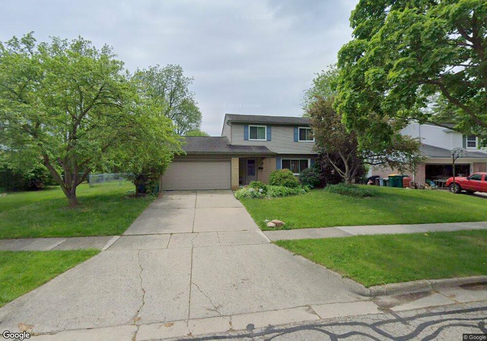
566 Marlpool Dr Saline, MI 48176
South Side NeighborhoodEstimated Value: $381,000 - $394,000
3
Beds
2
Baths
1,640
Sq Ft
$237/Sq Ft
Est. Value
About This Home
This home is located at 566 Marlpool Dr, Saline, MI 48176 and is currently estimated at $389,210, approximately $237 per square foot. 566 Marlpool Dr is a home located in Washtenaw County with nearby schools including Pleasant Ridge Elementary School, Heritage School, and Saline Middle School.
Ownership History
Date
Name
Owned For
Owner Type
Purchase Details
Closed on
Oct 27, 2020
Sold by
Babcock David M and Babcock Ann
Bought by
Babcock Ann
Current Estimated Value
Home Financials for this Owner
Home Financials are based on the most recent Mortgage that was taken out on this home.
Original Mortgage
$152,000
Outstanding Balance
$135,258
Interest Rate
2.8%
Mortgage Type
New Conventional
Estimated Equity
$253,952
Purchase Details
Closed on
Apr 25, 2008
Sold by
Prudential Relocation Inc
Bought by
Babcock David M and Babcock Ann
Home Financials for this Owner
Home Financials are based on the most recent Mortgage that was taken out on this home.
Original Mortgage
$173,057
Interest Rate
5.88%
Mortgage Type
FHA
Create a Home Valuation Report for This Property
The Home Valuation Report is an in-depth analysis detailing your home's value as well as a comparison with similar homes in the area
Home Values in the Area
Average Home Value in this Area
Purchase History
| Date | Buyer | Sale Price | Title Company |
|---|---|---|---|
| Babcock Ann | -- | Nationallink | |
| Babcock Ann | -- | Dec Frank P | |
| Babcock David M | $178,000 | None Available | |
| Prudential Relocation Inc | $178,000 | None Available |
Source: Public Records
Mortgage History
| Date | Status | Borrower | Loan Amount |
|---|---|---|---|
| Open | Babcock Ann | $152,000 | |
| Closed | Babcock Ann | $152,000 | |
| Previous Owner | Babcock David M | $173,057 |
Source: Public Records
Tax History
| Year | Tax Paid | Tax Assessment Tax Assessment Total Assessment is a certain percentage of the fair market value that is determined by local assessors to be the total taxable value of land and additions on the property. | Land | Improvement |
|---|---|---|---|---|
| 2025 | $5,311 | $176,500 | $0 | $0 |
| 2024 | $5,157 | $155,800 | $0 | $0 |
| 2023 | $4,962 | $145,300 | $0 | $0 |
| 2022 | $5,118 | $133,900 | $0 | $0 |
| 2021 | $4,914 | $128,800 | $0 | $0 |
| 2020 | $4,865 | $105,900 | $0 | $0 |
| 2019 | $4,754 | $125,900 | $125,900 | $0 |
| 2018 | $4,557 | $116,000 | $0 | $0 |
| 2017 | $268 | $114,800 | $0 | $0 |
| 2016 | $4,371 | $90,857 | $0 | $0 |
| 2015 | -- | $90,586 | $0 | $0 |
| 2014 | -- | $87,756 | $0 | $0 |
| 2013 | -- | $87,756 | $0 | $0 |
Source: Public Records
Map
Nearby Homes
- 500 Old Creek Dr
- 1450 W Bemis Rd
- 112 Burwyck Park Dr
- 109 Burwyck Park Dr Unit 3
- 29 Black Cherry Ln
- 110 Parsons Ln
- 100 Parsons Ln
- 126 Parsons Ln
- 106 Parsons Ln
- 124 Parsons Ln
- 112 Parsons Ln
- 202 W Henry St
- 116 W Mckay St
- 2204 Mill Ln
- 548 Park Place
- 350 Huntington Dr Unit 30
- 7608 E Michigan Ave
- 404 Mills Rd
- 9004 Charter Oak Ln
- 7663 Ann Arbor-Saline Rd
- 558 Marlpool Dr
- 574 Marlpool Dr
- 521 Forestbrooke Ct
- 0 Marlpool Dr
- 567 Marlpool Dr
- 559 Marlpool Dr
- 575 Marlpool Dr
- 545 Forestbrooke Ct
- 551 Marlpool Dr
- 522 Forestbrooke Dr
- 524 Marlpool Dr
- 543 Marlpool Dr
- 534 Forestbrooke Ct
- 536 Forestbrooke Dr
- 682 Marlpool Dr
- 565 Forestbrooke Ct
- 535 Marlpool Dr
- 550 Forestbrooke Dr
- 516 Marlpool Dr
- 703 Marlpool Dr
Your Personal Tour Guide
Ask me questions while you tour the home.