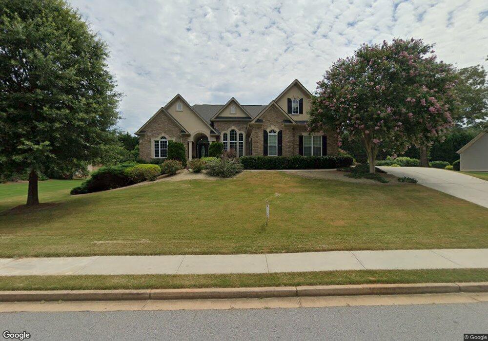
566 Sterling Water Dr Unit 32 Monroe, GA 30655
Estimated Value: $524,000 - $696,000
4
Beds
4
Baths
2,762
Sq Ft
$222/Sq Ft
Est. Value
About This Home
This home is located at 566 Sterling Water Dr Unit 32, Monroe, GA 30655 and is currently estimated at $613,513, approximately $222 per square foot. 566 Sterling Water Dr Unit 32 is a home located in Walton County with nearby schools including Walnut Grove Elementary School, Youth Middle School, and Walnut Grove High School.
Ownership History
Date
Name
Owned For
Owner Type
Purchase Details
Closed on
Mar 16, 2020
Sold by
T & T Ri Properties Llc
Bought by
Griffin Robert Alton and Griffin Natalie
Current Estimated Value
Home Financials for this Owner
Home Financials are based on the most recent Mortgage that was taken out on this home.
Original Mortgage
$337,250
Outstanding Balance
$298,113
Interest Rate
3.4%
Mortgage Type
New Conventional
Estimated Equity
$315,400
Purchase Details
Closed on
Jul 3, 2018
Sold by
Roeland Dwight J
Bought by
T
Purchase Details
Closed on
Jul 6, 2004
Sold by
Turner Land Dev Inc
Bought by
Kelly Hm Construction Inc
Home Financials for this Owner
Home Financials are based on the most recent Mortgage that was taken out on this home.
Original Mortgage
$258,750
Interest Rate
6.24%
Create a Home Valuation Report for This Property
The Home Valuation Report is an in-depth analysis detailing your home's value as well as a comparison with similar homes in the area
Home Values in the Area
Average Home Value in this Area
Purchase History
| Date | Buyer | Sale Price | Title Company |
|---|---|---|---|
| Griffin Robert Alton | $355,000 | -- | |
| T | $301,787 | -- | |
| Kelly Hm Construction Inc | $96,700 | -- |
Source: Public Records
Mortgage History
| Date | Status | Borrower | Loan Amount |
|---|---|---|---|
| Open | Griffin Robert Alton | $337,250 | |
| Previous Owner | Kelly Hm Construction Inc | $258,750 |
Source: Public Records
Tax History Compared to Growth
Tax History
| Year | Tax Paid | Tax Assessment Tax Assessment Total Assessment is a certain percentage of the fair market value that is determined by local assessors to be the total taxable value of land and additions on the property. | Land | Improvement |
|---|---|---|---|---|
| 2024 | $5,360 | $204,520 | $34,000 | $170,520 |
| 2023 | $4,963 | $199,160 | $34,000 | $165,160 |
| 2022 | $5,398 | $182,400 | $26,000 | $156,400 |
| 2021 | $4,602 | $155,960 | $20,000 | $135,960 |
| 2020 | $5,167 | $152,840 | $20,000 | $132,840 |
| 2019 | $4,050 | $144,960 | $20,000 | $124,960 |
| 2018 | $4,897 | $144,960 | $20,000 | $124,960 |
| 2017 | $4,603 | $133,600 | $20,000 | $113,600 |
| 2016 | $3,955 | $115,000 | $20,000 | $95,000 |
| 2015 | $3,788 | $108,320 | $20,000 | $88,320 |
| 2014 | $3,849 | $107,360 | $0 | $0 |
Source: Public Records
Map
Nearby Homes
- 561 Sterling Water Dr
- 543 Sterling Water Dr
- Riley A.3 2 Side Entry Plan at Nunnally Farm Rd
- 410 Iroquois Ct
- 6224 Waters Edge Dr
- 492 Nunnally Farm Rd
- 6212 Waters Edge Dr
- 635 Nunnally Farm Rd
- 172 Iroquois Ct
- 2112 Meadowood Cove
- 324 Bella Dr
- 2104 Meadowood Cove
- 43 Belmont Ct
- 4335 Lakeside Blvd Unit 6
- 2485 Amber Hills Dr
- 83 Bella Dr
- 1081 Hawthorn Ct
- 26 ACRES P J Rd E
- 566 Sterling Water Dr
- 564 Sterling Water Dr
- 568 Sterling Water Dr
- 588 Sterling Water Dr
- 567 Sterling Water Dr
- 562 Sterling Water Dr
- 486 Creekside Dr
- 571 Sterling Water Dr
- 565 Sterling Water Dr
- 563 Sterling Water Dr
- 569 Sterling Water Dr
- 560 Sterling Water Dr
- 480 Creekside Dr
- 559 Sterling Water Dr
- 485 Creekside Dr
- 460 Lakeshore Dr
- 0 Creekside Dr Unit 7374703
- 0 Creekside Dr Unit 7121890
- 0 Creekside Dr Unit 7332065
- 487 Creekside Dr