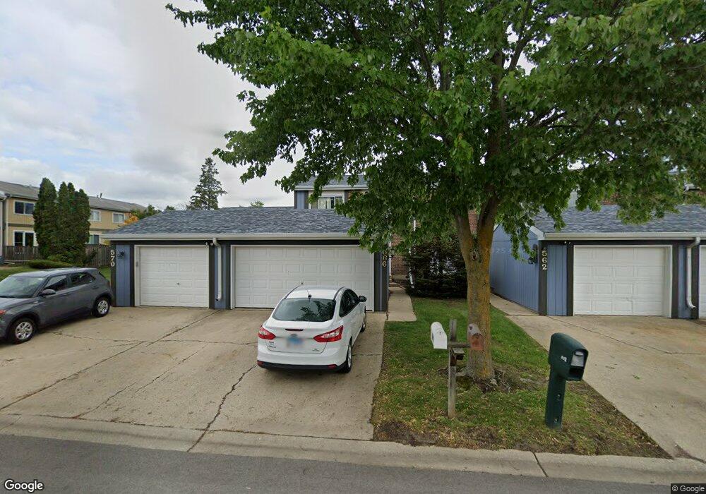
566 Sundance Dr Unit 5 Bolingbrook, IL 60440
East Bolingbrook NeighborhoodEstimated Value: $256,244 - $272,000
3
Beds
1
Bath
1,392
Sq Ft
$191/Sq Ft
Est. Value
About This Home
This home is located at 566 Sundance Dr Unit 5, Bolingbrook, IL 60440 and is currently estimated at $266,561, approximately $191 per square foot. 566 Sundance Dr Unit 5 is a home located in Will County with nearby schools including Oak View Elementary School, Bolingbrook High School, and Midwest Christian Montessori Academy.
Ownership History
Date
Name
Owned For
Owner Type
Purchase Details
Closed on
Aug 28, 2002
Sold by
Mcgauhey Radley S and Mcgauhey Mary F
Bought by
Harold Steven C and Harold Elizabeth C
Current Estimated Value
Home Financials for this Owner
Home Financials are based on the most recent Mortgage that was taken out on this home.
Original Mortgage
$110,400
Outstanding Balance
$46,690
Interest Rate
6.41%
Estimated Equity
$219,871
Create a Home Valuation Report for This Property
The Home Valuation Report is an in-depth analysis detailing your home's value as well as a comparison with similar homes in the area
Home Values in the Area
Average Home Value in this Area
Purchase History
| Date | Buyer | Sale Price | Title Company |
|---|---|---|---|
| Harold Steven C | $138,000 | Golden Title |
Source: Public Records
Mortgage History
| Date | Status | Borrower | Loan Amount |
|---|---|---|---|
| Open | Harold Steven C | $110,400 | |
| Closed | Harold Steven C | $27,600 |
Source: Public Records
Tax History Compared to Growth
Tax History
| Year | Tax Paid | Tax Assessment Tax Assessment Total Assessment is a certain percentage of the fair market value that is determined by local assessors to be the total taxable value of land and additions on the property. | Land | Improvement |
|---|---|---|---|---|
| 2024 | $6,479 | $78,158 | $8,587 | $69,571 |
| 2023 | $6,479 | $70,324 | $7,726 | $62,598 |
| 2022 | $5,674 | $63,400 | $6,965 | $56,435 |
| 2021 | $5,190 | $57,553 | $6,322 | $51,231 |
| 2020 | $4,859 | $54,039 | $5,936 | $48,103 |
| 2019 | $4,487 | $49,486 | $5,436 | $44,050 |
| 2018 | $3,839 | $42,964 | $4,720 | $38,244 |
| 2017 | $3,436 | $38,785 | $4,261 | $34,524 |
| 2016 | $3,168 | $35,500 | $3,900 | $31,600 |
| 2015 | $2,908 | $33,000 | $3,600 | $29,400 |
| 2014 | $2,908 | $33,000 | $3,600 | $29,400 |
| 2013 | $2,908 | $33,000 | $3,600 | $29,400 |
Source: Public Records
Map
Nearby Homes
- 316 Pueblo Dr
- 621 Sundance Dr
- 228 Elkhorn Ct Unit B
- 329 Redwing Dr
- 261 Bryant Way
- 208 Flagstaff Dr
- VACANT W Boughton Rd
- 534 Cottonwood Cir
- 412 Clifton Ln
- 353 Foster Way Unit 2
- 565 Cottonwood Cir
- 623 Cochise Cir
- 267 Clarendon Ln Unit 1
- 352 Gehrig Cir
- 141 N Lancaster Dr
- 117 Galewood Dr
- 11 Roanoke Ct
- 118 Springleaf Dr Unit 5
- 284 Berkeley Dr Unit 1
- 3 Roanoke Ct
- 562 Sundance Dr
- 570 Sundance Dr
- 558 Sundance Dr Unit 5
- 554 Sundance Dr
- 550 Sundance Dr
- 328 Pinto Dr
- 324 Pinto Dr
- 332 Pinto Dr
- 336 Pinto Dr
- 565 Sundance Dr
- 569 Sundance Dr
- 340 Pinto Dr
- 573 Sundance Dr
- 542 Sundance Dr
- 577 Sundance Dr
- 344 Pinto Dr Unit 5
- 581 Sundance Dr Unit 5
- 317 Pueblo Dr
- 585 Sundance Dr
- 547 Pontiac Ln