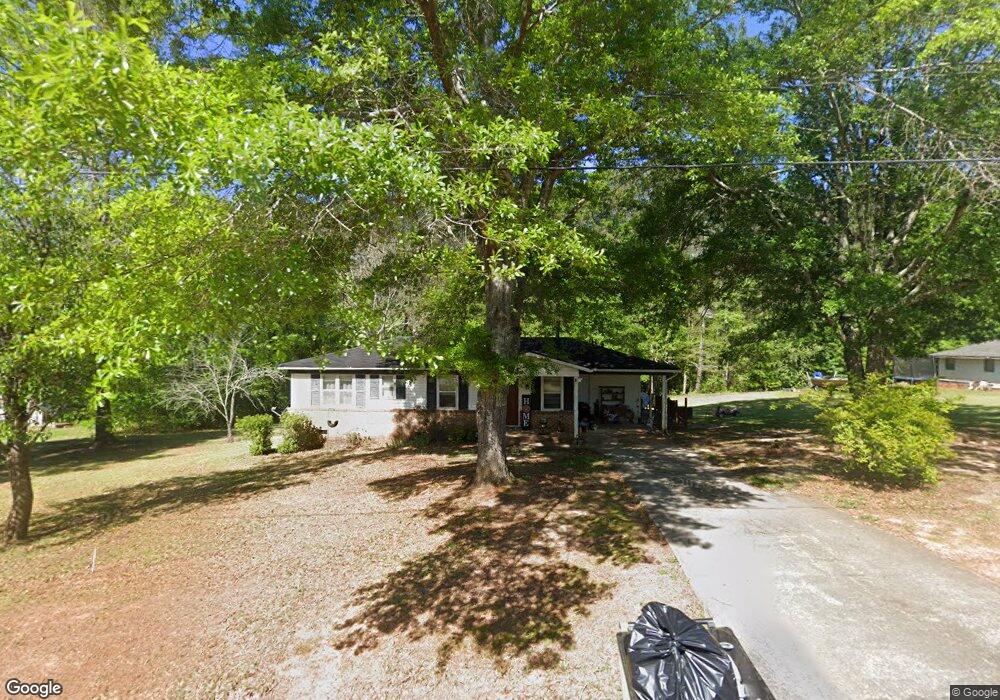
566 Sunnyland Dr Thomaston, GA 30286
Estimated Value: $175,000 - $212,000
3
Beds
2
Baths
1,109
Sq Ft
$168/Sq Ft
Est. Value
About This Home
This home is located at 566 Sunnyland Dr, Thomaston, GA 30286 and is currently estimated at $186,126, approximately $167 per square foot. 566 Sunnyland Dr is a home located in Upson County with nearby schools including Upson-Lee South Elementary School, Upson-Lee North Elementary School, and Upson-Lee Middle School.
Ownership History
Date
Name
Owned For
Owner Type
Purchase Details
Closed on
May 20, 2010
Sold by
The Bank Of New York Mello
Bought by
Miller Lewis
Current Estimated Value
Home Financials for this Owner
Home Financials are based on the most recent Mortgage that was taken out on this home.
Original Mortgage
$36,156
Outstanding Balance
$24,210
Interest Rate
5.03%
Mortgage Type
New Conventional
Estimated Equity
$161,916
Purchase Details
Closed on
Dec 2, 2009
Sold by
Tabor Elizabeth B
Bought by
The Bank Of New York Mellon
Purchase Details
Closed on
Mar 15, 2006
Sold by
Not Provided
Bought by
Miller Lewis
Home Financials for this Owner
Home Financials are based on the most recent Mortgage that was taken out on this home.
Original Mortgage
$70,400
Interest Rate
6.25%
Mortgage Type
New Conventional
Create a Home Valuation Report for This Property
The Home Valuation Report is an in-depth analysis detailing your home's value as well as a comparison with similar homes in the area
Home Values in the Area
Average Home Value in this Area
Purchase History
| Date | Buyer | Sale Price | Title Company |
|---|---|---|---|
| Miller Lewis | $41,000 | -- | |
| The Bank Of New York Mellon | -- | -- | |
| Miller Lewis | -- | -- |
Source: Public Records
Mortgage History
| Date | Status | Borrower | Loan Amount |
|---|---|---|---|
| Open | The Bank Of New York Mellon | $36,156 | |
| Previous Owner | Miller Lewis | $70,400 |
Source: Public Records
Tax History Compared to Growth
Tax History
| Year | Tax Paid | Tax Assessment Tax Assessment Total Assessment is a certain percentage of the fair market value that is determined by local assessors to be the total taxable value of land and additions on the property. | Land | Improvement |
|---|---|---|---|---|
| 2024 | $1,302 | $49,525 | $8,000 | $41,525 |
| 2023 | $1,301 | $47,654 | $8,000 | $39,654 |
| 2022 | $1,073 | $38,692 | $8,000 | $30,692 |
| 2021 | $889 | $33,733 | $8,000 | $25,733 |
| 2020 | $808 | $28,634 | $6,400 | $22,234 |
| 2019 | $749 | $24,438 | $4,000 | $20,438 |
| 2018 | $749 | $24,438 | $4,000 | $20,438 |
| 2017 | $632 | $18,804 | $3,200 | $15,604 |
| 2016 | $627 | $18,333 | $3,200 | $15,133 |
| 2015 | $627 | $18,333 | $3,200 | $15,133 |
| 2014 | $628 | $18,333 | $3,200 | $15,133 |
Source: Public Records
Map
Nearby Homes
- 556 Sunnyland Dr
- 524 Sunnyland Dr
- 216 E Moores Crossing Rd
- 0 W Moores Crossing Rd Unit 10605207
- 115 Hillside Dr
- 2615 Barnesville Hwy
- 101 Pineview Dr
- 2724 Barnesville St
- 1205 Shady Ln
- 657 Tom McKinley Rd
- 508 Heath Dr
- 201 Creekside Manor Dr
- 458 E St
- LOT 193 Morningside Ct
- LOT 195 Morningside Ct
- LOT 194 Morningside Ct
- 114 C St NE
- 106 C St NE
- 307 Pardue Dr
- 74 E St