Estimated Value: $228,551 - $265,000
3
Beds
2
Baths
968
Sq Ft
$259/Sq Ft
Est. Value
About This Home
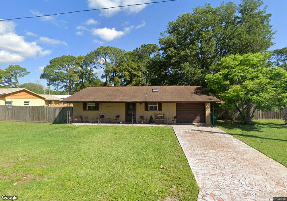
This home is located at 5660 Fairbridge St, Cocoa, FL 32927 and is currently estimated at $250,888, approximately $259 per square foot. 5660 Fairbridge St is a home located in Brevard County with nearby schools including Enterprise Elementary School, Space Coast Junior/Senior High School, and East Atlantic Prep of Brevard County.
Ownership History
Date
Name
Owned For
Owner Type
Purchase Details
Closed on
Jan 29, 2024
Sold by
Graham Linda R
Bought by
Graham Linda R and Maiella Kathleen
Current Estimated Value
Purchase Details
Closed on
Oct 29, 1997
Sold by
Graham Robert V
Bought by
Graham Linda R
Purchase Details
Closed on
May 2, 1995
Sold by
Lathorne Karen L
Bought by
Graham Robert V and Graham Linda R
Purchase Details
Closed on
Mar 10, 1994
Sold by
Kozimor Karen
Bought by
Lanthorne Karen L
Create a Home Valuation Report for This Property
The Home Valuation Report is an in-depth analysis detailing your home's value as well as a comparison with similar homes in the area
Home Values in the Area
Average Home Value in this Area
Purchase History
| Date | Buyer | Sale Price | Title Company |
|---|---|---|---|
| Graham Linda R | $100 | None Listed On Document | |
| Graham Linda R | $100 | None Listed On Document | |
| Graham Linda R | -- | -- | |
| Graham Robert V | $55,000 | -- | |
| Lanthorne Karen L | $54,700 | -- |
Source: Public Records
Tax History
| Year | Tax Paid | Tax Assessment Tax Assessment Total Assessment is a certain percentage of the fair market value that is determined by local assessors to be the total taxable value of land and additions on the property. | Land | Improvement |
|---|---|---|---|---|
| 2025 | $807 | $59,490 | -- | -- |
| 2024 | $790 | $57,820 | -- | -- |
| 2023 | $790 | $56,140 | $0 | $0 |
| 2022 | $809 | $54,510 | $0 | $0 |
| 2021 | $809 | $52,930 | $0 | $0 |
| 2020 | $776 | $52,200 | $0 | $0 |
| 2019 | $724 | $51,030 | $0 | $0 |
| 2018 | $724 | $50,080 | $0 | $0 |
| 2017 | $717 | $49,050 | $0 | $0 |
| 2016 | $711 | $48,050 | $18,000 | $30,050 |
| 2015 | $710 | $47,720 | $15,000 | $32,720 |
| 2014 | $710 | $47,350 | $11,000 | $36,350 |
Source: Public Records
Map
Nearby Homes
- 5721 Beaverbrook St
- 6481 La Brea Ave
- 6581 Bancroft Ave
- 5680 Banos Ave
- 6643 Emil Ave
- 6438 Hudson Rd
- 6460 Ainsworth Rd
- 6615 Dock Ave
- 0 Aruin St Unit 1222557
- 6460 Homestead Ave
- 23-35-21-JX-B-2 Aruin St
- 6545 Addie Ave
- 6450 Ember Ave
- 6250 Ainsworth Rd
- 5555 Brandon St
- 6760 Cairo Rd
- 5680 Brandon St
- 6815 Bryant Rd
- 00 Unknown
- 6135 Allmont St
- 5640 Fairbridge St
- 5680 Fairbridge St
- 5620 Fairbridge St
- 5625 Curtis Blvd
- 5645 Fairbridge St
- 0000 No Name
- 7300 N Us Highway ! Hwy Unit 206
- 4650 N Highway 1 Hwy
- 0 No Street Address Unit 333694
- 2313006 Blk 1 & 1 2 Lots 2 3 Can Grov St
- 2313642 Section 32 Block 12 Lot 9
- 231790 Section 32 Block 18 Can Grove
- 0 No Street Address Unit 936304
- 5665 Fairbridge St
- 5645 Curtis Blvd
- 5615 Curtis Blvd
- 5625 Fairbridge St
- 5710 Fairbridge St
- 5685 Fairbridge St
- 5600 Fairbridge St
Your Personal Tour Guide
Ask me questions while you tour the home.