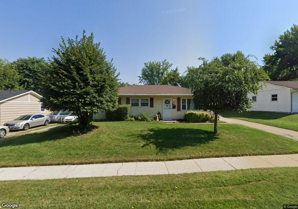
5661 Sharp Rd Dayton, OH 45432
Estimated Value: $158,000 - $206,000
3
Beds
2
Baths
1,046
Sq Ft
$176/Sq Ft
Est. Value
About This Home
This home is located at 5661 Sharp Rd, Dayton, OH 45432 and is currently estimated at $183,630, approximately $175 per square foot. 5661 Sharp Rd is a home located in Montgomery County with nearby schools including Parkwood Elementary School, Herman K Ankeney Middle School, and Beavercreek High School.
Ownership History
Date
Name
Owned For
Owner Type
Purchase Details
Closed on
Sep 13, 2022
Sold by
Dorothy Ann Haughey Irrevocable Trust
Bought by
Heiser Brandon M and Berry Abigail A
Current Estimated Value
Purchase Details
Closed on
Oct 21, 2008
Sold by
Haughey Dorothy Ann and Haughey Dorothy A
Bought by
Haughey Dorothy Ann and Dorothy Ann Haughey Irrevocable Trust
Purchase Details
Closed on
Jan 19, 2001
Sold by
Estate Of Esta Neal Haughey
Bought by
Haughey Dorothy Ann and Haughey Dorothy A
Create a Home Valuation Report for This Property
The Home Valuation Report is an in-depth analysis detailing your home's value as well as a comparison with similar homes in the area
Home Values in the Area
Average Home Value in this Area
Purchase History
| Date | Buyer | Sale Price | Title Company |
|---|---|---|---|
| Heiser Brandon M | $150,000 | -- | |
| Haughey Dorothy Ann | -- | Attorney | |
| Haughey Dorothy Ann | -- | -- |
Source: Public Records
Mortgage History
| Date | Status | Borrower | Loan Amount |
|---|---|---|---|
| Closed | Heiser Brandon M | $0 |
Source: Public Records
Tax History
| Year | Tax Paid | Tax Assessment Tax Assessment Total Assessment is a certain percentage of the fair market value that is determined by local assessors to be the total taxable value of land and additions on the property. | Land | Improvement |
|---|---|---|---|---|
| 2025 | $2,609 | $41,510 | $9,640 | $31,870 |
| 2024 | $2,531 | $41,510 | $9,640 | $31,870 |
| 2023 | $2,531 | $41,510 | $9,640 | $31,870 |
| 2022 | $1,299 | $27,130 | $6,300 | $20,830 |
| 2021 | $1,305 | $27,130 | $6,300 | $20,830 |
| 2020 | $1,309 | $27,130 | $6,300 | $20,830 |
| 2019 | $1,335 | $25,830 | $6,300 | $19,530 |
| 2018 | $1,241 | $25,830 | $6,300 | $19,530 |
| 2017 | $1,217 | $25,830 | $6,300 | $19,530 |
| 2016 | $1,182 | $24,640 | $6,300 | $18,340 |
| 2015 | $1,336 | $24,640 | $6,300 | $18,340 |
| 2014 | $1,336 | $24,640 | $6,300 | $18,340 |
| 2012 | -- | $30,330 | $7,000 | $23,330 |
Source: Public Records
Map
Nearby Homes
- 1209 Ringwalt Dr
- 1176 Irmal Dr
- 1163 Irmal Dr
- 5664 Mayville Dr
- 5713 Mayville Dr
- 1260 Jeanette Dr
- Lot 10 Linden Ave
- Lot 11 Linden Ave
- 1307 Cobblestone St
- 1301 Ames Ave
- 992 Spinning Rd
- 1841 Wilene Dr
- 1929 Willowgreen Dr
- 1726 Rausch Ave
- 4328 Richland Ave
- 852 Crestmont Dr
- 4301 Richland Ave
- 1585 Larchwood Dr
- 844 Cascade Dr
- 1568 Garwood Dr
Your Personal Tour Guide
Ask me questions while you tour the home.