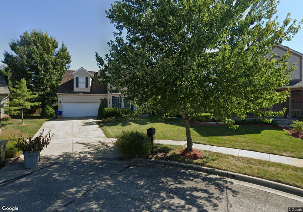
5664 Quinn Ct Westerville, OH 43081
West Albany NeighborhoodEstimated Value: $429,000 - $470,610
4
Beds
3
Baths
2,633
Sq Ft
$172/Sq Ft
Est. Value
About This Home
This home is located at 5664 Quinn Ct, Westerville, OH 43081 and is currently estimated at $453,403, approximately $172 per square foot. 5664 Quinn Ct is a home located in Franklin County with nearby schools including Avalon Elementary School, Northgate Intermediate, and Woodward Park Middle School.
Ownership History
Date
Name
Owned For
Owner Type
Purchase Details
Closed on
Mar 7, 2016
Sold by
Pallone Roman J
Bought by
Pallone Denise R
Current Estimated Value
Purchase Details
Closed on
Apr 27, 2001
Sold by
Gibboney Michael J
Bought by
Pallone Roman J and Pallone Denise R
Home Financials for this Owner
Home Financials are based on the most recent Mortgage that was taken out on this home.
Original Mortgage
$145,050
Interest Rate
6.95%
Purchase Details
Closed on
May 15, 1997
Sold by
Cardinal Title Holding Company
Bought by
Gibboney Michael Joseph
Create a Home Valuation Report for This Property
The Home Valuation Report is an in-depth analysis detailing your home's value as well as a comparison with similar homes in the area
Home Values in the Area
Average Home Value in this Area
Purchase History
| Date | Buyer | Sale Price | Title Company |
|---|---|---|---|
| Pallone Denise R | -- | None Available | |
| Pallone Roman J | $170,700 | Landsel Title Agency | |
| Gibboney Michael Joseph | $29,000 | Cardinal Title |
Source: Public Records
Mortgage History
| Date | Status | Borrower | Loan Amount |
|---|---|---|---|
| Previous Owner | Pallone Roman J | $145,050 |
Source: Public Records
Tax History Compared to Growth
Tax History
| Year | Tax Paid | Tax Assessment Tax Assessment Total Assessment is a certain percentage of the fair market value that is determined by local assessors to be the total taxable value of land and additions on the property. | Land | Improvement |
|---|---|---|---|---|
| 2024 | $6,348 | $141,440 | $41,340 | $100,100 |
| 2023 | $6,267 | $141,435 | $41,335 | $100,100 |
| 2022 | $5,604 | $108,050 | $36,960 | $71,090 |
| 2021 | $5,614 | $108,050 | $36,960 | $71,090 |
| 2020 | $5,621 | $108,050 | $36,960 | $71,090 |
| 2019 | $5,395 | $88,940 | $30,800 | $58,140 |
| 2018 | $4,825 | $88,940 | $30,800 | $58,140 |
| 2017 | $5,392 | $88,940 | $30,800 | $58,140 |
| 2016 | $4,700 | $70,950 | $15,650 | $55,300 |
| 2015 | $4,266 | $70,950 | $15,650 | $55,300 |
| 2014 | $4,277 | $70,950 | $15,650 | $55,300 |
| 2013 | $2,010 | $67,585 | $14,910 | $52,675 |
Source: Public Records
Map
Nearby Homes
- 5556 Falco Dr
- 6501 Walnut Fork Dr Unit 6501
- 6455 Walnut Fork Dr Unit 6455
- 6498 Ash Rock Cir Unit 6498
- 5600 Apothecary Way
- 5604 Apothecary Way Unit 4
- 5656 Apothecary Way Unit 2
- 6813 Ridge Rock Dr Unit 14
- 6950 Harlem Rd
- 5478 Albany Terrace Way Unit 1405
- 6221 Hudson Reserve Way
- 5937 Seffner Dr
- 5981 Niahway St Unit 57
- 5730 Colts Gate Dr Unit 43
- 6160 Albany Way Dr
- 5777 Colts Gate Dr Unit 44
- 5288 Abby Gate Ave Unit 16
- 0 N Hamilton Rd
- 6923 Rothwell St Unit 46923
- 5655 Marshfield Dr
- 5656 Quinn Ct
- 5672 Quinn Ct
- 6793 Bethany Dr
- 6825 Breshly Way
- 5641 Breshly Way
- 6787 Bethany Dr
- 5667 Quinn Ct
- 5648 Quinn Ct
- 6799 Bethany Dr
- 5633 Breshly Way
- 6781 Bethany Dr
- 5640 Quinn Ct
- 5625 Breshly Way
- 5659 Quinn Ct
- 6769 Leapsway Dr
- 5651 Quinn Ct
- 6777 Bethany Dr
- 5643 Quinn Ct
- 5632 Quinn Ct
- 5617 Breshly Way