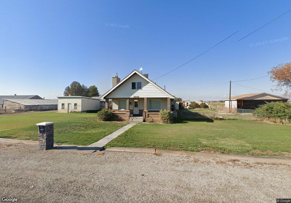
5666 S 1450 W Spanish Fork, UT 84660
Estimated Value: $533,000 - $1,296,038
3
Beds
1
Bath
1,442
Sq Ft
$706/Sq Ft
Est. Value
About This Home
This home is located at 5666 S 1450 W, Spanish Fork, UT 84660 and is currently estimated at $1,018,760, approximately $706 per square foot. 5666 S 1450 W is a home located in Utah County with nearby schools including Brockbank Elementary School, Spanish Fork Jr High School, and Spanish Fork High School.
Ownership History
Date
Name
Owned For
Owner Type
Purchase Details
Closed on
Jul 1, 2021
Sold by
Stulce Jeffery L and Stulce Vicki G
Bought by
Stulce Family Trust and Stulce
Current Estimated Value
Purchase Details
Closed on
Apr 17, 2015
Sold by
Thatcher Holly Hansen and Hansen Shad Eugene
Bought by
Stulce Jeffery L and Stulce Vicki G
Home Financials for this Owner
Home Financials are based on the most recent Mortgage that was taken out on this home.
Original Mortgage
$435,920
Interest Rate
3.73%
Mortgage Type
Commercial
Purchase Details
Closed on
Mar 4, 2015
Sold by
The Ernest Roach Farms Inc
Bought by
Hansen William E and Hansen Norma Nell
Home Financials for this Owner
Home Financials are based on the most recent Mortgage that was taken out on this home.
Original Mortgage
$435,920
Interest Rate
3.73%
Mortgage Type
Commercial
Create a Home Valuation Report for This Property
The Home Valuation Report is an in-depth analysis detailing your home's value as well as a comparison with similar homes in the area
Home Values in the Area
Average Home Value in this Area
Purchase History
| Date | Buyer | Sale Price | Title Company |
|---|---|---|---|
| Stulce Family Trust | -- | None Listed On Document | |
| Stulce Family Trust | -- | None Listed On Document | |
| Stulce Family Trust | -- | None Listed On Document | |
| Stulce Jeffery L | -- | North American Title | |
| Hansen William E | -- | North American Title |
Source: Public Records
Mortgage History
| Date | Status | Borrower | Loan Amount |
|---|---|---|---|
| Previous Owner | Stulce Jeffery L | $435,920 |
Source: Public Records
Tax History Compared to Growth
Tax History
| Year | Tax Paid | Tax Assessment Tax Assessment Total Assessment is a certain percentage of the fair market value that is determined by local assessors to be the total taxable value of land and additions on the property. | Land | Improvement |
|---|---|---|---|---|
| 2025 | $2,553 | $285,736 | $591,400 | $357,400 |
| 2024 | $2,553 | $255,187 | $0 | $0 |
| 2023 | $2,439 | $243,956 | $0 | $0 |
| 2022 | $2,033 | $810,400 | $600,400 | $210,000 |
| 2021 | $1,838 | $556,800 | $392,900 | $163,900 |
| 2020 | $1,544 | $505,800 | $341,900 | $163,900 |
| 2019 | $1,436 | $409,700 | $257,500 | $152,200 |
| 2018 | $1,359 | $369,900 | $237,500 | $132,400 |
| 2017 | $1,379 | $107,201 | $0 | $0 |
| 2016 | $1,286 | $96,958 | $0 | $0 |
| 2015 | $1,249 | $93,345 | $0 | $0 |
| 2014 | $1,251 | $93,553 | $0 | $0 |
Source: Public Records
Map
Nearby Homes
- 5200 S River Dr Unit 3
- 5500 W 5600 S
- 6550 S 1050 W
- 5272 S River Ln
- 559 N Mitchell Dr
- 833 W 250 N
- 226 N 860 W Unit 156
- 956 W 40 N
- 1040 W Center St
- 2182 W 4600 S
- 1299 W 250 S
- 1841 N 630 St W Unit 71
- 1788 N 630 St W Unit 47
- 1826 N 630 St W Unit 101
- 393 N 400 W
- 13 N 710 W
- 333 S 1170 W
- 1377 W 450 S
- 429 S 1280 W
- 1026 W 350 S
- 5630 S 1450 W
- 5578 S 1450 W
- 1444 Palmyra Dr
- 1351 Palmyra Dr
- 1345 Palmyra Dr
- 1326 Palmyra Dr
- 1325 Palmyra Dr
- 5462 S 1450 W
- 5431 S 1450 W
- 5944 S 1450 W
- 1568 Palmyra Dr
- 1608 Palmyra Dr
- 1748 W 5950 S
- 1176 Palmyra Dr
- 5348 S 1450 W
- 1132 Palmyra Dr
- 1712 Palmyra Dr
- 1735 Palmyra Dr
- 1728 Palmyra Dr
- 5753 Palmyra Dr