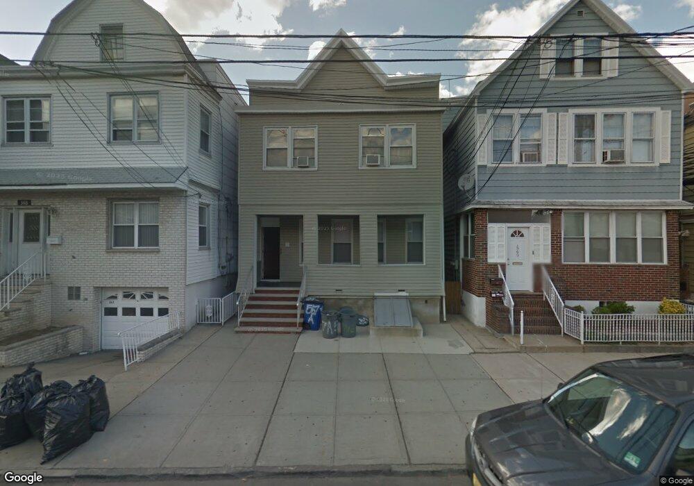
567 Avenue A Bayonne, NJ 07002
Constable Hook NeighborhoodEstimated Value: $681,000 - $812,000
5
Beds
4
Baths
2,540
Sq Ft
$295/Sq Ft
Est. Value
About This Home
This home is located at 567 Avenue A, Bayonne, NJ 07002 and is currently estimated at $748,666, approximately $294 per square foot. 567 Avenue A is a home located in Hudson County with nearby schools including Bayonne High School and Beacon Christian Academy.
Ownership History
Date
Name
Owned For
Owner Type
Purchase Details
Closed on
Jan 14, 2021
Sold by
Treglia Robert and Treglia Pietro
Bought by
Bayonne 4 Family Llc
Current Estimated Value
Purchase Details
Closed on
Mar 16, 2010
Sold by
Hofacker Edward
Bought by
Treglia Robert and Treglia Pietro
Purchase Details
Closed on
Dec 23, 2006
Sold by
Holacker Edward
Bought by
Holacker Edward
Purchase Details
Closed on
Dec 3, 2001
Sold by
Hofacker Eddie and Conklin Frederick G
Bought by
Hofacker Edward
Create a Home Valuation Report for This Property
The Home Valuation Report is an in-depth analysis detailing your home's value as well as a comparison with similar homes in the area
Home Values in the Area
Average Home Value in this Area
Purchase History
| Date | Buyer | Sale Price | Title Company |
|---|---|---|---|
| Bayonne 4 Family Llc | -- | None Available | |
| Bayonne 4 Family Llc | -- | None Listed On Document | |
| Treglia Robert | $325,000 | -- | |
| Holacker Edward | -- | None Available | |
| Hofacker Edward | -- | -- |
Source: Public Records
Tax History Compared to Growth
Tax History
| Year | Tax Paid | Tax Assessment Tax Assessment Total Assessment is a certain percentage of the fair market value that is determined by local assessors to be the total taxable value of land and additions on the property. | Land | Improvement |
|---|---|---|---|---|
| 2025 | $14,827 | $530,300 | $163,200 | $367,100 |
| 2024 | $14,228 | $530,300 | $163,200 | $367,100 |
| 2023 | $14,228 | $530,300 | $163,200 | $367,100 |
| 2022 | $13,963 | $530,300 | $163,200 | $367,100 |
| 2021 | $13,851 | $530,300 | $163,200 | $367,100 |
| 2020 | $13,608 | $530,300 | $163,200 | $367,100 |
| 2019 | $12,626 | $146,300 | $60,000 | $86,300 |
| 2018 | $12,374 | $146,300 | $60,000 | $86,300 |
| 2017 | $12,054 | $146,300 | $60,000 | $86,300 |
| 2016 | $11,609 | $146,300 | $60,000 | $86,300 |
| 2015 | $11,227 | $146,300 | $60,000 | $86,300 |
| 2014 | $10,892 | $146,300 | $60,000 | $86,300 |
Source: Public Records
Map
Nearby Homes
- 599 John F. Kennedy Blvd
- 618 Avenue A
- 200 Park Rd Unit A-3
- 680 Kennedy Blvd Unit 406
- 119 W 21st St
- 76 W 25th St
- 98 W 27th St
- 129 W 20th St
- 150 W 29th St
- 72 W 22nd St
- 505-507 John F. Kennedy Blvd
- 88 W 20th St Unit 2
- 88 W 20th St Unit 1
- 33 W 24th St
- 69 W 19th St
- 490 Kennedy Blvd
- 67 W 19th St
- 63 W 19th St
- 172 W 31st St
- 96 W 18th St
- 565 Avenue A
- 569 Avenue A
- 569 Avenue A Unit 2
- 571 Avenue A
- 571 Avenue A Unit 2F
- 571 Avenue A Unit 4
- 563 Avenue A
- 159 W 24th St
- 159 W 24th St Unit 2
- 573 Avenue A
- 573 Avenue A Unit 2
- 161 W 24th St
- 575 Avenue A
- 163 W 24th St
- 561 Avenue A
- 561 Avenue A Unit 1
- 561 Avenue A Unit A
- 561 Avenue A Unit 1st floor
- 561 Avenue A Unit A
- 577 Avenue A