Estimated Value: $294,542 - $361,000
3
Beds
2
Baths
2,500
Sq Ft
$133/Sq Ft
Est. Value
About This Home
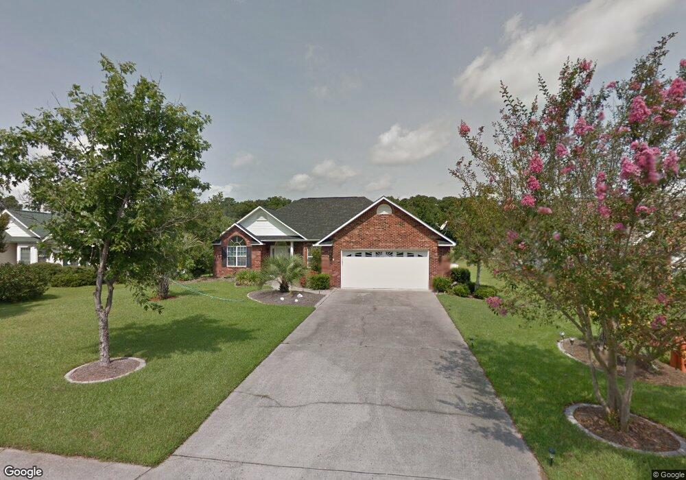
This home is located at 567 Bucks Trail, Longs, SC 29568 and is currently estimated at $333,136, approximately $133 per square foot. 567 Bucks Trail is a home located in Horry County with nearby schools including Daisy Elementary School, Loris Middle School, and Loris High School.
Ownership History
Date
Name
Owned For
Owner Type
Purchase Details
Closed on
Nov 12, 2010
Sold by
Napolio Walter A
Bought by
Dubois Carl E
Current Estimated Value
Purchase Details
Closed on
Oct 22, 2002
Sold by
Kercher Ralph R and Kercher Vera M
Bought by
Napolio Walter A and Napolio Imogene
Home Financials for this Owner
Home Financials are based on the most recent Mortgage that was taken out on this home.
Original Mortgage
$158,650
Interest Rate
5.93%
Mortgage Type
Purchase Money Mortgage
Create a Home Valuation Report for This Property
The Home Valuation Report is an in-depth analysis detailing your home's value as well as a comparison with similar homes in the area
Home Values in the Area
Average Home Value in this Area
Purchase History
| Date | Buyer | Sale Price | Title Company |
|---|---|---|---|
| Dubois Carl E | $229,000 | -- | |
| Napolio Walter A | $167,000 | -- |
Source: Public Records
Mortgage History
| Date | Status | Borrower | Loan Amount |
|---|---|---|---|
| Previous Owner | Napolio Walter A | $158,650 |
Source: Public Records
Tax History
| Year | Tax Paid | Tax Assessment Tax Assessment Total Assessment is a certain percentage of the fair market value that is determined by local assessors to be the total taxable value of land and additions on the property. | Land | Improvement |
|---|---|---|---|---|
| 2025 | $698 | $0 | $0 | $0 |
| 2024 | $698 | $13,220 | $3,800 | $9,420 |
| 2023 | $698 | $11,322 | $2,004 | $9,318 |
| 2021 | $2,497 | $11,322 | $2,004 | $9,318 |
| 2020 | $2,366 | $11,322 | $2,004 | $9,318 |
| 2019 | $2,366 | $11,322 | $2,004 | $9,318 |
| 2018 | $2,473 | $11,416 | $2,110 | $9,306 |
| 2017 | $2,466 | $11,416 | $2,110 | $9,306 |
| 2016 | -- | $11,416 | $2,110 | $9,306 |
| 2015 | $2,466 | $11,417 | $2,111 | $9,306 |
| 2014 | $2,383 | $11,417 | $2,111 | $9,306 |
Source: Public Records
Map
Nearby Homes
- 565 Bucks Trail
- 563 Bucks Trail
- 552 Bucks Trail
- 635 Bucks Trail
- 414 Staghorn Ln
- 460 Deer Watch Cir
- 697 Tupelo Ln Unit 24-G
- 715 Gryffindor Dr
- 730 Gryffindor Dr
- 300 Rolling Ridge Dr
- 673 Tupelo Ln Unit 19H
- 661 Tupelo Ln Unit 16H
- 0 Tupelo Ln
- 657 Tupelo Ln Unit 15F
- 646 Tupelo Ln Unit 4-E
- 10625 S Highway 905
- 424 Joseph St
- 205 Letha Dr Unit Lot 24
- Tbd Water Tower Rd
- TBD Highway 905 Unit Lot 1
- 571 Bucks Trail
- 563 Bucks Trail Unit Aberdeen
- 578 Bucks Trail
- 564 Bucks Trail
- 602 Bucks Trail
- 559 Bucks Trail
- 560 Bucks Trail
- 583 Bucks Trail
- 608 Bucks Trail
- 600 Bucks Trail
- 610 Bucks Trail
- 558 Bucks Trail
- 411 Meadow View Ct
- 557 Bucks Trail
- Lot #1 Bucks Trail
- 616 Bucks Trail
- 556 Bucks Trail
- 417 Meadow View Ct
- 555 Bucks Trail
- 555 Bucks Trail
Your Personal Tour Guide
Ask me questions while you tour the home.