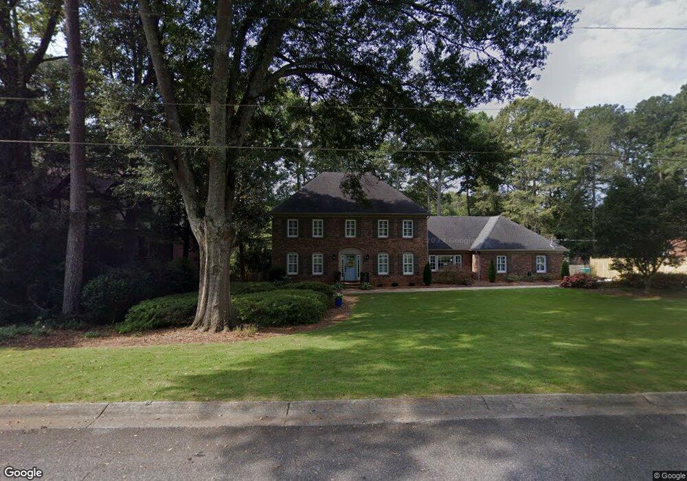
567 Daisy Nash Dr SW Unit 1 Lilburn, GA 30047
Estimated Value: $466,287 - $520,000
4
Beds
3
Baths
3,177
Sq Ft
$157/Sq Ft
Est. Value
About This Home
This home is located at 567 Daisy Nash Dr SW Unit 1, Lilburn, GA 30047 and is currently estimated at $497,572, approximately $156 per square foot. 567 Daisy Nash Dr SW Unit 1 is a home located in Gwinnett County with nearby schools including Knight Elementary School, Trickum Middle School, and Parkview High School.
Ownership History
Date
Name
Owned For
Owner Type
Purchase Details
Closed on
Apr 30, 2001
Sold by
Shea Kevin C and Shea Mary C
Bought by
Mcknight Jeffrey G and Mcknight Cindy R
Current Estimated Value
Home Financials for this Owner
Home Financials are based on the most recent Mortgage that was taken out on this home.
Original Mortgage
$125,000
Interest Rate
6.9%
Mortgage Type
New Conventional
Create a Home Valuation Report for This Property
The Home Valuation Report is an in-depth analysis detailing your home's value as well as a comparison with similar homes in the area
Home Values in the Area
Average Home Value in this Area
Purchase History
| Date | Buyer | Sale Price | Title Company |
|---|---|---|---|
| Mcknight Jeffrey G | $230,000 | -- |
Source: Public Records
Mortgage History
| Date | Status | Borrower | Loan Amount |
|---|---|---|---|
| Closed | Mcknight Jeffrey G | $125,000 |
Source: Public Records
Tax History Compared to Growth
Tax History
| Year | Tax Paid | Tax Assessment Tax Assessment Total Assessment is a certain percentage of the fair market value that is determined by local assessors to be the total taxable value of land and additions on the property. | Land | Improvement |
|---|---|---|---|---|
| 2025 | $5,485 | $197,000 | $36,000 | $161,000 |
| 2024 | -- | $180,680 | $36,000 | $144,680 |
| 2023 | $4,779 | $179,160 | $32,000 | $147,160 |
| 2022 | $4,830 | $159,400 | $32,000 | $127,400 |
| 2021 | $4,181 | $124,520 | $26,800 | $97,720 |
| 2020 | $4,158 | $122,160 | $24,000 | $98,160 |
| 2019 | $3,836 | $113,120 | $24,000 | $89,120 |
| 2018 | $3,690 | $103,840 | $20,000 | $83,840 |
| 2016 | $3,555 | $96,720 | $20,000 | $76,720 |
| 2015 | $2,869 | $76,240 | $15,200 | $61,040 |
| 2014 | -- | $76,240 | $15,200 | $61,040 |
Source: Public Records
Map
Nearby Homes
- 5453 Plain Field Ln
- 565 James St SW Unit 10
- 453 James St SW
- 522 Foxmoor Dr SW Unit 1
- 564 Deer Run SW
- 287 Willow Cove Ct
- 445 Bruce Way SW
- 753 Brookwood Terrace SW
- 3730 Willow Mill Dr
- 478 Dorsey Cir SW
- 772 Brookwood Terrace SW
- 234 Shadow Lake Dr SW
- 312 Westminister Ln SW
- 871 Cedar Trace SW
- 676 Killian Hill Rd SW
- 4245 Cedar Creek Trail SW
- 156 Round Pond Dr
- 246 Round Pond Dr
- 577 Daisy Nash Dr SW
- 557 Daisy Nash Dr SW
- 349 William Ivey Rd SW
- 359 William Ivey Rd SW
- 0 William Ivey Rd SW Unit 8188136
- 0 William Ivey Rd SW Unit 8620201
- 0 William Ivey Rd SW Unit 8182614
- 339 William Ivey Rd SW
- 566 Daisy Nash Dr SW Unit 1
- 576 Daisy Nash Dr SW
- 587 Daisy Nash Dr SW
- 547 Daisy Nash Dr SW
- 556 Daisy Nash Dr SW
- 586 Daisy Nash Dr SW
- 329 William Ivey Rd SW
- 546 Daisy Nash Dr SW
- 537 Daisy Nash Dr SW
- 348 William Ivey Rd SW
- 379 William Ivey Rd SW
- 597 Daisy Nash Dr SW