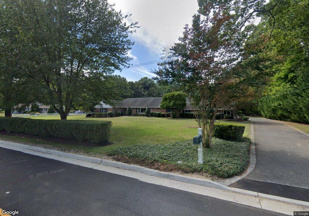
567 Harding Rd Little Silver, NJ 07739
Estimated Value: $1,053,000 - $1,524,000
3
Beds
2
Baths
2,744
Sq Ft
$492/Sq Ft
Est. Value
About This Home
This home is located at 567 Harding Rd, Little Silver, NJ 07739 and is currently estimated at $1,350,563, approximately $492 per square foot. 567 Harding Rd is a home located in Monmouth County with nearby schools including Point Road School, Markham Place School, and Red Bank Regional High School.
Ownership History
Date
Name
Owned For
Owner Type
Purchase Details
Closed on
Feb 23, 1995
Sold by
Estate Bessie Lawes
Bought by
Hickey F Patrick and Hickey Michele
Current Estimated Value
Home Financials for this Owner
Home Financials are based on the most recent Mortgage that was taken out on this home.
Original Mortgage
$185,000
Interest Rate
8.89%
Mortgage Type
Purchase Money Mortgage
Create a Home Valuation Report for This Property
The Home Valuation Report is an in-depth analysis detailing your home's value as well as a comparison with similar homes in the area
Home Values in the Area
Average Home Value in this Area
Purchase History
| Date | Buyer | Sale Price | Title Company |
|---|---|---|---|
| Hickey F Patrick | $307,500 | -- |
Source: Public Records
Mortgage History
| Date | Status | Borrower | Loan Amount |
|---|---|---|---|
| Closed | Hickey F Patrick | $185,000 |
Source: Public Records
Tax History Compared to Growth
Tax History
| Year | Tax Paid | Tax Assessment Tax Assessment Total Assessment is a certain percentage of the fair market value that is determined by local assessors to be the total taxable value of land and additions on the property. | Land | Improvement |
|---|---|---|---|---|
| 2025 | $17,434 | $1,004,500 | $705,000 | $299,500 |
| 2024 | $16,682 | $1,032,800 | $776,900 | $255,900 |
| 2023 | $16,682 | $926,800 | $676,900 | $249,900 |
| 2022 | $10,189 | $844,900 | $606,900 | $238,000 |
| 2021 | $10,189 | $818,500 | $606,900 | $211,600 |
| 2020 | $16,496 | $813,800 | $606,900 | $206,900 |
| 2019 | $16,171 | $812,600 | $606,900 | $205,700 |
| 2018 | $16,044 | $803,000 | $606,900 | $196,100 |
| 2017 | $16,004 | $797,000 | $606,900 | $190,100 |
| 2016 | $15,717 | $792,200 | $606,900 | $185,300 |
| 2015 | $15,618 | $777,400 | $576,900 | $200,500 |
| 2014 | $15,738 | $732,000 | $576,900 | $155,100 |
Source: Public Records
Map
Nearby Homes
- 82 Ridge Rd
- 172 Woods End Dr
- 69 Harvard Rd
- 135 Harrison Ave
- 94 Park Ave
- 132 Harrison Ave
- 91 Forrest Ave
- 281 Hance Rd
- 492 Hance Rd
- 30 Crest Dr
- 420 Rumson Rd
- 10 Gentry Dr
- 23 Jackson St
- 57 John St
- 63 McCarter Ave
- 137 Lexington Ave
- 1 Clifford Graves Ct
- 87 Rumson Rd
- 85 Tower Hill Dr Unit 608
- 83 Tower Hill Dr
- 575 Harding Rd
- 541 Harding Rd
- 541 Harding Rd Unit B
- 583 Harding Rd
- 535 Harding Rd
- 234 Whispering Woods Ct
- 236 Whispering Woods Ct Unit B
- 232 Whispering Woods Ct
- 240 Whispering Woods Ct Unit D
- 230 Whispering Woods Ct
- 238 Whispering Woods Ct
- 204 Heritage Ct
- 270 Clearbrook Ct
- 206 Heritage Ct
- 272 Clearbrook Ct
- 589 Harding Rd
- 268 Clearbrook Ct
- 208 Heritage Ct
- 202 Heritage Ct
- 274 Clearbrook Ct