Estimated Value: $400,000 - $513,826
4
Beds
2
Baths
2,651
Sq Ft
$168/Sq Ft
Est. Value
About This Home
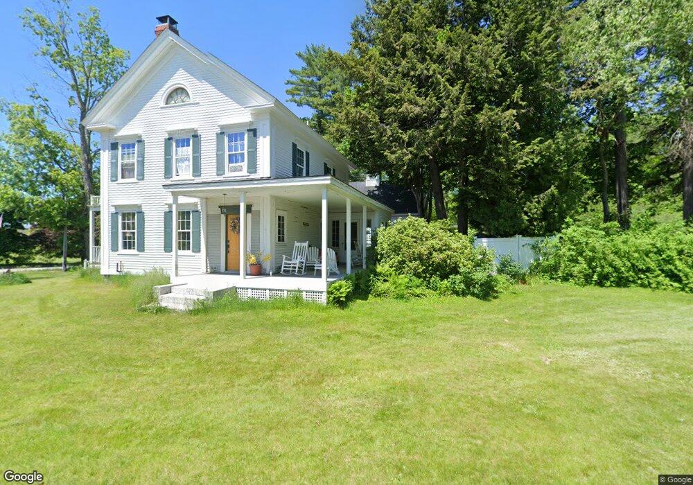
This home is located at 567 Main St, Wayne, ME 04284 and is currently estimated at $444,707, approximately $167 per square foot. 567 Main St is a home located in Kennebec County.
Ownership History
Date
Name
Owned For
Owner Type
Purchase Details
Closed on
May 12, 2009
Sold by
Haines Stephanie H
Bought by
Danforth Michael R and Danforth Laurel A
Current Estimated Value
Home Financials for this Owner
Home Financials are based on the most recent Mortgage that was taken out on this home.
Original Mortgage
$116,000
Outstanding Balance
$73,489
Interest Rate
4.9%
Mortgage Type
Purchase Money Mortgage
Estimated Equity
$371,218
Create a Home Valuation Report for This Property
The Home Valuation Report is an in-depth analysis detailing your home's value as well as a comparison with similar homes in the area
Home Values in the Area
Average Home Value in this Area
Purchase History
| Date | Buyer | Sale Price | Title Company |
|---|---|---|---|
| Danforth Michael R | -- | -- |
Source: Public Records
Mortgage History
| Date | Status | Borrower | Loan Amount |
|---|---|---|---|
| Open | Danforth Michael R | $116,000 |
Source: Public Records
Tax History
| Year | Tax Paid | Tax Assessment Tax Assessment Total Assessment is a certain percentage of the fair market value that is determined by local assessors to be the total taxable value of land and additions on the property. | Land | Improvement |
|---|---|---|---|---|
| 2024 | $5,853 | $494,800 | $103,800 | $391,000 |
| 2023 | $3,747 | $181,900 | $62,400 | $119,500 |
| 2022 | $3,432 | $181,900 | $62,400 | $119,500 |
| 2021 | $3,267 | $181,900 | $62,400 | $119,500 |
| 2020 | $3,267 | $181,900 | $62,400 | $119,500 |
| 2019 | $3,267 | $181,900 | $62,400 | $119,500 |
| 2017 | $2,945 | $181,900 | $62,400 | $119,500 |
| 2016 | $2,698 | $181,900 | $62,400 | $119,500 |
| 2015 | $2,650 | $181,900 | $62,400 | $119,500 |
| 2014 | $2,614 | $181,900 | $62,400 | $119,500 |
| 2013 | $2,583 | $181,900 | $62,400 | $119,500 |
Source: Public Records
Map
Nearby Homes
- 506 Main St
- 16 Davis Point Rd
- M 6, L 32 Main St
- Lot 39 Main St
- 376 Main St
- 316 Pond Rd
- 57 Deer Hill Rd
- 156 Lakeshore Dr
- 29 Kents Hill Rd
- 64 Paddleford Rd
- MR5 L8 Oak Hill Rd
- 381 Turkey Ln
- 105 Nottingham Rd
- 591 North Rd
- 192 Turkey Ln
- 307 Route 41
- 974 Sturtevant Hill Rd
- 42 Squire Ct
- 60 Route 41
- 4 Baldwin Hill Rd
- 577 Main St
- 0 Pond Rd Unit 585507
- 0 Pond Rd Unit 514933
- 0 Pond Rd Unit 504185
- 0 Pond Rd Unit 394353
- 0 Pond Rd Unit 252498
- 0 Pond Rd Unit 239041
- 0 Pond Rd Unit 181028
- 0 Pond Rd Unit 164487
- 0 Pond Rd Unit 559993
- 0 Pond Rd Unit 588437
- 0 Pond Rd Unit 541307
- 0 Pond Rd Unit 220629
- 0 Pond Rd Unit 221051
- 0 Pond Rd Unit 1312892
- 1 Maine 133
- 3 Pond Rd
- 568 Main St
- 465 Maine 133
- Map 9-Lot Pond Rd
Your Personal Tour Guide
Ask me questions while you tour the home.