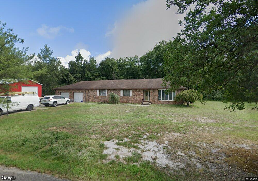
567 Ongs Hat Rd Southampton, NJ 08088
Estimated Value: $531,000 - $719,000
--
Bed
--
Bath
2,808
Sq Ft
$214/Sq Ft
Est. Value
About This Home
This home is located at 567 Ongs Hat Rd, Southampton, NJ 08088 and is currently estimated at $600,243, approximately $213 per square foot. 567 Ongs Hat Rd is a home located in Burlington County with nearby schools including Southampton Twp School No 1, Southampton Twp School No 2, and Southampton Twp School No 3.
Ownership History
Date
Name
Owned For
Owner Type
Purchase Details
Closed on
Jan 17, 2005
Sold by
Yetman John Patrick and Drone Lisa L
Bought by
Yetman John Patrick
Current Estimated Value
Home Financials for this Owner
Home Financials are based on the most recent Mortgage that was taken out on this home.
Original Mortgage
$150,000
Outstanding Balance
$75,883
Interest Rate
5.78%
Mortgage Type
Fannie Mae Freddie Mac
Estimated Equity
$524,360
Purchase Details
Closed on
May 28, 2002
Sold by
Yetman John Patrick and Drone Lisa L
Bought by
Yetman John Patrick and Drone Lisa L
Purchase Details
Closed on
Jun 29, 1999
Sold by
Kim Steven C and Kim Chong Hui
Bought by
Yetman John Patrick and Drone Lisa L
Home Financials for this Owner
Home Financials are based on the most recent Mortgage that was taken out on this home.
Original Mortgage
$105,000
Interest Rate
7.54%
Create a Home Valuation Report for This Property
The Home Valuation Report is an in-depth analysis detailing your home's value as well as a comparison with similar homes in the area
Home Values in the Area
Average Home Value in this Area
Purchase History
| Date | Buyer | Sale Price | Title Company |
|---|---|---|---|
| Yetman John Patrick | -- | -- | |
| Yetman John Patrick | -- | -- | |
| Yetman John Patrick | $135,000 | Surety Title Corporation |
Source: Public Records
Mortgage History
| Date | Status | Borrower | Loan Amount |
|---|---|---|---|
| Open | Yetman John Patrick | $150,000 | |
| Closed | Yetman John Patrick | $105,000 |
Source: Public Records
Tax History Compared to Growth
Tax History
| Year | Tax Paid | Tax Assessment Tax Assessment Total Assessment is a certain percentage of the fair market value that is determined by local assessors to be the total taxable value of land and additions on the property. | Land | Improvement |
|---|---|---|---|---|
| 2025 | $9,927 | $300,900 | $98,500 | $202,400 |
| 2024 | $9,560 | $300,900 | $98,500 | $202,400 |
| 2023 | $9,560 | $300,900 | $98,500 | $202,400 |
| 2022 | $9,223 | $300,900 | $98,500 | $202,400 |
| 2021 | $8,670 | $289,200 | $98,500 | $190,700 |
| 2020 | $8,479 | $289,200 | $98,500 | $190,700 |
| 2019 | $8,297 | $289,200 | $98,500 | $190,700 |
| 2018 | $8,103 | $289,200 | $98,500 | $190,700 |
| 2017 | $8,132 | $289,200 | $98,500 | $190,700 |
| 2016 | $7,959 | $289,200 | $98,500 | $190,700 |
| 2015 | $7,707 | $289,200 | $98,500 | $190,700 |
| 2014 | $7,435 | $289,200 | $98,500 | $190,700 |
Source: Public Records
Map
Nearby Homes
- 206 Burrs Mill Rd
- 144 Burrs Mill Rd
- 427 Isaac Budd Rd
- 430 Isaac Budd Rd
- 521 Magnolia Rd
- 250 Purdue Ave
- 448 Cornell Ave
- 143 Oak Pines Blvd
- 86 Scrapetown Rd
- 148 Oak Pines Blvd
- 517 Ridge Rd
- 421 Lakeview Terrace
- 104 Burrs Mill Rd
- 0 Ongs Hat Rd Unit NJBL2021664
- 214 Buddtown Rd
- 69 Buckingham Dr
- 72 Saint Davids Place
- 103 Buckingham Dr
- 107 Buckingham Dr
- 9 Maidstone Place
- 564 Ongs Hat Rd
- 573 Ongs Hat Rd
- 568 Ongs Hat Rd
- 570 Ongs Hat Rd
- 562 Ongs Hat Rd
- 304 Stockton Bridge Rd
- 560 Ongs Hat Rd
- 551 Ongs Hat Rd
- 544 Ongs Hat Rd
- 421 Ongs Hat Rd
- 542 Ongs Hat Rd
- 539 Ongs Hat Rd
- 540 Ongs Hat Rd
- 288 Stockton Bridge Rd
- 291 Stockton Bridge Rd
- 284 Stockton Bridge Rd
- 537 Ongs Hat Rd
- 10 Stockton Bridge Rd
- 535 Ongs Hat Rd
- 538 Ongs Hat Rd