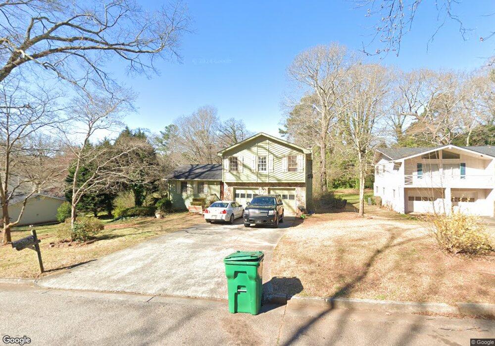
567 Rimrock Trail Stone Mountain, GA 30083
Estimated Value: $253,000 - $299,000
4
Beds
3
Baths
2,040
Sq Ft
$138/Sq Ft
Est. Value
About This Home
This home is located at 567 Rimrock Trail, Stone Mountain, GA 30083 and is currently estimated at $280,885, approximately $137 per square foot. 567 Rimrock Trail is a home located in DeKalb County with nearby schools including Allgood Elementary School, Freedom Middle School, and Clarkston High School.
Ownership History
Date
Name
Owned For
Owner Type
Purchase Details
Closed on
Nov 29, 2004
Sold by
Mers Inc
Bought by
Wade Thelma
Current Estimated Value
Home Financials for this Owner
Home Financials are based on the most recent Mortgage that was taken out on this home.
Original Mortgage
$93,520
Outstanding Balance
$50,709
Interest Rate
7.1%
Mortgage Type
New Conventional
Estimated Equity
$230,176
Purchase Details
Closed on
Apr 6, 2004
Sold by
Cason Evelyn
Bought by
Mortgage Electronic Registrati
Purchase Details
Closed on
Apr 5, 2000
Sold by
Davis James B and Davis Lori E
Bought by
Cason Evelyn
Home Financials for this Owner
Home Financials are based on the most recent Mortgage that was taken out on this home.
Original Mortgage
$135,000
Interest Rate
11.5%
Mortgage Type
New Conventional
Create a Home Valuation Report for This Property
The Home Valuation Report is an in-depth analysis detailing your home's value as well as a comparison with similar homes in the area
Home Values in the Area
Average Home Value in this Area
Purchase History
| Date | Buyer | Sale Price | Title Company |
|---|---|---|---|
| Wade Thelma | $116,900 | -- | |
| Mortgage Electronic Registrati | $118,118 | -- | |
| Cason Evelyn | $135,000 | -- |
Source: Public Records
Mortgage History
| Date | Status | Borrower | Loan Amount |
|---|---|---|---|
| Open | Wade Thelma | $93,520 | |
| Previous Owner | Cason Evelyn | $135,000 |
Source: Public Records
Tax History Compared to Growth
Tax History
| Year | Tax Paid | Tax Assessment Tax Assessment Total Assessment is a certain percentage of the fair market value that is determined by local assessors to be the total taxable value of land and additions on the property. | Land | Improvement |
|---|---|---|---|---|
| 2024 | $2,414 | $95,160 | $16,000 | $79,160 |
| 2023 | $2,414 | $99,120 | $16,000 | $83,120 |
| 2022 | $2,011 | $81,520 | $7,200 | $74,320 |
| 2021 | $1,528 | $60,600 | $7,200 | $53,400 |
| 2020 | $1,440 | $56,600 | $7,200 | $49,400 |
| 2019 | $1,293 | $50,400 | $7,200 | $43,200 |
| 2018 | $938 | $43,760 | $7,200 | $36,560 |
| 2017 | $1,040 | $38,800 | $7,200 | $31,600 |
| 2016 | $974 | $36,400 | $7,200 | $29,200 |
| 2014 | $570 | $18,800 | $7,160 | $11,640 |
Source: Public Records
Map
Nearby Homes
- 4595 Garden Hills Dr
- 4570 Craghill Cir
- 4616 Garden Hills Dr Unit 1
- 4584 Garden Hills Dr
- 4634 Garden Hills Dr
- 4651 Garden Hills Dr
- 4657 Garden Hills Dr
- 486 Prince of Wales
- 436 Prince of Wales
- 457 Prince of Wales
- 419 Prince of Wales
- 4698 Shumate Dr
- 4820 Banner Elk Dr
- 539 Prince of Wales
- 404 Prince of Wales
- 4727 Garden Hills Dr
- 400 Prince of Wales
- 555 Rimrock Trail
- 579 Rimrock Trail
- 4612 Elam Rd
- 591 Rimrock Trail
- 547 Rimrock Trail
- 562 Rimrock Trail
- 4632 Craghill Cir
- 552 Rimrock Trail
- 570 Rimrock Trail
- 0 Rimrock Trail Unit 7499862
- 0 Rimrock Trail Unit 7391385
- 0 Rimrock Trail Unit 8457666
- 0 Rimrock Trail Unit 8279469
- 0 Rimrock Trail Unit 8168343
- 0 Rimrock Trail Unit 8165528
- 535 Rimrock Trail Unit 1
- 544 Rimrock Trail
- 578 Rimrock Trail
- 586 Rimrock Trail
- 527 Rimrock Trail