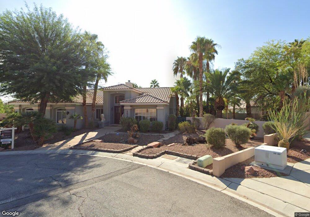
5670 N Fort Apache Rd Las Vegas, NV 89149
Estimated Value: $719,000 - $974,000
4
Beds
3
Baths
3,407
Sq Ft
$265/Sq Ft
Est. Value
About This Home
This home is located at 5670 N Fort Apache Rd, Las Vegas, NV 89149 and is currently estimated at $903,271, approximately $265 per square foot. 5670 N Fort Apache Rd is a home located in Clark County with nearby schools including Marshall C. Darnell Elementary School, Edmundo "Eddie" Escobedo, Sr. Middle School, and Centennial High School.
Ownership History
Date
Name
Owned For
Owner Type
Purchase Details
Closed on
Jan 24, 2003
Sold by
Gibson Kelly
Bought by
Showalter Robert N and Showalter Nina
Current Estimated Value
Home Financials for this Owner
Home Financials are based on the most recent Mortgage that was taken out on this home.
Original Mortgage
$351,000
Outstanding Balance
$139,875
Interest Rate
5%
Mortgage Type
Unknown
Estimated Equity
$763,396
Purchase Details
Closed on
Jul 27, 2000
Sold by
Gibson Thomas A
Bought by
Gibson Kelly
Create a Home Valuation Report for This Property
The Home Valuation Report is an in-depth analysis detailing your home's value as well as a comparison with similar homes in the area
Home Values in the Area
Average Home Value in this Area
Purchase History
| Date | Buyer | Sale Price | Title Company |
|---|---|---|---|
| Showalter Robert N | $390,000 | National Title Company | |
| Gibson Kelly | -- | -- |
Source: Public Records
Mortgage History
| Date | Status | Borrower | Loan Amount |
|---|---|---|---|
| Open | Showalter Robert N | $351,000 |
Source: Public Records
Tax History Compared to Growth
Tax History
| Year | Tax Paid | Tax Assessment Tax Assessment Total Assessment is a certain percentage of the fair market value that is determined by local assessors to be the total taxable value of land and additions on the property. | Land | Improvement |
|---|---|---|---|---|
| 2025 | $4,227 | $224,641 | $92,750 | $131,891 |
| 2024 | $4,104 | $224,641 | $92,750 | $131,891 |
| 2023 | $3,004 | $209,308 | $84,000 | $125,308 |
| 2022 | $4,178 | $185,232 | $70,000 | $115,232 |
| 2021 | $3,869 | $171,422 | $61,250 | $110,172 |
| 2020 | $3,590 | $170,978 | $61,250 | $109,728 |
| 2019 | $3,364 | $169,543 | $61,250 | $108,293 |
| 2018 | $3,210 | $153,720 | $49,000 | $104,720 |
| 2017 | $4,048 | $148,458 | $42,000 | $106,458 |
| 2016 | $3,004 | $139,694 | $31,500 | $108,194 |
| 2015 | $2,999 | $123,506 | $26,250 | $97,256 |
| 2014 | $2,911 | $104,919 | $17,500 | $87,419 |
Source: Public Records
Map
Nearby Homes
- 5624 N Dapple Gray Rd
- 5685 N Campbell Rd
- 5630 Searching Bear Ct
- 3336 Plan at Homestead West
- 3704 Plan at Homestead West
- 5650 Searching Bear Ct
- 5515 N Campbell Rd
- 5621 Golseton Ct
- Harley Plan at Arabella
- 5680 Golestan Ct
- 5661 Golestan Ct
- Hanson Plan at Arabella
- Rocco Plan at Estrella Place
- 5620 Goleston Ct
- Robert Plan at Estrella Place
- 5620 Golestan Ct
- 5641 Golestan Ct
- 5621 Golestan Ct
- 9180 W Hammer Ln
- Primrose Plan at Crestwood Ranch
- 5660 N Fort Apache Rd
- 5675 N Dapple Gray Rd
- 9170 W Ann Rd
- 5680 N Fort Apache Rd
- 5635 N Dapple Gray Rd
- 5690 N Fort Apache Rd
- 9180 W Ann Rd
- 5685 N Dapple Gray Rd
- 5665 N Dapple Gray Rd
- 5645 N Dapple Gray Rd
- 5625 N Dapple Gray Rd
- 9190 W Ann Rd
- 5695 N Dapple Gray Rd
- 5735 N Dapple Gray Rd
- 5720 N Fort Apache Rd
- 5615 N Dapple Gray Rd
- 5725 N Dapple Gray Rd
- 5660 N Dapple Gray Rd
- 5740 N Fort Apache Rd
- 5745 N Dapple Gray Rd