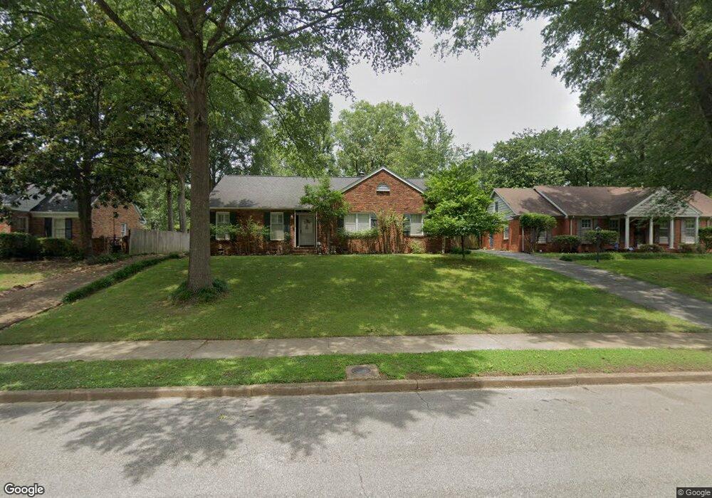
5674 Normandy Rd Memphis, TN 38120
East Memphis NeighborhoodEstimated Value: $312,577 - $365,000
About This Home
This home is located at 5674 Normandy Rd, Memphis, TN 38120 and is currently estimated at $332,394, approximately $180 per square foot. 5674 Normandy Rd is a home located in Shelby County with nearby schools including Richland Elementary School, White Station Middle, and White Station High.
Ownership History
We collect this data history from publicly available records. To have your information removed, we recommend requesting removal directly through your county’s website.
Purchase Details
Home Financials for this Owner
Home Financials are based on the most recent Mortgage that was taken out on this home.Purchase Details
Home Financials for this Owner
Home Financials are based on the most recent Mortgage that was taken out on this home.Purchase Details
Home Financials for this Owner
Home Financials are based on the most recent Mortgage that was taken out on this home.Purchase Details
Home Financials for this Owner
Home Financials are based on the most recent Mortgage that was taken out on this home.Home Values in the Area
Average Home Value in this Area
Purchase History
We collect this data history from publicly available records. To have your information removed, we recommend requesting removal directly through your county’s website.
| Date | Buyer | Sale Price | Title Company |
|---|---|---|---|
| $206,000 | Chicago Title Insurance Co | ||
| $197,500 | Realty Title | ||
| $177,500 | -- | ||
| $177,500 | -- | ||
| $165,000 | -- | ||
| $165,000 | -- |
Mortgage History
We collect this data history from publicly available records. To have your information removed, we recommend requesting removal directly through your county’s website.
| Date | Status | Borrower | Loan Amount |
|---|---|---|---|
| Open | $176,000 | ||
| Previous Owner | $158,000 | ||
| Previous Owner | $135,000 | ||
| Previous Owner | $132,000 | ||
| Closed | $29,625 |
Tax History
We collect this data history from publicly available records. To have your information removed, we recommend requesting removal directly through your county’s website.
| Year | Tax Paid | Tax Assessment Tax Assessment Total Assessment is a certain percentage of the fair market value that is determined by local assessors to be the total taxable value of land and additions on the property. | Land | Improvement |
|---|---|---|---|---|
| 2025 | $1,978 | $73,525 | $19,125 | $54,400 |
| 2024 | $2,260 | $66,675 | $19,125 | $47,550 |
| 2023 | $4,062 | $66,675 | $19,125 | $47,550 |
| 2022 | $4,062 | $66,675 | $19,125 | $47,550 |
| 2021 | $4,109 | $66,675 | $19,125 | $47,550 |
| 2020 | $3,599 | $49,675 | $15,900 | $33,775 |
| 2019 | $3,599 | $49,675 | $15,900 | $33,775 |
| 2018 | $3,599 | $49,675 | $15,900 | $33,775 |
| 2017 | $2,042 | $49,675 | $15,900 | $33,775 |
| 2016 | $1,835 | $42,000 | $0 | $0 |
| 2014 | $1,835 | $42,000 | $0 | $0 |
Map
- 5676 Barfield Rd
- 5710 Woodbriar Cove
- 5737 Buxbriar Ave
- 5585 Milford Rd
- 5504 Normandy Rd
- 5690 N Angela Rd
- 5722 Shady Glen Rd
- 5734 Dunwoody Ave
- 5557 Mason Rd
- 5572 Mason Rd
- 5385 Walnut Grove Rd
- 5360 Normandy Ave
- 5347 Denwood Ave
- 5330 Walnut Grove Rd
- 233 Lynnfield St
- 5524 Fountain Bay Dr
- 424 Malboro Rd
- 182 Brenrich Cove S
- 5301 Denwood Ave
- 320 S Yates Rd
- 5674 Normandy Ave
- 5682 Normandy Rd
- 5682 Normandy Ave
- 5669 Barfield Rd
- 5690 Normandy Ave
- 5658 Normandy Ave
- 5661 Barfield Rd
- 5677 Barfield Rd
- 5673 Normandy Rd
- 5673 Normandy Place
- 5681 Normandy Ave
- 5663 Normandy Place
- 5653 Barfield Rd
- 5685 Barfield Rd
- 5698 Normandy Ave
- 5698 Normandy Rd
- 5650 Normandy Rd
- 5650 Normandy Ave
- 5689 Normandy Ave
- 5689 Normandy Rd
Ask me questions while you tour the home.