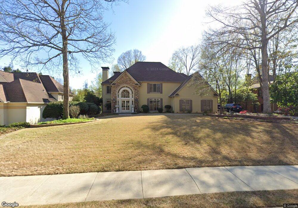
5675 Commons Ln Unit 87E Alpharetta, GA 30005
Seven Oaks NeighborhoodEstimated Value: $908,000 - $1,214,000
5
Beds
5
Baths
4,394
Sq Ft
$236/Sq Ft
Est. Value
About This Home
This home is located at 5675 Commons Ln Unit 87E, Alpharetta, GA 30005 and is currently estimated at $1,036,171, approximately $235 per square foot. 5675 Commons Ln Unit 87E is a home located in Fulton County with nearby schools including River Trail Middle School, Northview High School, and McGinnis Woods School.
Ownership History
Date
Name
Owned For
Owner Type
Purchase Details
Closed on
Sep 30, 2011
Sold by
Stahr Garrett M
Bought by
Bridge Michael and Monteon Lisa
Current Estimated Value
Home Financials for this Owner
Home Financials are based on the most recent Mortgage that was taken out on this home.
Original Mortgage
$417,000
Outstanding Balance
$286,595
Interest Rate
4.26%
Mortgage Type
New Conventional
Estimated Equity
$749,576
Purchase Details
Closed on
Apr 18, 2000
Sold by
Hardee Thomas E
Bought by
Stahr Rebecca and Stahr Garrett M
Home Financials for this Owner
Home Financials are based on the most recent Mortgage that was taken out on this home.
Original Mortgage
$300,000
Interest Rate
7.6%
Mortgage Type
New Conventional
Create a Home Valuation Report for This Property
The Home Valuation Report is an in-depth analysis detailing your home's value as well as a comparison with similar homes in the area
Home Values in the Area
Average Home Value in this Area
Purchase History
| Date | Buyer | Sale Price | Title Company |
|---|---|---|---|
| Bridge Michael | $445,000 | -- | |
| Stahr Rebecca | $375,000 | -- |
Source: Public Records
Mortgage History
| Date | Status | Borrower | Loan Amount |
|---|---|---|---|
| Open | Bridge Michael | $417,000 | |
| Previous Owner | Stahr Rebecca | $300,000 |
Source: Public Records
Tax History Compared to Growth
Tax History
| Year | Tax Paid | Tax Assessment Tax Assessment Total Assessment is a certain percentage of the fair market value that is determined by local assessors to be the total taxable value of land and additions on the property. | Land | Improvement |
|---|---|---|---|---|
| 2025 | $6,433 | $382,120 | $87,320 | $294,800 |
| 2023 | $6,433 | $328,760 | $71,000 | $257,760 |
| 2022 | $6,170 | $267,720 | $55,760 | $211,960 |
| 2021 | $6,113 | $220,160 | $51,280 | $168,880 |
| 2020 | $6,170 | $225,200 | $54,840 | $170,360 |
| 2019 | $728 | $219,680 | $53,880 | $165,800 |
| 2018 | $6,769 | $227,640 | $66,040 | $161,600 |
| 2017 | $5,981 | $187,880 | $55,320 | $132,560 |
| 2016 | $5,886 | $187,880 | $55,320 | $132,560 |
| 2015 | $5,951 | $187,880 | $55,320 | $132,560 |
| 2014 | $5,382 | $165,640 | $48,760 | $116,880 |
Source: Public Records
Map
Nearby Homes
- 110 W Meadows Ct
- 12205 Stevens Creek Dr
- 5455 Woodrun Ln
- 11835 Leeward Walk Cir
- 5735 Sunset Maple Dr
- 5650 Preserve Cir
- 5575 Ashwind Trace
- 680 Evening Pine Ln
- 11615 Windbrooke Way
- 5785 Oxborough Way Unit 1
- 585 Meadows Creek Dr
- 11575 Windbrooke Way Unit 2
- 640 Evening Pine Ln
- 5530 Preserve Cir
- 11420 Crossington Rd
- 5675 Commons Ln
- 5665 Commons Ln
- 0 Commons Ln Unit 8355882
- 0 Commons Ln Unit 8333640
- 0 Commons Ln Unit 8233019
- 0 Commons Ln Unit 8165088
- 0 Commons Ln Unit 8055624
- 0 Commons Ln Unit 8107609
- 0 Commons Ln Unit 7012395
- 0 Commons Ln Unit 7211216
- 0 Commons Ln Unit 7234744
- 0 Commons Ln Unit 7255694
- 0 Commons Ln Unit 7338943
- 0 Commons Ln Unit 7498157
- 0 Commons Ln Unit 7500887
- 12175 Oak Hollow Way
- 225 Magnolia Blossom Terrace
- 5655 Commons Ln
- 5695 Commons Ln
- 5690 Commons Ln