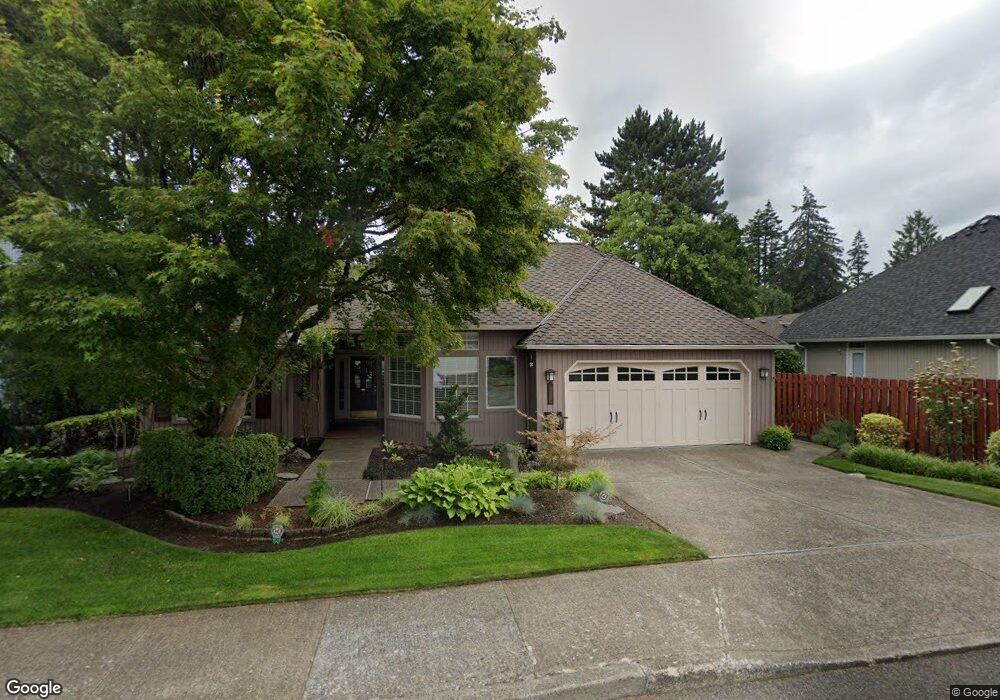
5675 Langford Ln Lake Oswego, OR 97035
Lake Forest NeighborhoodEstimated Value: $713,000 - $770,000
2
Beds
2
Baths
1,561
Sq Ft
$476/Sq Ft
Est. Value
About This Home
This home is located at 5675 Langford Ln, Lake Oswego, OR 97035 and is currently estimated at $743,475, approximately $476 per square foot. 5675 Langford Ln is a home located in Clackamas County with nearby schools including River Grove Elementary School, Lakeridge Middle School, and Lakeridge High School.
Ownership History
Date
Name
Owned For
Owner Type
Purchase Details
Closed on
Feb 1, 2022
Sold by
Mittelstaedt Craig H
Bought by
Mittelstaedt Family Trust
Current Estimated Value
Purchase Details
Closed on
May 19, 1999
Sold by
Thompson Douglas R and Thompson Darlene F
Bought by
Mittelstaedt Craig H and Mittelstaedt Janice L
Home Financials for this Owner
Home Financials are based on the most recent Mortgage that was taken out on this home.
Original Mortgage
$211,200
Interest Rate
6.86%
Create a Home Valuation Report for This Property
The Home Valuation Report is an in-depth analysis detailing your home's value as well as a comparison with similar homes in the area
Home Values in the Area
Average Home Value in this Area
Purchase History
| Date | Buyer | Sale Price | Title Company |
|---|---|---|---|
| Mittelstaedt Family Trust | $98,000 | None Listed On Document | |
| Mittelstaedt Craig H | $248,500 | Pacific Nw Title |
Source: Public Records
Mortgage History
| Date | Status | Borrower | Loan Amount |
|---|---|---|---|
| Previous Owner | Mittelstaedt Craig H | $211,200 |
Source: Public Records
Tax History Compared to Growth
Tax History
| Year | Tax Paid | Tax Assessment Tax Assessment Total Assessment is a certain percentage of the fair market value that is determined by local assessors to be the total taxable value of land and additions on the property. | Land | Improvement |
|---|---|---|---|---|
| 2025 | $6,606 | $371,147 | -- | -- |
| 2024 | $6,357 | $360,337 | -- | -- |
| 2023 | $6,357 | $349,842 | $0 | $0 |
| 2022 | $6,003 | $339,653 | $0 | $0 |
| 2021 | $5,510 | $329,761 | $0 | $0 |
| 2020 | $5,375 | $320,157 | $0 | $0 |
| 2019 | $5,233 | $310,833 | $0 | $0 |
| 2018 | $4,964 | $301,780 | $0 | $0 |
| 2017 | $4,786 | $292,990 | $0 | $0 |
| 2016 | $4,321 | $284,456 | $0 | $0 |
| 2015 | $4,165 | $276,171 | $0 | $0 |
| 2014 | $4,014 | $268,127 | $0 | $0 |
Source: Public Records
Map
Nearby Homes
- 5725 Windfield Loop
- 5835 Carman Dr
- 5767 Baleine St
- 15540 Partridge Dr
- 5185 Carman Dr
- 6300 Shakespeare St
- 5010 Park Bluff Place
- 15601 Manchester Dr
- 4992 Park Bluff Place
- 4974 Park Bluff Place
- 6290 Carman Dr
- 6290 SW Carman Dr
- 16405 Bonaire Ave
- 16061 Waluga Dr
- 16508 Bonaire Ave
- 5057 W Sunset Dr
- 4521 Trillium Woods
- 4520 Trillium Woods
- 16960 Denney Ct
- 4284 Oakridge Rd
- 5717 Langford Ln
- 5717 SW Langford Ln
- 5651 Langford Ln
- 5696 Windfield Loop
- 5626 Windfield Loop
- 5710 Windfield Loop
- 5644 Windfield Loop
- 5666 Langford Ln
- 5755 Windfield Loop
- 5682 Langford Ln
- 5650 Langford Ln
- 5748 Windfield Loop
- 5722 Langford Ln
- 5636 SW Langford Ln
- 5636 Langford Ln
- 5605 Windfield Loop
- 5766 Langford Ln
- 5691 Windfield Loop
- 5721 Kimball Ct
- 5675 Windfield Loop